- Usage in publication:
-
- Atrisco Member
- Modifications:
-
- Principal reference
- AAPG geologic province:
-
- Estancia basin
Summary:
Pg. 15 (fig. 2), 21 (fig. 6), 23-25. Atrisco Member of Ceja Formation of Santa Fe Group. Originally proposed as an informal member of the "Middle Red" formation of Santa Fe Group by Connell and others (New Mexico Geol., v. 20, no. 1, p. 2-7, 1998). Consists of light yellowish-brown to yellowish-red, fine-grained, interbedded silty sand and clay. Thickness 85 to 100 m (280 to 330 feet). West of the Rio Grande underlies and interfingers with Rio Puerco Member of Ceja Formation; east of the Rio Grande underlies and interfingers with Sierra Ladrones Formation. Overlies Navajo Draw Member of Arroyo Ojito Formation. Has a distinctive signature on borehole geophyscial logs. Age is considered Pliocene (Blancan) based on stratigraphic position and regional relations; Pliocene-Pleistocene boundary placed at base of Irvingtonian NALMA, = 1.8 Ma. [ca. 2010 Pliocene-Pleistocene boundary = 2.5 Ma; Rio Puerco Member and upper part of Atrisco Member are Pleistocene (see p. 21, fig. 6).]
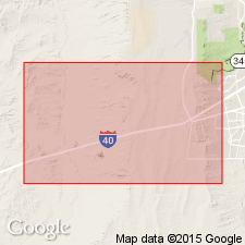
Type section (subsurface): [New Mexico Geological Survey] well no. 98a, near intersection of 98th Street and I-40, Albuquerque's west side, [approx. Lat. 35 deg. 05 min. 10 sec. N., Long. 106 deg. 44 min. 52 sec. W., Albuquerque West 7.5-min quadrangle], Bernalillo Co., north-central NM. Named from Town of Atrisco Grant, Bernalillo Co., north-central NM. (See also Connell and others, 1998.)
Source: Publication.
For more information, please contact Nancy Stamm, Geologic Names Committee Secretary.
Asterisk (*) indicates published by U.S. Geological Survey authors.
"No current usage" (†) implies that a name has been abandoned or has fallen into disuse. Former usage and, if known, replacement name given in parentheses ( ).
Slash (/) indicates name conflicts with nomenclatural guidelines (CSN, 1933; ACSN, 1961, 1970; NACSN, 1983, 2005, 2021). May be explained within brackets ([ ]).

