The National Geologic Map Database is migrating to a new infrastructure. We apologize for any service disruptions during this process.
|
|---|


- Usage in publication:
-
- Atoka formation*
- Modifications:
-
- Original reference
- Dominant lithology:
-
- Sandstone
- Shale
- AAPG geologic province:
-
- Ouachita folded belt
- Arkoma basin
Summary:
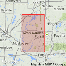
Pg. 273. Atoka formation, basal formation of Coal Measures. Alternating sandstones and shales, 7,000 feet thick, with, at intervals of 1,000 to 1,200 feet, four groups of sandstone strata each nearly 100 feet thick. Exposed in Choctaw coal field (in T. 5 N., R. 17 through 27 E.), Le Flore, Latimer, Pittsburgh, and Atoka Counties, Oklahoma. Underlies Hartshorne sandstone. Unfossiliferous. Age is Late Carboniferous. Report includes geologic map.
Named from Atoka, Atoka Co., eastern OK, which is situated on outcrop of formation.
Source: US geologic names lexicon (USGS Bull. 896, p. 88); supplemental information from GNU records (USGS DDS-6; Denver GNULEX).
- Usage in publication:
-
- Atoka formation*
- Modifications:
-
- Revised
- AAPG geologic province:
-
- Arkoma basin
Summary:
Atoka formation, 3,100 feet thick, underlies Hartshorne sandstone and overlies Wapanucka limestone. Includes Chickachoc chert lentil in lower part, locally in southeastern part of Colgate quadrangle, Coal County, Oklahoma. Age is Carboniferous.
Source: US geologic names lexicon (USGS Bull. 896, p. 88); supplemental information from GNU records (USGS DDS-6; Denver GNULEX).

- Usage in publication:
-
- Atoka formation*
- Modifications:
-
- Overview
- AAPG geologic province:
-
- Ouachita folded belt
- Arkoma basin
Summary:
The formation (of Pennsylvanian age) underlying Atoka formation in area south and east of Ti Valley-Choctaw belt of Ouachita Mountains, Oklahoma, and extending into Scott County, Arkansas, is now known as Johns Valley shale, and the formation underlying it in parts of the Ti Valley-Choctaw belt of Ouachita Mountains, Oklahoma, is Wapanucka limestone, but in other places the Wapanucka limestone and underlying Springer formation are absent, and the Atoka appears to rest on the older Caney shale (now restricted to beds of Mississippian age). The formation that underlies it in Arkansas Valley of Arkansas is Jackfork sandstone. (See H.D. Miser, AAPG Bull., v. 18, no. 8, 1934).
Source: US geologic names lexicon (USGS Bull. 896, p. 88).
- Usage in publication:
-
- Atoka formation*
- Modifications:
-
- Revised
- AAPG geologic province:
-
- Chautauqua platform
Summary:
Pg. 504 -507; C.W. Wilson, Jr., and N.D. Newell, 1937, Oklahoma Geol. Survey Bull., no. 57, p. 24-25, pl. 1. Atoka formation, in Muskogee-Porum district, subdivided into 12 units, 6 sandstone members each overlain by an unnamed shale unit. Sandstone members (ascending): Coody (Coata), Pope Chapel, Georges Fork, Dirty Creek, Webbers Falls, and Blackjack School. Total thickness 950 to 1,260 feet. Unconformably overlies Bloyd formation of Morrow group; underlies Hartshorne sandstone. Basal formation of Des Moines group. Atoka, Hartshorne, McAlester, and Savanna formations and a part of Boggy shale are directly traceable into Winslow formation as heretofore mapped in Muskogee quadrangle. Age is Middle Pennsylvanian. Report includes geologic map, columnar sections, measured sections.
Source: US geologic names lexicon (USGS Bull. 1200, p. 165-167); supplemental information from GNU records (USGS DDS-6; Denver GNULEX).
- Usage in publication:
-
- Atoka formation*
- Modifications:
-
- Revised
Summary:
Pg. 854 (fig. 1), 858, 859. Atoka formation. Overlies Barnett Hill formation (new). Unit here termed Barnett Hill was locally assigned by Taff to Atoka formation but in other areas was included in Wapanucka.
Source: US geologic names lexicon (USGS Bull. 1200, p. 165-167).
- Usage in publication:
-
- Atoka formation
- Modifications:
-
- Areal extent
- AAPG geologic province:
-
- Chautauqua platform
- Arkoma basin
Summary:
Pg. 17 (table 1), 50-52, measured section. Atoka formation. Detailed discussion of Morrow series in northeastern Oklahoma. All sections measured in Morrow series were carried at least to base of Atoka sandstone and, where possible, to top of hills, so as to include a portion of Atoka formation. Locally thin-bedded, generally medium- to coarse-grained cross-bedded sandstone rests on upper part of Bloyd shale in all areas except northward from Yonkers, where Bloyd was removed by pre-Atoka erosion, and Atoka is in contact with Hale formation. Top of Atoka not present in area. These post-Morrow beds in Adair and most of Cherokee Counties were called Winslow (Taff, USGS Geol. Atlas, Folio 122; 1906, USGS Geol. Atlas, Folio 132) and, in Wagoner and Mayes Counties, have been referred to Cherokee. Croneis (1930, Arkansas Geol. Survey Bull., no. 3) first used term Atoka for beds called Winslow in Arkansas, and Wilson (1937) recognized Atoka, Hartshorne, McAlester, and Savanna formations in Muskogee area, replacing general term Winslow. Des Moines series.
Source: US geologic names lexicon (USGS Bull. 1200, p. 165-167).
- Usage in publication:
-
- Atoka formation*
- Modifications:
-
- Areal extent
- AAPG geologic province:
-
- Arkoma basin
Summary:
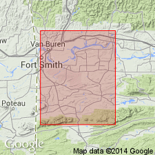
Pg. 69 (table), 70-73, pl. 11. Discussion of Fort Smith district, in Scott, Sebastian, Crawford, Franklin, and Logan Counties, Arkansas. Atoka formation, oldest bedded rock exposed in area, crops out in five parts of district; largest area of outcrop is in southern part of district. Consists chiefly of alternating beds of sandstone and shale, the shale being more abundant, and locally contains discontinuous streaks of coal and coaly shale. Thickness about 6,900 feet south of Backbone Mountain; about 3,300 feet near Mansfield. Underlies Hartshorne sandstone, minor unconformity. Atoka formation of Fort Smith district is identical with Atoka formation in Oklahoma.
Source: US geologic names lexicon (USGS Bull. 1200, p. 165-167).
- Usage in publication:
-
- Atoka formation
- Modifications:
-
- Revised
- AAPG geologic province:
-
- Arkoma basin
Summary:
Pg. 1935-1953. Atoka formation. In Arkansas, subdivided to include Greenland sandstone member (new) at base. Overlies Bloyd shale of Morrow group. Exact position of boundary between Morrow group and Atoka being difficult to determine on purely physical stratigraphic basis in Washington County.
Source: US geologic names lexicon (USGS Bull. 1200, p. 165-167).
- Usage in publication:
-
- Atoka formation
- Atoka series
- Modifications:
-
- Mapped 1:48k
- AAPG geologic province:
-
- Arkoma basin
Summary:
Atoka formation described in Waldron quadrangle, Scott County, Arkansas. Composite section of measured outcrops of Atoka across Waldron syncline shows that about 11,800 feet of strata assigned to formation crop out between top of formation, 4 miles north of Waldron and Ross Creek fault, 3.5 miles south of Waldron. Rocks underlying those exposed in Waldron syncline crop out in Brushy Mountain anticline where they have combined stratigraphic thickness of about 7,200 feet. Total thickness in northern part of Waldron quadrangle, north of Ross Creek fault, appears to be at least 19,000 feet. In southern part of quadrangle, stratigraphic thickness in Black Fork syncline is estimated at about 18,500 feet, but highest and lowest strata are not present. Overlies Johns Valley shale; underlies Hartshorne sandstone. (Stratigraphic equivalence of Hartshorne in Waldron quadrangle with Hartshorne in Fort Smith district and eastern Oklahoma is in doubt). Atoka formation is included in Atoka series.
Source: US geologic names lexicon (USGS Bull. 1200, p. 165-167).
- Usage in publication:
-
- Atoka formation
- Modifications:
-
- Areal extent
- AAPG geologic province:
-
- Chautauqua platform
Summary:
Pg. 14 (fig. 2), 82-86, pls. Discussion of south and west flanks of Ozark uplift, northeastern Oklahoma. Atoka formation is widespread from Arkansas line westward to Arkansas River southeast of Muskogee. Thins northward from maximum of 600 feet southeast of Muskogee to 0 near Adair where it is truncated and overlapped by younger units. Northward thinning is by convergence, loss of lower member by progressive northward overlap and unconformity above. Webbers Falls member believed to be most extensive. Lies with unconformity upon Bloyd, Hale, and Fayetteville formations. Truncated by erosion and overlapped northward by shales, clays, and sandstones of Hartshorne-McAlester sequence. Assigned to Atoka series of Middle Pennsylvanian age.
Source: US geologic names lexicon (USGS Bull. 1200, p. 165-167).
- Usage in publication:
-
- Atoka formation
- Modifications:
-
- Areal extent
Blythe, J.G., 1959, Atoka formation on the north side of the McAlester basin [Oklahoma]: Oklahoma Geological Survey Circular, no. 47, 74 p.
Summary:
Pg. 5-74. Discussion of Atoka formation on north side of McAlester basin. Formation passes northward into a platform facies, thins, and is overlapped by Desmoinesian rocks. Facies changes and thinning of section north of Arkansas River made it unwise to attempt perfect identification of the rapidly thinning shelf-facies section with member as described in Muskogee-Porum area. Webbers Falls sandstone provided persistent marker unit and made it possible to identify Blackjack School member. Georges Fork and Dirty Creek members could not be identified north of Arkansas River and were mapped as one unit. Likewise Coody and Pope Chapel were mapped as one unit. Thickness 37 to 508 feet.
Source: US geologic names lexicon (USGS Bull. 1200, p. 165-167).
- Usage in publication:
-
- Atoka formation
- Modifications:
-
- Age modified
- Areal extent
Summary:
Pg. 17 (fig. 2), 63, 64, pl. 1. Atoka formation. Formation is 6,800 feet thick in Boktukola syncline; an unknown thickness has been removed by erosion. Basal part of formation is Morrowan. Contains sandstone mold faunas similar to Honess' (1924, [Oklahoma] Bur. Geol. Circ., no. 3) "Morrow fauna" and spiculite cherts which may be partially equivalent to Chickachoc chert. Middle and upper parts of formation of Boktukola syncline are equivalent to Atoka formation of frontal Ouachitas. Harris Creek syncline is fan fold which exposes Atoka formation rather than anticline of Stanley shale as shown on Geologic map of Oklahoma. Overlies Johns Valley formation in Boktukola and Harris synclines. Age is Morrowan-Atokan.
Source: US geologic names lexicon (USGS Bull. 1200, p. 165-167).
- Usage in publication:
-
- Atoka Formation*
- Modifications:
-
- Areal extent
- AAPG geologic province:
-
- Arkoma basin
Summary:
In Snowball quadrangle, Newton and Searcy Counties, Arkansas, overlies newly named Witts Springs Formation. Age is Early Pennsylvanian (Morrowan).
Source: Modified from GNU records (USGS DDS-6; Denver GNULEX).
- Usage in publication:
-
- Atoka Formation*
- Modifications:
-
- Areal extent
- AAPG geologic province:
-
- Chautauqua platform
- Arkoma basin
Summary:
Atoka Formation. In Adair, Sequoyah, Muskogee, and Cherokee Counties, Oklahoma., unconformably overlies McCully Formation (new), a substitute for Bloyd Shale. Age is Middle Pennsylvanian (Atokan).
Source: Modified from GNU records (USGS DDS-6; Denver GNULEX).
For more information, please contact Nancy Stamm, Geologic Names Committee Secretary.
Asterisk (*) indicates published by U.S. Geological Survey authors.
"No current usage" (†) implies that a name has been abandoned or has fallen into disuse. Former usage and, if known, replacement name given in parentheses ( ).
Slash (/) indicates name conflicts with nomenclatural guidelines (CSN, 1933; ACSN, 1961, 1970; NACSN, 1983, 2005, 2021). May be explained within brackets ([ ]).