The National Geologic Map Database is migrating to a new infrastructure. We apologize for any service disruptions during this process.
|
|---|


- Usage in publication:
-
- Atlanta Group*
- Modifications:
-
- Named
- AAPG geologic province:
-
- Piedmont-Blue Ridge province
Summary:
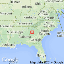
The Atlanta Group, here named, is an eugeosynclinal sequence of flysch-like rocks which crop out in the Newnan-Tucker synform, probably a synformal syncline, 90 km long and 40 km wide. It is subdivided into 12 formations and 3 members (listed in unit record). Thickness ranges from 6,000 to 18,000 m. It is intruded by 325 m.y. old Stone Mountain and Panola Granites. It is younger than 1100 m.y., the age of the discordantly overlying Snellville Formation. The contact with the overlying Lithonia Gneiss is a thrust fault or an unconformity. Age is Late Proterozoic and (or) early Paleozoic.
Source: GNU records (USGS DDS-6; Reston GNULEX).

- Usage in publication:
-
- Atlanta Group†
- Modifications:
-
- Abandoned
- AAPG geologic province:
-
- Piedmont-Blue Ridge province
Summary:
The Atlanta Group of Higgins and Atkins (1981) is here abandoned. Of the units assigned to it, the [†]Wolf Creek, [†]Promised Land, Clairmont, Wahoo Creek, Stonewall, Clarkston, and [†]Big Cotton Indian Formations, Norcross Gneiss, and Fairburn Member of the Clarkston Formation remain in good usage; the Senoia Formation is revised as the Senoia Member of the Zebulon Formation; and the Camp Creek, Inman Yard, and Intrenchment Creek Formations, the Hannah Member of the Promised Land Formation, and the Tar Creek Member of the Clarkston Formation are abandoned.
[Wolf Creek now "mixed unit of allochthonous assemblage". Promised Land now Lithonia Gneiss. Clairmont now Clairmont Member of Stonewall Gneiss. Big Cotton Indian now "mixed unit of allochthonous assemblage" or Stonewall Gneiss.]
Source: GNU records (USGS DDS-6; Reston GNULEX).
For more information, please contact Nancy Stamm, Geologic Names Committee Secretary.
Asterisk (*) indicates published by U.S. Geological Survey authors.
"No current usage" (†) implies that a name has been abandoned or has fallen into disuse. Former usage and, if known, replacement name given in parentheses ( ).
Slash (/) indicates name conflicts with nomenclatural guidelines (CSN, 1933; ACSN, 1961, 1970; NACSN, 1983, 2005, 2021). May be explained within brackets ([ ]).