The National Geologic Map Database is migrating to a new infrastructure. We apologize for any service disruptions during this process.
|
|---|


- Usage in publication:
-
- Atascadero formation
- Modifications:
-
- Original reference
- Dominant lithology:
-
- Sandstone
- AAPG geologic province:
-
- Coastal basins
Summary:
Atascadero formation. Grayish-yellow, thick- and thin-bedded soft sandstone with small amount of conglomerate and shale. Thickness 3,000 to 4,000 feet. Is local representative of Chico group. Represents all of Chico deposits present in the area. Unconformably underlies Vaquero[s] sandstone. Unconformably overlies Knoxville; northeast of Santa Lucia Range unconformably overlies Toro formation. Age is Late Cretaceous, based on a few poorly preserved fossils found in northern slope of Santa Lucia Range.
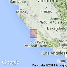
Named from exposures along Atascadero Creek, [Atascadero 7.5-min quadrangle], San Luis Obispo Co., southern CA.
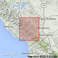
Confined to two areas: (1) long band 1 to 2 mi wide, along northern slope of Santa Lucia Range near Little Falls Canyon, and (2) narrow strip along coast from point 5 mi west of Cayucos to and beyond edge of quadrangle.
Source: Publication; US geologic names lexicon (USGS Bull. 896, p. 85); GNU records (USGS DDS-6; Menlo GNULEX).

- Usage in publication:
-
- Atascadero formation†
- Modifications:
-
- Abandoned
- AAPG geologic province:
-
- Coastal basins
Summary:
†Atascadero formation abandoned. Replaced with Chico formation. [See also Chico.]
Source: US geologic names lexicon (USGS Bull. 896, p. 85).
- Usage in publication:
-
- Atascadero Formation
- Modifications:
-
- Reinstated
- Revised
- Biostratigraphic dating
- Dominant lithology:
-
- Sandstone
- Siltstone
- Mudstone
- Conglomerate
- AAPG geologic province:
-
- Coastal basins
Summary:
Pg. 9 (fig. 3), 14-16, geol. map. Atascadero Formation of Fairbanks (1904) is reinstated. Revised locally, west of Atascadero, to include strata Fairbanks assigned to underlying Toro Formation, here informally called Paradise Valley sequence (subdivided into, descending: Ka4, upper sandstone with mudstone; Ka3, sandstone with mudstone and conglomerate; Ka2, graywacke and dark mudstone; and Ka1, lower dark mudstone with graywacke). The USGS abandoned the Atascadero in favor of Chico Formation [see GNC entry under Wilmarth, ca. 1930]; Taliaferro (AAPG Bull., v. 28, no. 4, p. 449-521, 1944) assigned the beds to his Asuncion Formation. The Atascadero as reinstated is widely exposed in the Santa Lucia Range, west of the Rinconada fault. It is characterized by sequences of light- to medium-gray or olive-gray, thin- to thick-bedded sandstone with interbedded siltstone, mudstone, and subordinate amounts of conglomerate and impure limestone. Exposed thickness 5,200+ feet. Unconformably underlies unnamed Oligocene(?) to Miocene conglomerate; in fault contact with underlying Toro Formation (Upper Jurassic to Lower Cretaceous). Few fossils [listed]; notably LINEARIA MULTICOSTATA, GLYCYMERIS sp., G. VEATCHII var. ANAE. Age is Late Cretaceous (probably Cenomanian or Turonian to Campanian or Maestrichtian).
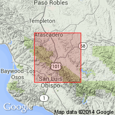
[Type locality: exposures mapped along Atascadero Creek, south of Atascadero, in T. 28 S., R. 12 E., San Luis Obispo Co., southern CA.]
Source: Publication.
- Usage in publication:
-
- Atascadero Formation*
- Modifications:
-
- Adopted
- AAPG geologic province:
-
- Coastal basins
Summary:
Atascadero Formation, essentially of Fairbanks (1904), adopted by the USGS. Consists of thick-bedded arkosic sandstone and thin-bedded sandstone and mudstone. Atascadero reinstated by Hart (1976); beds previously called Chico Formation. Tectonically overlies Franciscan assemblage. Unconformably underlies Vaqueros Formation or, where absent, Monterey Formation. Age is Late Cretaceous (Campanian).
Type locality: exposures mapped along Atascadero Creek, south of Atascadero, in T. 28 S., R. 12 E., San Luis Obispo Co., southern CA.
Source: Modified from GNU records (USGS DDS-6; Menlo GNULEX).
For more information, please contact Nancy Stamm, Geologic Names Committee Secretary.
Asterisk (*) indicates published by U.S. Geological Survey authors.
"No current usage" (†) implies that a name has been abandoned or has fallen into disuse. Former usage and, if known, replacement name given in parentheses ( ).
Slash (/) indicates name conflicts with nomenclatural guidelines (CSN, 1933; ACSN, 1961, 1970; NACSN, 1983, 2005, 2021). May be explained within brackets ([ ]).