

- Usage in publication:
-
- Astoria shales
- Modifications:
-
- Original reference
- Dominant lithology:
-
- Shale
- AAPG geologic province:
-
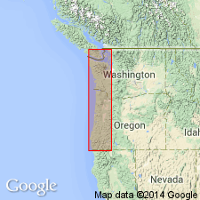
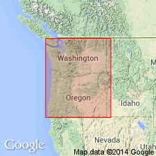
- Oregon-Washington Coast Ranges province
Summary:
Pg. 457-458. Astoria shales. The unpublished notes of Professor Condon, formerly State Geologist, state that backbone of Coast Range consists of argillaceous shales, which contain invertebrate and vertebrate fossils, frequently in concretions. To this formation Dr. Condon gives the name Astoria shales. Fossils are Miocene.
[See also E.D. Cope, [1881], Amer. Phil. Soc. Proc., v. 19, p. 62.]
Source: US geologic names lexicon (USGS Bull. 896, p. 84-85).
- Usage in publication:
-
- Astoria shales
- Modifications:
-
- Revised
- AAPG geologic province:
-
- Oregon-Washington Coast Ranges province
Summary:
Pg. 223-227. Astoria shales. Clayey and sandy shales of various colors and degrees of consolidation. Weather soft and clayey, and so appear along banks of river at Astoria. Most prominent on left or south bank. Included in †Astoria group (Miocene). Overlies ATURIA bed (Eocene). [See under †Astoria group.]
[†Astoria group discarded because Astoria shale has priority and is more useful name. The ATURIA zone is now [ca. 1938] considered to be Miocene and is included in Astoria shale.]
Source: US geologic names lexicon (USGS Bull. 896, p. 84-85).
- Usage in publication:
-
- Astoria shale
- Modifications:
-
- Revised
- AAPG geologic province:
-
- Oregon-Washington Coast Ranges province
Summary:
Assigned ATURIA zone to Oligocene and excluded it from Astoria shale.
Source: US geologic names lexicon (USGS Bull. 896, p. 84-85).
- Usage in publication:
-
- Astoria shale
- Modifications:
-
- Revised
- AAPG geologic province:
-
- Oregon-Washington Coast Ranges province
Summary:
Included ATURIA zone in Astoria shale, and assigned a thickness of 400 feet to the zone (which he assigned to the Oligocene) and a thickness of 1,000+/- feet to the overlying part of Astoria shale, which he assigned to Miocene.
Source: US geologic names lexicon (USGS Bull. 896, p. 84-85).
- Usage in publication:
-
- Astoria shale
- Modifications:
-
- Revised
- AAPG geologic province:
-
- Oregon-Washington Coast Ranges province
Summary:
Astoria shale. Recently Howe (unpublished thesis Leland Stanford Univ., 1922) investigated Astoria locality and states that the 2 sandstones present there (one underlying Astoria shales and one overlying the shales) have been confused by several writers. He states that by careful mapping the beds containing ATURIA and the places from which Dall lists his fossils are middle Miocene and not Oligocene as thought by Dall. Also that 54 percent of the species present in the shales are also present in the sandstones, and that 43 percent of the species at Astoria are also found in Monterey-Temblor (middle Miocene) of California.
Source: US geologic names lexicon (USGS Bull. 896, p. 84-85).

- Usage in publication:
-
- Astoria shale
- Modifications:
-
- Revised
- Age modified
- AAPG geologic province:
-
- Oregon-Washington Coast Ranges province
Summary:
Pg. 295-306. Assigned Astoria shale and ATURIA zone to middle Miocene, and listed fossils. In city of Astoria [type locality], formation consists of a lower sandstone member, probably more than 150 feet thick, overlain by a succession of sandy shales, about 1,000 feet thick, and these in turn by a second sandstone member.
Source: US geologic names lexicons (USGS Bull. 896, p. 84-85; USGS Bull. 1200, p. 157).
- Usage in publication:
-
- Astoria shale
- Modifications:
-
- Overview
- AAPG geologic province:
-
- Oregon-Washington Coast Ranges province
Summary:
Pg. 295-306. Assigned Astoria shale and ATURIA zone to Miocene.
Source: US geologic names lexicon (USGS Bull. 896, p. 84-85).
- Usage in publication:
-
- Astoria formation
- Modifications:
-
- Biostratigraphic dating
- Overview
- Areal extent
- Reference
- Dominant lithology:
-
- Sandstone
- Conglomerate
- Shale
- AAPG geologic province:
-
- Oregon-Washington Coast Ranges province
Summary:
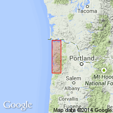
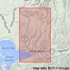
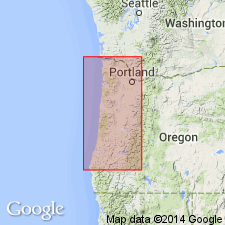
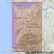
Named for Astoria, OR. Name "Astoria" used in earliest reports on west coast Tertiary by Dana (1849); first formally used by Cope (1880) as the "Astoria shales". Latter name used by Howe (1926) who described section at Astoria and recognized it as type locality of Miocene of west coast. Present author redescribes unit as the "Astoria formation" and presents good historical summary and description of "best" stratigraphic section [T16-17, R7W], from ridge between Chehalis River and North River in southwestern WA. Unit is extended to include the Clallam formation and Weaver's (1912) Wahkiakum and Chehalis formations. [Reference] section there ("Clemons section", about 2500 feet thick) consists of massive coarse sandstone, locally cross-bedded and locally containing conglomerate lenses, minor amount of clay shale in upper part and occasional lignite seams. Sandstone, typically dark colored, weathering yellow or buff, commonly contains carbonaceous fragments. Finer-grained sandstone is bluish-gray. Unconformably overlies Oligocene "Lincoln-Blakely series"; unconformably underlies the Montesano formation of Weaver (1912). Age is middle Miocene based on fossils [mollusks].
Source: GNU records (USGS DDS-6; Menlo GNULEX).

- Usage in publication:
-
- Astoria shale
- Modifications:
-
- Adopted
- AAPG geologic province:
-
- Oregon-Washington Coast Ranges province
Summary:
The USGS now [ca. 1938] classifies Astoria shale, including ATURIA zone at base, as Miocene.
Source: US geologic names lexicon (USGS Bull. 896, p. 85).
- Usage in publication:
-
- Astoria formation
- Modifications:
-
- Overview
- AAPG geologic province:
-
- Oregon-Washington Coast Ranges province
Summary:
Pg. 173, 175-187. Astoria formation. Consists of sandy clay shales with brown sandstone in upper part, in Grays Harbor area; becomes progressively more sandy toward the lower Columbia River and prevailingly massive brown medium-grained sandstone in northwest Oregon. Basaltic flows are intercalated in southwest Washington and increase in importance until, east of Portland, the formation is composed almost entirely of basalt. Thickness varies from 1,500 to as much as 12,000 feet. In some areas underlies Montesano formation; unconformably overlies Twin Rivers formation.
[See also C.E. Weaver and others, 1944, GSA Bull., v. 55, no. 5, p. 184, chart.]
Source: US geologic names lexicon (USGS Bull. 1200, p. 157).
- Usage in publication:
-
- Astoria formation
- Modifications:
-
- Overview
- AAPG geologic province:
-
- Oregon-Washington Coast Ranges province
Summary:
Astoria formation. In Clatsop and Tillamook Counties, Oregon, the Astoria reported as overlying beds of Blakeley age.
Source: US geologic names lexicon (USGS Bull. 1200, p. 157).
- Usage in publication:
-
- Astoria formation
- Modifications:
-
- Biostratigraphic dating
- AAPG geologic province:
-
- Oregon-Washington Coast Ranges province
Summary:
Astoria formation. Foraminiferal fauna indicates an age of lower to middle Miocene; some evidence indicates upper lower Miocene (upper Saucesian).
Source: US geologic names lexicon (USGS Bull. 1200, p. 157).
- Usage in publication:
-
- Astoria Formation*
- Modifications:
-
- Biostratigraphic dating
- Areal extent
- AAPG geologic province:
-
- Oregon-Washington Coast Ranges province
Summary:
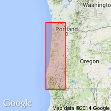
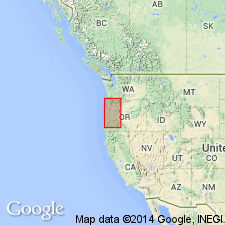
This report summarizes reported occurrences of Astoria Formation in Oregon that extend from type locality at Astoria discontinuously along coast as far south as Cape Blanco. At type locality Howe (1926) divided unit into [3 informal members]: lower sandstone, shale, and upper sandstone. Lower sandstone is more than 150 feet thick; shale is probably less than 1000 feet thick; no thickness given for upper sandstone. Coastal exposures to south are dominantly calcareous silty shale and fine-grained silty sandstone with maximum thickness of 250 feet in uninterrupted section. Locally intruded by volcanic rocks and locally includes volcanic detritus. Unconformably overlies Nye Mudstone, Blakely Formation, and Tunnel Point Sandstone at different localities. Unconformably overlain at various places by Pleistocene sedimentary deposits, Pliocene(?) Empire Formation, and Miocene Columbia River Basalt. Age is early to middle Miocene; indicated by abundant invertebrate fossils (table, p. 21).
Source: GNU records (USGS DDS-6; Menlo GNULEX).
- Usage in publication:
-
- Astoria Formation
- Modifications:
-
- Revised
- AAPG geologic province:
-
- Oregon-Washington Coast Ranges province
Summary:
Comprises four members (ascending): Angora Peak sandstone member, Silver Point mudstone member, Newport sandstone member (here informally named) and Big Creek sandstone member (here informally named). First three members represent separate embayments progressively southward from Astoria along the Oregon coast; fourth, occurs east of Astoria. Angora Peak is fine- to coarse-grained, micaceous feldspathic, and volcanic sandstone, 1000 feet thick. Silver Point gradationally overlies and intertongues with Angora Peak and is well-laminated to structureless micaceous and carbonaceous silty mudstone, 700 feet thick. Newport is moderately to well-sorted, medium- to fine-grained sandstone, 1000 feet thick. Big Creek, which is lateral equivalent of Angora Peak and Silver Point members, is 1400 feet thick. All members are lithologically similar. Age is early to middle Miocene.
Source: GNU records (USGS DDS-6; Menlo GNULEX).
- Usage in publication:
-
- Astoria Formation*
- Modifications:
-
- Biostratigraphic dating
- AAPG geologic province:
-
- Oregon-Washington Coast Ranges province
Summary:
Base of the Astoria Formation, in Newport embayment on northwestern Oregon coast, is considered to be lower boundary of Newportian Stage (late early Miocene age). In southwestern Washington, the Astoria Formation is conformably overlain by the Montesano Formation; top of the Astoria here is considered to be upper boundary of Newportian Stage ([middle] middle Miocene). In its type area, the lower part of the Astoria Formation contains VERTIPECTEN FUCANUS, ACILA (A.) GETTYSBURGENSIS and ATURIA ANGUSTATA (Conrad) which have their last occurrences in Pillarian Stage. Upper part of Astoria at its type contains PATINOPECTEN PROPATULUS zonal fossil of Newportian Stage.
Source: GNU records (USGS DDS-6; Menlo GNULEX).
For more information, please contact Nancy Stamm, Geologic Names Committee Secretary.
Asterisk (*) indicates published by U.S. Geological Survey authors.
"No current usage" (†) implies that a name has been abandoned or has fallen into disuse. Former usage and, if known, replacement name given in parentheses ( ).
Slash (/) indicates name conflicts with nomenclatural guidelines (CSN, 1933; ACSN, 1961, 1970; NACSN, 1983, 2005, 2021). May be explained within brackets ([ ]).