The National Geologic Map Database is migrating to a new infrastructure. We apologize for any service disruptions during this process.
|
|---|


- Usage in publication:
-
- Asses Ears Granite
- Modifications:
-
- Original reference
- Dominant lithology:
-
- Granite
- AAPG geologic province:
-
- Alaska West-Central region
Summary:
Pg. 3-4. Two types of granite described: Asses Ears and American Creek. The Asses Ears is medium-grained, subhedral granular biotite granite containing perthitic orthoclase, andesine, quartz, biotite, hornblende, and minor apatite and pyrite. Virtually unaltered tremolite present in marble on upper Magnet Creek, but not on marble ridge just west of Asses Ears. Age is Mesozoic(?).
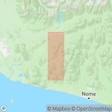
Inmachuk map area covers 110 sq mi in northern Seward Peninsula, 10 mi north of Kotzebue Sound and 25 mi southwest of Deering, Seward Peninsula, west-central AK.
Source: US geologic names lexicon (USGS Bull. 1350, p. 34-35).

- Usage in publication:
-
- Asses Ears Granite
- Modifications:
-
- Age modified
- AAPG geologic province:
-
- Alaska West-Central region
Summary:
Forms small stock near Cloud Lake in area north of Imuruk Lake, Bendeleben quad, Seward Peninsula, AK. Several facies include coarsely-porphyritic biotite granite. Hybrid rocks are developed along west margin where unit intrudes sheet of Paleozoic carbonate rocks. Is Cretaceous age. [no basis given]
Source: GNU records (USGS DDS-6; Menlo GNULEX).
For more information, please contact Nancy Stamm, Geologic Names Committee Secretary.
Asterisk (*) indicates published by U.S. Geological Survey authors.
"No current usage" (†) implies that a name has been abandoned or has fallen into disuse. Former usage and, if known, replacement name given in parentheses ( ).
Slash (/) indicates name conflicts with nomenclatural guidelines (CSN, 1933; ACSN, 1961, 1970; NACSN, 1983, 2005, 2021). May be explained within brackets ([ ]).