The National Geologic Map Database is migrating to a new infrastructure. We apologize for any service disruptions during this process.
|
|---|


- Usage in publication:
-
- Asphalt Ridge sandstone
- Modifications:
-
- Original reference
- Dominant lithology:
-
- Sandstone
- AAPG geologic province:
-
- Uinta basin
Summary:
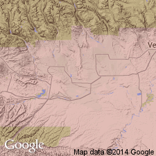
Pg. 99 (table 2), 110-111, pl. 1. Asphalt Ridge sandstone of Mesaverde group. Defined as lower of two basal marine sandstones of Mesaverde group in Vernal (northeastern Utah) region. Usually a single massive yellow to white soft sandstone bed bounded on top by a thin tongue of Mancos shale and on bottom by main body of Mancos shale. Upper boundary transitional; in some places it is impossible to draw a sharp line between Asphalt Ridge and overlying Rim Rock sandstone (new). Thickness about 100 feet. Fossiliferous (mollusks). Age is Late Cretaceous (post-Niobrara).
Typically exposed in Asphalt Ridge, [in T. 4 and 5 S., R. 21 E., Vernal NE and Vernal SE 7.5-min quadrangles, Uintah Co.], northeastern UT. Traced, with interruptions, from north end of Asphalt Ridge to the Rim Rock at Green River, where it feathers out into main body of Mancos shale. [Not separately mapped.]
Source: US geologic names lexicon (USGS Bull. 1200, p. 155-156); supplemental information from GNU records (USGS DDS-6; Denver GNULEX).
For more information, please contact Nancy Stamm, Geologic Names Committee Secretary.
Asterisk (*) indicates published by U.S. Geological Survey authors.
"No current usage" (†) implies that a name has been abandoned or has fallen into disuse. Former usage and, if known, replacement name given in parentheses ( ).
Slash (/) indicates name conflicts with nomenclatural guidelines (CSN, 1933; ACSN, 1961, 1970; NACSN, 1983, 2005, 2021). May be explained within brackets ([ ]).