


- Usage in publication:
-
- Ashton zone
- Modifications:
-
- Overview
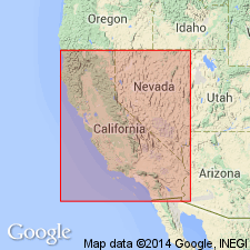
- AAPG geologic province:
-
- Los Angeles basin
Summary:
Ashton zone. A subsurface zone in lower part of Fernando group in Huntington Beach oil field of Orange County, southern California. Consists of 1,200 to 2,000 or more feet of sticky brown shale, sandy shales, sands, and hard shells. Some producing wells have penetrated it to depth of at least 1,750 feet, according to S.H. Gester. H.S. Gale, 1933 (AAPG Bull., v. 18, no. 3, p. 330) assigned it to Repetto siltstone (lower Pliocene).
[Named from Eddystone Oil Company (later Shell Oil Company) "Ashton" No. 1 well, Huntington Beach oil field, Orange Co., southern CA.]
Source: US geologic names lexicon (USGS Bull. 896, p. 83).
- Usage in publication:
-
- Ashton zones
- Ashton zone
- Modifications:
-
- Overview
- AAPG geologic province:
-
- Los Angeles basin
Summary:
Pg. 673; see also W.R. Wardner, Jr., p. 20, S.G. Wissler, p. 220, 230, pl. 5 (p. 234-235), D.K. Weaver and V.H. Wilhelm, p. 329-331, same vol.
Ashton zones. On pl. 5 divided into ascending: 1. lower Ashton zone (in Puente formation); 2. intermediate Ashton zone (spans Puente and Repetto formations), foraminifer zone 2 (latest Miocene) and zones 17 to 12 (early Pliocene); and 3. upper Ashton zone (in Repetto formation), foraminifer zones 12 to 7 (Pliocene), KARRERIELLA MILLERI Natland faunal division.
Source: Publication.
For more information, please contact Nancy Stamm, Geologic Names Committee Secretary.
Asterisk (*) indicates published by U.S. Geological Survey authors.
"No current usage" (†) implies that a name has been abandoned or has fallen into disuse. Former usage and, if known, replacement name given in parentheses ( ).
Slash (/) indicates name conflicts with nomenclatural guidelines (CSN, 1933; ACSN, 1961, 1970; NACSN, 1983, 2005, 2021). May be explained within brackets ([ ]).