


- Usage in publication:
-
- Ashland limestone member
- Modifications:
-
- Original reference
- Dominant lithology:
-
- Limestone
- AAPG geologic province:
-
- Salina basin
Summary:
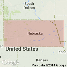
Pg. 7, 24. Ashland limestone member of Braddyville formation. Main body light gray, massive, hard limestone. Basal 3.5 feet interbedded limestones and shales. Thickness 12 feet. Lies 16 to 18 feet above South Bend limestone. Is top member of Braddyville formation in Nebraska. Age is Pennsylvanian. Report includes measured sections, cross sections.
Named from town of Ashland, Saunders Co., southeastern NE.
Source: US geologic names lexicon (USGS Bull. 896, p. 81); GNC KS-NE Pennsylvanian Corr. Chart, sheet 1, Oct. 1936; supplemental information from GNU records (USGS DDS-6; Denver GNULEX).
- Usage in publication:
-
- Ashland limestone†
- Modifications:
-
- Abandoned
Summary:
Pg. 11. Ashland limestone abandoned, as another name has priority. The Ashland limestone is the Weepingwater [Weeping Water] limestone.
Source: US geologic names lexicon (USGS Bull. 896, p. 81); GNC KS-NE Pennsylvanian Corr. Chart, sheet 1, Oct. 1936; supplemental information from GNU records (USGS DDS-6; Denver GNULEX).
For more information, please contact Nancy Stamm, Geologic Names Committee Secretary.
Asterisk (*) indicates published by U.S. Geological Survey authors.
"No current usage" (†) implies that a name has been abandoned or has fallen into disuse. Former usage and, if known, replacement name given in parentheses ( ).
Slash (/) indicates name conflicts with nomenclatural guidelines (CSN, 1933; ACSN, 1961, 1970; NACSN, 1983, 2005, 2021). May be explained within brackets ([ ]).