

- Usage in publication:
-
- Ashland mica schists
- Modifications:
-
- Original reference
- Dominant lithology:
-
- Schist
- AAPG geologic province:
-
- Piedmont-Blue Ridge province
Summary:
Pg. 8. Ashland mica schists. Metamorphic sediments of undetermined age, probably Paleozoic. Older than Talladega slates and younger than the older (probably pre-Cambrian) mica schists.
[Named from development around Ashland, Clay Co., eastern AL.]
Source: US geologic names lexicon (USGS Bull. 896, p. 81).
- Usage in publication:
-
- Ashland mica schist
- Modifications:
-
- Age modified
- AAPG geologic province:
-
- Piedmont-Blue Ridge province
Summary:
Map, p. 32-33. Ashland mica schist. Schists, chiefly garnetiferous biotite schist and siliceous, more or less graphitic, muscovite schist, the two types intergrading. Contains some quartzite. Is penetrated by both basic and acid intrusives, not separable on map. Thickness probably 10,000 feet. Assigned to Algonkian, but without definite proof.
[GNC remark (ca. 1936, US geologic names lexicon, USGS Bull. 896, p. 81): In view of fact that "Archean system" and "Algonkian system" have been discarded, this formation is now classifed by the USGS as pre-Cambrian.]
Source: US geologic names lexicon (USGS Bull. 896, p. 81).
- Usage in publication:
-
- Ashland Group
- Modifications:
-
- Revised
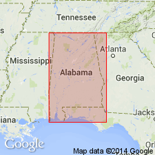
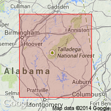
- Areal extent
- AAPG geologic province:
-
- Piedmont-Blue Ridge province
Summary:
Rocks mapped as Ashland Mica Schist by Crickmay (1952) in GA and NC, and by Adams and others (1926) in AL, are actually two different rock sequences which are better embraced by the term "Group" rather than "Mica Schist." Lithologic distribution of amphibolites suggests that Ashland Group correlates with Ashe Formation in NC and with Mount Rogers Formation farther to the northeast. [Note that Ashland Group contains no named formations, only an unnamed upper and lower sequence.]
Source: GNU records (USGS DDS-6; Reston GNULEX).
- Usage in publication:
-
- Ashland Supergroup
- Modifications:
-
- Revised
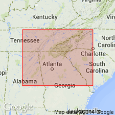
- AAPG geologic province:
-
- Piedmont-Blue Ridge province
Summary:
Author here proposes that Ashland Mica Schist as used by Adams (1926) be elevated to supergroup status to incorporate the groups of the Coosa block in east-central Alabama. Ashland includes Poe Bridge Mountain and Mad Indian Groups in the northeastern part of the study area (Clay, Randolph, and Cleburne Cos) and the correlative Higgins Ferry and Hatchet Creek Groups in the southwestern part (Coosa and Chilton Cos). The contact between the Mad Indian and Poe Bridge Mountain Groups and between the Higgins Ferry and Hatchet Creek Groups appears to be stratigraphic rather than tectonic, but relative age of units is undetermined.
Source: GNU records (USGS DDS-6; Reston GNULEX).
For more information, please contact Nancy Stamm, Geologic Names Committee Secretary.
Asterisk (*) indicates published by U.S. Geological Survey authors.
"No current usage" (†) implies that a name has been abandoned or has fallen into disuse. Former usage and, if known, replacement name given in parentheses ( ).
Slash (/) indicates name conflicts with nomenclatural guidelines (CSN, 1933; ACSN, 1961, 1970; NACSN, 1983, 2005, 2021). May be explained within brackets ([ ]).