- Usage in publication:
-
- Asher formation
- Modifications:
-
- Original reference
- Dominant lithology:
-
- Redbeds
- Sandstone
- AAPG geologic province:
-
- Chautauqua platform
Summary:
Pg. 141-142, pls. 3, 27, and map. Asher formation. Typical red beds. Basal 30 feet consists of a series of coarse, red and brownish-red sandstones that cap north bluff of Canadian River from bridge south of Asher to northern edge of Stonewall quadrangle. Contains no arkosic material, but arkose is characteristic of underlying Pontotoc terrane [group]. The portion of formation present in northwest corner of quadrangle is 250 feet thick. No upper limit is here defined. No fossils found, but upon evidence afforded by color and position in section is referred to lower Permian. Next younger formation is Guertie sand, of Pleistocene age. Report includes geologic map.
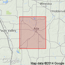
Named from development at and west of Asher, Pottawatomie Co., central southern OK.
[GNC remark (ca. 1938, US geologic names lexicon, USGS Bull. 896, p. 80): The top of Asher formation as defined by H.D. Miser (geol. map of Oklahoma, 1926) is base of Enid formation as first defined. See "Tentative correlation of the named geologic units of Oklahoma," compiled by M.G. Wilmarth, Secretary of Committee on Geologic Names, USGS unpub. corr. chart, Jan. 1931, sheet 1.]
Source: US geologic names lexicon (USGS Bull. 896, p. 80); GNC OK Corr. Chart, sheet 1, Jan. 1931; supplemental information from GNU records (USGS DDS-6; Denver GNULEX).
For more information, please contact Nancy Stamm, Geologic Names Committee Secretary.
Asterisk (*) indicates published by U.S. Geological Survey authors.
"No current usage" (†) implies that a name has been abandoned or has fallen into disuse. Former usage and, if known, replacement name given in parentheses ( ).
Slash (/) indicates name conflicts with nomenclatural guidelines (CSN, 1933; ACSN, 1961, 1970; NACSN, 1983, 2005, 2021). May be explained within brackets ([ ]).

