The National Geologic Map Database is migrating to a new infrastructure. We apologize for any service disruptions during this process.
|
|---|


- Usage in publication:
-
- Ash Spring Basalt Member
- Modifications:
-
- Areal extent
- Dominant lithology:
-
- Basalt
- AAPG geologic province:
-
- Permian basin
Summary:
Pg. 23, pI. 2, road logs. Ash Spring Basalt Member of Chisos Formation of Big Bend Park Group. Overlies Alamo Creek Basalt Member and underlies Bee Mountain Basalt Member (new). Thickness about 75 feet at Casa Grande Peak. Age is late Eocene.
Source: US geologic names lexicon (USGS Bull. 1350, p. 34).
- Usage in publication:
-
- Ash Spring Basalt Member
- Modifications:
-
- Principal reference
- Dominant lithology:
-
- Basalt
- AAPG geologic province:
-
- Permian basin
Summary:
Pg. 116-118, pls. Ash Spring Basalt Member of Chisos Formation. Formal proposal of name. Second lava above base of Chisos Formation. Conspicuously porphyritic with phenocrysts of plagioclase, some more than half an inch long at type locality. At all exposures the basal 10 feet is scoriaceous and many of these openings are filled with secondary crystals. Thickness 65 to 200 feet. At all localities studied, where it is more than 50 feet thick, it consists of two or more flows. Overlies Alamo Creek Basalt Member and underlies Bee Mountain Basalt Member (both of Chisos). Age is late Eocene.
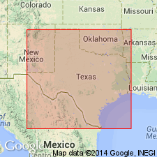
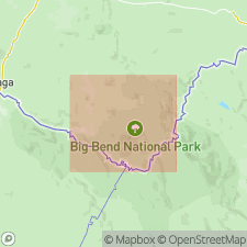
Type locality: on north side of Chisos Mountains where it forms massive ledge. Named for Ash Spring, Brewster Co., southwestern TX.
Source: US geologic names lexicon (USGS Bull. 1350, p. 34).
- Usage in publication:
-
- Ash Spring Basalt [Member]
- Modifications:
-
- Geochronologic dating
- AAPG geologic province:
-
- Permian basin
Summary:
Pg. 24. Ash Spring Basalt [Member] of Chisos Formation. Sample from basalt flow, in The Basin quadrangle, Brewster County, southwestern Texas, yielded a K-Ar age of 34.5 +/-1.7 Ma (whole-rock). Data from R.A. Maxwell and others, 1967 (Univ. Texas-Austin Pub. 6711, 320 p.); age recalculated using decay constants of Steiger and Jager, 1977 (Earth Planet. Sci. Letters, v. 36, p. 359-362). [Age considered Oligocene. Eocene-Oligocene boundary 36.6 (38-34) Ma (from Geologic Names Committee, USGS, 1983 ed. geol. time scale, with additions from N.J. Snelling, 1985, The Geol. Soc. Mem., no. 10).]
Source: Publication.
For more information, please contact Nancy Stamm, Geologic Names Committee Secretary.
Asterisk (*) indicates published by U.S. Geological Survey authors.
"No current usage" (†) implies that a name has been abandoned or has fallen into disuse. Former usage and, if known, replacement name given in parentheses ( ).
Slash (/) indicates name conflicts with nomenclatural guidelines (CSN, 1933; ACSN, 1961, 1970; NACSN, 1983, 2005, 2021). May be explained within brackets ([ ]).