The National Geologic Map Database is migrating to a new infrastructure. We apologize for any service disruptions during this process.
|
|---|


- Usage in publication:
-
- Ash Hollow formation
- Modifications:
-
- Original reference
- Dominant lithology:
-
- Sand
- Sandstone
- AAPG geologic province:
-
- Denver basin
Summary:
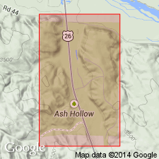
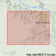
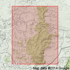
Pg. 260-262, 283. Ash Hollow formation. Near junction of North and South Forks of Platte River, first rocky strata were observed. They continue along South Fork, cropping out at intervals at one or the other side of river, and were found most developed in Ash Hollow where they attain thickness of over 250 feet. This series is composed of an alternation of loose, finely sandy, and of harder rocky strata, the latter consisting of fine or coarse drift-sand, generally cemented by carbonate of lime, forming more or less calcareous sandstones, and gritty, very impure limestones. [Age is] probably Pliocene-Tertiary. Fossilized seeds present in rocks near forks of Platte River. From Ash Hollow westward, strata gradually assume different appearance, and instead of being calcareo-arenaceous they become more purely arenaceous and, finally, argillo-arenaceous. This formation is older than Ash Hollow series. Term Ash Hollow formation used on page 283.
Source: US geologic names lexicon (USGS Bull. 1200, p. 149-150).
- Usage in publication:
-
- Ash Hollow formation
- Modifications:
-
- Areal extent
- AAPG geologic province:
-
- Denver basin
Summary:
Pg. 223-224, 227. Ash Hollow formation. Name applied to "mortar beds" of Ogallala group. Thickness 100 to 250 feet. Underlies Sidney gravel formation; overlies Valentine formation. Age is Pliocene.
Source: US geologic names lexicon (USGS Bull. 1200, p. 149-150).
- Usage in publication:
-
- Ash Hollow formation
- Modifications:
-
- Areal extent
- AAPG geologic province:
-
- Denver basin
Summary:
p. 435-436. Ash Hollow formation. At type locality, where they overlie about 55 feet of Brule formation, beds belonging to Ash Hollow formation consist of layers of gravel, sand, silt, and fine sandy clay, with some beds of volcanic ash, all more or less indurated into hard caliche beds at regular intervals. Thickness 250 to 275 feet. Term Ash Hollow is not a new or even recent name as was supposed by Lugn (1938). Term Ash Hollow formation was applied to exactly same beds in Ash Hollow Canyon by Engelmann (1876).
[See also 1939, GSA Bull., v. 50, no. 8, p. 1260-1261.]
Source: US geologic names lexicon (USGS Bull. 1200, p. 149-150).
- Usage in publication:
-
- Ash Hollow formation
- Modifications:
-
- Revised
- AAPG geologic province:
-
- Anadarko basin
- Chadron arch
- Las Animas arch
Summary:
Pg. 139-145. Ash Hollow formation of Ogallala group. Subdivided to include (ascending) Wray channel, Minnechaduza, and Feldt Ranch beds (all new). Age is Pliocene.
Source: US geologic names lexicon (USGS Bull. 1200, p. 149-150).

- Usage in publication:
-
- Ash Hollow member
- Modifications:
-
- Areal extent
- AAPG geologic province:
-
- Central Kansas uplift
- Anadarko basin
Summary:
Pg. 18 (fig. 8), (fig. 9), 20. Ash Hollow member of Ogallala formation. Geographically extended into Kansas where it is considered member of Ogallala formation. Underlies Kimball member; overlies Valentine member. Age is Pliocene.
Source: US geologic names lexicon (USGS Bull. 1200, p. 149-150).

- Usage in publication:
-
- Ash Hollow member
- Modifications:
-
- Revised
- AAPG geologic province:
-
- Central Kansas uplift
Summary:
Pg. 9-13, 27. Ash Hollow member of Ogallala formation. In Norton County, Kansas, includes (ascending) Calvert ash bed and Reager ash bed (both new). Age is Pliocene.
Source: US geologic names lexicon (USGS Bull. 1200, p. 149-150).
- Usage in publication:
-
- Ash Hollow formation
- Modifications:
-
- Areal extent
- AAPG geologic province:
-
- Powder River basin
Summary:
Pg. 1384. Ash Hollow formation. Geographically extended into Bear Lodge Mountains [Black Hills National Forest, Crook County, northeastern Wyoming]. Age is Pliocene.
Source: US geologic names lexicon (USGS Bull. 1200, p. 149-150).
- Usage in publication:
-
- Ash Hollow member
- Modifications:
-
- Revised
- AAPG geologic province:
-
- Central Kansas uplift
Summary:
Pg. 244 (fig. 1), 253-255. Ash Hollow member of Ogallala formation. In northwestern Kansas, includes (ascending) Rawlins, Fort Wallace, Dellvale, Reager, and Reamsville volcanic ash beds (all, except Reager, are newly named). Age is Pliocene.
Source: US geologic names lexicon (USGS Bull. 1200, p. 149-150).
- Usage in publication:
-
- Ash Hollow member
- Modifications:
-
- Overview
- AAPG geologic province:
-
- Anadarko basin
- Central Kansas uplift
- Chadron arch
- Las Animas arch
- Salina basin
Summary:
Pg. 27-28, 29-32, 42-46, 54-60, 85-86, pl. 1. Ash Hollow member of Ogallala formation. Includes volcanic ash beds Dellvale, Fort Wallce, Rawlins (used to correlate with type), and Reamsville. Average thickness about 75 to 200 feet; is 305+ feet at type (Ash Hollow, southeast of Lewellen, NE). In northern Kansas, underlies Kimball member of Ogallala, and overlies Valentine member of Ogallala or, where absent, unconformably overlies Cretaceous Pierre shale or Niobrara formation. Fossils (plants, mollusks, vertebrates). Includes Hemphillian age local faunas: Wray in lower part; Long Island Quarry (tentatively Hemphillian?) in lower to middle part; Rhinoceras [Rhinoceros] Hill in middle part; and Lost Quarry and Edson in upper part. Fossil seeds include BIORBIA FOSSILIA, CELTIS WILLISTONI, KRYNITZKIA AURICULATA, K. CORONIFORMIS, and PUNICUM ELEGANS. Age is late Tertiary (Pliocene).
Source: Publication.
- Usage in publication:
-
- Ash Hollow formation
- Modifications:
-
- Mapped 1:62.5k
- Dominant lithology:
-
- Sandstone
- AAPG geologic province:
-
- Sioux uplift
Summary:
Ash Hollow formation of Ogallala group. Geographically extended into Dallas quadrangle, Tripp and Gregory Counties, southernmost South Dakota. Bulk of formation consists of interbedded buff to greenish-tan fine-grained arkosic sand and ledge-forming vuggy calcareous arkosic sandstone; beds of greenish-tan fine-grained clayey and silty arkosic sand locally present; some of strata are ashy, and some contain white dense limestone concretions. Maximum thickness 110 feet. Includes Bijou facies. Underlies Herrick formation; disconformably overlies Brule(?) and Valentine formations. Age is Pliocene; only identifiable fossils were CELTIS (hackberry seeds), NANNIPPUS (horse teeth), and turtle shells.
Source: Publication; US geologic names lexicon (USGS Bull. 1200, p. 149-150).
- Usage in publication:
-
- Ash Hollow Formation
- Modifications:
-
- Revised
- AAPG geologic province:
-
- Chadron arch
- Salina basin
Summary:
Pg. 230 (fig. 3), 246 (fig. 4), 280-284, 294 (fig. 13), 297-316, 338-345 (figs. 32-38). Ash Hollow Formation of Ogallala Group. In central northern Nebraska, includes (descending): Merritt Dam Member (new) and Cap Rock Member. Age is late Miocene (Clarendonian to possibly late? Hemphilian NALMA). [See also entries under individual members.]
Source: Publication.
- Usage in publication:
-
- Ash Hollow Formation
- Modifications:
-
- Revised
- Dominant lithology:
-
- Sandstone
- Gravel
- Siltstone
- AAPG geologic province:
-
- Chadron arch
- Denver basin
Swinehart, J.B., Souders, V.L., DeGraw, H.M., and Diffendal, R.F., Jr., 1985, Cenozoic paleogeography of western Nebraska: Society of Economic Paleontologists and Mineralogists, Rocky Mountain Section, Rocky Mountain Paleogeography Symposium, v. 3, p. 209-229., Reprinted as University of Nebraska-Lincoln, Conservation and Survey Division, Reprint Series, no. 52
Summary:
Pg. 211, 212 (fig. 4), 213 (table 1). Ash Hollow Formation of Ogallala Group. [In western Nebraska, includes strata previously assigned to †Kimball and †Sidney Formations of Ogallala Group.] North part consists of gray, olive, and olive-brown fine- to coarse-grained sandstones, some sandy western-source gravels (abundant igneous and metamorphic clasts derived from western plutonic areas), and locally occurring ash beds. South part consists of gray, brown, and reddish-brown fine- to coarse-grained sandstones, silty sandstones, sandy western-source gravels, siltstones, and locally occurring ash beds. More poorly sorted and more carbonate cement than in north part. Deposits from two parts mingle in Garden and Arthur Counties. Maximum thickness 600 feet (183 m). Top formation of Ogallala Group. Is younger than Valentine Formation of Ogallala Group and older than Pliocene Broadwater Formation. Age is Miocene, [shown on fig. 4 from about 10.5 to 5 Ma +/-].
[See also Diffendal (1990) entry.]
Source: Publication.
- Usage in publication:
-
- Ash Hollow Formation
- Modifications:
-
- Revised
- Dominant lithology:
-
- Sand
- Gravel
- Calcrete
- AAPG geologic province:
-
- Chadron arch
- Denver basin
Diffendal, R.F., Jr., 1990, The Sidney Gravel and Kimball Formation; supposed parts of the Ogallala Group (Neogene), are not objectively mappable units: University of Texas-Austin, Bureau of Economic Geology, p. 23-38., Reprinted as University of Nebraska-Lincoln, Conservation and Survey Division, Papers in Natural Resources, no. 137
Summary:
Ash Hollow Formation of Ogallala Group. In Nebraska, the Ash Hollow Formation is expanded to include strata previously assigned to †Kimball and †Sidney Formations of Ogallala Group (both abandoned herein). Consists of sand and gravel interbedded with pebbly sandstone and some calcrete. Unconformably overlies Oligocene Brule Formation of White River Group. Age is Miocene.
Source: Publication.
- Usage in publication:
-
- Ash Hollow Formation
- Modifications:
-
- Biostratigraphic dating
- Geochronologic dating
- AAPG geologic province:
-
- Chadron arch
- Denver basin
Tedford, R.H., Albright, L.B., III, Barnosky, A.D., Ferrusquia-Villafranca, Ismael, Hunt, R.M., Jr., Storer, J.E., Swisher, C.C., III, Voorhies, M.R., Webb, S.D., and Whistler, D.P., 2004, Mammalian biochronology of the Arikareean through Hemphillian interval (late Oligocene through early Pliocene epochs): Columbia University Press, p. 167-231.
Summary:
Pg. 195-196, 222, chart (fig. 6.2). Ash Hollow Formation of Ogallala Group. Recognized in Nebraska, northern Great Plains. Unconformably underlies unnamed part of Ogallala Group containing Santee ash (5.0 +/-0.2 Ma, Boelstorff, 1978, Nebraska Acad. Sci. Trans., v. 6, p. 35-49) and latest Hemphillian (Hh4) NALMA Santee local fauna. [These were previously included in the Ash Hollow; see Tedford and others, 1987, Cenozoic mammals North Amer., p. 191, chart (fig. 6.2), and references therein.] Unconformably overlies Valentine Formation of Ogallala. Glass shards, from Swallow and Davis ashes in lower part of Ash Hollow Formation, yielded Ar/Ar ages from about 11.5 to 12.2 Ma (citing C.C. Swisher, III, 1992, Univ. California-Berkeley PhD dissert.). Fossils. Includes several named vertebrate faunas, some being local (in alphabetical order): Aphelops Draw, Bear Tooth, Cambridge, Feltz Ranch, Kat Quarry, Leptarctus Quarry, Minnechaduza, Oshkosh, Snake Creek, Uptegrove, Xmas Quarry, ZX Bar. Age is Miocene; Clarendonian to Hemphillian NALMA (Cl1 to Hh3).
Source: Publication.

- Usage in publication:
-
- Ash Hollow Member
- Modifications:
-
- [Not used]
- AAPG geologic province:
-
- Anadarko basin
- Central Kansas uplift
- Salina basin
Summary:
Ash Hollow Member of Ogallala Formation. Discarded by the Kansas Geol. Survey. Validity of name in question because of depositional nature of the Ogallala and distance from type section. Rocks included in Ogallala Formation, undivided.
Source: Publication.
For more information, please contact Nancy Stamm, Geologic Names Committee Secretary.
Asterisk (*) indicates published by U.S. Geological Survey authors.
"No current usage" (†) implies that a name has been abandoned or has fallen into disuse. Former usage and, if known, replacement name given in parentheses ( ).
Slash (/) indicates name conflicts with nomenclatural guidelines (CSN, 1933; ACSN, 1961, 1970; NACSN, 1983, 2005, 2021). May be explained within brackets ([ ]).