

- Usage in publication:
-
- Ash Creek group*
- Modifications:
-
- Original reference
- Dominant lithology:
-
- Basalt
- Rhyolite
- Andesite
- Sandstone
- Shale
- AAPG geologic province:
-
- Southwestern Basin-and-Range region
Summary:
Pg. 9-10, pl. 1. Ash Creek group. Eastern of two major subdivisions of Yavapai series. Separated from western subdivision, the Alder group, by Shylock fault. Rocks consist of basaltic, andesitic, rhyolitic, and dacitic flows and pyroclastic rocks and thick sequence of tuffaceous sedimentary rocks containing interbeds of jasper-magnetite and chert. Divided into seven formations. Gaddes basalt (new) is oldest, and is overlain by Buzzard rhyolite (new). Shea basalt, dacite of Burnt Canyon, and Brindle Pup andesite (new), lenticular units about the same age, separate Buzzard rhyolite from younger Deception rhyolite. Grapevine Gulch formation (new) is younger than Deception rhyolite. Group perhaps 20,000 feet thick, not including base or top. Sum of maximum thickness of each formation is 23,500 feet, but because some volcanic formations are lenticular, a lower figure is more accurate estimate for group as a whole. Age is Precambrian (Yavapai).
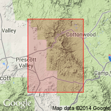
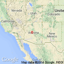
Named from Ash Creek, which cuts through representative section south of Mingus Mountain, Yavapai Co., central AZ.
Source: US geologic names lexicon (USGS Bull. 1200, p. 148).
- Usage in publication:
-
- Ash Creek Group*
- Modifications:
-
- Geochronologic dating
- AAPG geologic province:
-
- Southwestern Basin-and-Range region
Summary:
Is the older group of the Yavapai Series in Mingus Mountain quad, Yavapai Co, AZ, in the Southwestern Basin-and-Range region. Divided into 1) Gaddes Basalt (base), 2) Buzzard Rhyolite, 3) Brindle Pup Andesite and the laterally age-equivalent dacite of Burnt Canyon and Shea Basalt, 4) Deception Rhyolite, and 5) Grapevine Gulch Formation. Neither top nor base exposed. Is approximately 20,000 ft thick. The younger group named Big Bug Group of Yavapai has the Green Gulch Volcanics as its basal unit. Alder Group formerly the upper group of Yavapai abandoned. Intruded by Precambrian quartz diorite pluton. Geologic map. Generalized columnar sections. Isotopic dating of zircons from Deception yielded an apparent age of 1,820 +-. Of Precambrian age.
Source: GNU records (USGS DDS-6; Denver GNULEX).
For more information, please contact Nancy Stamm, Geologic Names Committee Secretary.
Asterisk (*) indicates published by U.S. Geological Survey authors.
"No current usage" (†) implies that a name has been abandoned or has fallen into disuse. Former usage and, if known, replacement name given in parentheses ( ).
Slash (/) indicates name conflicts with nomenclatural guidelines (CSN, 1933; ACSN, 1961, 1970; NACSN, 1983, 2005, 2021). May be explained within brackets ([ ]).