

- Usage in publication:
-
- Artesia Group
- Modifications:
-
- Original reference
- Dominant lithology:
-
- Dolomite
- Sandstone
- Anhydrite
- Siltstone
- AAPG geologic province:
-
- Permian basin
Summary:
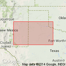
Pg. 504-517. Artesia Group. Proposed to replace terms Whitehorse Group, Chalk Bluff Formation, and Bernal Formation in eastern New Mexico and west Texas. Group includes (in descending order) Tansill, Yates, Seven Rivers, Queen, and Grayburg Formations. It is a rock-stratigraphic unit, as are all formations of the group, and includes carbonate, evaporite, and clastic facies. Reference well is designated in subsurface in which group has thickness of 1,710 feet. Tops of formations: Tansill, 1,040 feet; Yates, 1,144 feet; Seven Rivers, 1,405 feet; Queen, 1,970 feet; Grayburg, 2,390 feet. Top of underlying San Andres Formation placed at 2,750 feet. Age is Early and Late Permian (Guadalupian). Report includes geologic map, cross sections, correlation chart. Term Artesia Group (undifferentiated) can be used as a surface mapping unit where it is not possible to differentiate the component formations of the group (in northeast and east-central New Mexico).
[Type locality not designated.] Named from town of Artesia in Pecos River Valley, NM, a few mi northeast of extensive exposures of component formations of group, and from Artesia field, in T. 18 S., R. 28 E., Eddy Co., NM, in which formations of group are extensively recognized in subsurface.
Reference section (subsurface): depth-interval 1,040 to 2,750 ft, Humble Oil and Refining Company Federal Bogle No. 1 well, in sec. 30, T. 16 S., R. 30 E., Eddy Co., NM.
Source: US geologic names lexicon (USGS Bull. 1350, p. 32-33); supplemental information from GNU records (USGS DDS-6; Denver GNULEX).
- Usage in publication:
-
- Artesia Group*
- Modifications:
-
- Adopted
- AAPG geologic province:
-
- Permian basin
Summary:
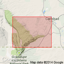
Pg. 28-37. Artesia Group. Named by Tait and others to include (ascending) Grayburg, Queen, Seven Rivers, Yates, and Tansill Formations. As defined includes a carbonate facies adjacent to the basin-margin facies and an evaporite facies farther shelfward. Group thus replaces the abandoned Carlsbad Group which was defined to include the carbonate facies only of the Seven Rivers, Yates, and Tansill Formations. Inasmuch as the constituent formations of the Artesia Group are distinguishable within the evaporite facies in the subsurface throughout southeastern New Mexico, the Chalk Bluff Formation of Lang (1937) is also abandoned. The Chalk Bluff originally included all the rocks in the evaporite facies from top of San Andres Limestone to the base of the Salado Formation.
Source: US geologic names lexicon (USGS Bull. 1350, p. 32-33).
- Usage in publication:
-
- Artesia Formation
- Modifications:
-
- Areal extent
- AAPG geologic province:
-
- Palo Duro basin
- Estancia basin
Summary:
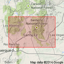
Name extended into north-central New Mexico to Montezuma Gap and Villaneuva area, San Miguel Co., NM in the Palo Duro basin, and to the Rowe-Glorieta Mesa and Lany areas, Santa Fe Co., NM in the Estancia basin. Name assigned to rocks that were formerly thought to belong to the Bernal Formation. Rocks north of the localities mentioned in sentence 1, however, formerly assigned to the Bernal are reassigned to the Anton Chico Member of the Moenkopi Formation. Artesia in San Miguel and Santa Fe Cos. is probably = to Grayburg and Queen, and possibly Seven Rivers Formations of the Artesia Group of southeast NM. Artesia in north-central NM unconformably overlies San Andres Formation and unconformably underlies Anton Chico Member of Moenkopi. The Artesia is distinguishable from Moenkopi by its finer grain size, absence of conglomerate, predominance of brown, sandy siltstone. Measured section (described) 42.5 m thick of Bernal at Bernal Butte is a measured section of Artesia (on west end, Bernal Butte, SE1/4 NW1/4 SE1/4 sec. 36, T14N, R15E, San Miguel Co., NM, Las Vegas-Raton). Of Guadalupian age.
Source: GNU records (USGS DDS-6; Denver GNULEX).
For more information, please contact Nancy Stamm, Geologic Names Committee Secretary.
Asterisk (*) indicates published by U.S. Geological Survey authors.
"No current usage" (†) implies that a name has been abandoned or has fallen into disuse. Former usage and, if known, replacement name given in parentheses ( ).
Slash (/) indicates name conflicts with nomenclatural guidelines (CSN, 1933; ACSN, 1961, 1970; NACSN, 1983, 2005, 2021). May be explained within brackets ([ ]).