- Usage in publication:
-
- Arroyo Penasco formation
- Modifications:
-
- Original reference
- Dominant lithology:
-
- Sandstone
- Shale
- Limestone
- Chert
- AAPG geologic province:
-
- Many basins
Summary:
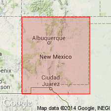
Pg. 3, 6-9. Arroyo Penasco formation. Proposed for the 20 to 150 feet of gray dense fine-grained to oolitic massive- to medium-bedded limestone occurring in Pinos and Penasco Canyons in Nacimiento Mountains. A fossiliferous chert zone some 15 to 20 feet thick occurs at top of formation. Unconformably underlies Pennsylvanian Log Springs formation (new); in some areas, unconformable below Sandia formation; uncomformably overlies Precambrian gneiss. Age is Late Mississippian.
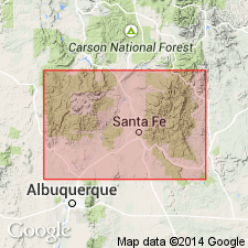
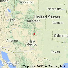
Type section: in Pinos and Penasco Canyons, Nacimiento Mountains, in SW/4 SE/4 sec. 5, T. 16 N., R. 1 E., near northwest corner of Jemez Indian Reservation, [San Ysidro 15-min quadrangle], Sandoval Co., northern NM. Named from the Penasco Arroyo, 1 mi southeast of type section. Also exposed in San Pedro, Jemez, Sandia, and Sangre de Cristo Mountains.
Source: US geologic names lexicon (USGS Bull. 1200, p. 144); supplemental information from GNU records (USGS DDS-6; Denver GNULEX).
- Usage in publication:
-
- Arroyo Penasco formation*
- Modifications:
-
- Overview
- Dominant lithology:
-
- Sandstone
- Conglomerate
- Limestone
- Chert
- AAPG geologic province:
-
- San Juan basin
Summary:
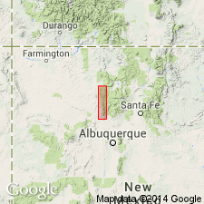
Named [in this report as well as in 1955 paper by Armstrong] for a small intermittent stream [Arroyo Penasco] on west flank of southern Nacimiento Mountains. Type section measured in sec 5, T16N, R1E, Sandoval Co, NM in San Juan basin which is the most complete section. Unconformably overlies Precambrian granite and unconformably underlies Sandia formation at type. Is 313 ft thick at type where it is composed of a gravelly sandstone to pebbly conglomerate of subangular quartz grains at base, that are overlain by white, dark gray weathering crystalline, generally very fine crystalline, slightly dolomitic limestone. Limestone may be massive. Topmost 127 to 158 ft are white chert. A second section 135 ft thick measured in sec 36, T23N, R1W that unconformably overlies Precambrian gneiss and unconformably underlies Sandia formation, is composed of medium-grained white sandstone, gray, dense, fine- to medium-crystalline massive limestone. [Underlies Log Springs formation in Armstrong, 1955.] Faunal assemblage includes about 350 specimens of forams, corals, conularids, bryozoans, crinoid columnals and plates brachiopods, mollusks, and ostracodes. List of fossils. Meramec or Late Mississippian age suggested.
Source: GNU records (USGS DDS-6; Denver GNULEX).
- Usage in publication:
-
- Arroyo Penasco formation*
- Modifications:
-
- Not used
Summary:
Arroyo Penasco formation not used in Sangre de Cristo Mountains of north-central NM (Taos Co, San Luis basin; Mora Co, Las Vegas-Raton basin; and San Miguel Co, Palo Duro basin) but is restricted for use in the Nacimiento Mountains and San Pedro Mountains (Sandoval Co, San Juan basin) only. In the Sangre de Cristo Mountains the following new names are proposed instead: Espiritu Santo formation (at base) and Tererro formation (at top), with its (ascending) Macho, Manuelitas, and Cowles members.
Source: GNU records (USGS DDS-6; Denver GNULEX).
- Usage in publication:
-
- Arroyo Penasco Formation
- Modifications:
-
- Overview
- Age modified
- AAPG geologic province:
-
- San Juan basin
- Estancia basin
- San Luis basin
- Palo Duro basin
- Las Vegas-Raton basin
Summary:
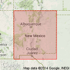
Arroyo Penasco Formation, 10-130 ft thick, rests on a peneplain surface of Precambrian rocks and is overlain unconformably by Pennsylvanian sediments. Crops out in north-central NM in: San Pedro, Nacimiento, and Jemez Mountains (Sandoval Co, San Juan basin); Sandia Mountains (Sandoval and Bernalillo Cos, San Juan and Estancia basins); Manzano and Manzanita Mountains (Torrance Co, Estancia basin); and Sangre de Cristo Mountains (Taos, Mora, and San Miguel Cos, San Luis, Las Vegas-Raton, and Palo Duro basins). The basal unit, 2-60 ft thick, is transgressive and composed of quartz conglomerate, sandstone, and thin shale. Three incomplete carbonate cycles recognized: Lowest, Cycle 1, deposited initially as shallow-marine lime mudstone followed by stromatolitic intertidal to supratidal carbonate rocks; Cycle 2 is shallow-marine to intertidal echinoderm wackestone to lime mudstone and dolomite; Cycle 3 is shallow-marine wackestone to arenaceous oolitic to ooid-echinoderm packstone ending as subtidal lime mudstone to intertidal dolomite. Fossiliferous. Formation is late Osage (Early Mississippian) to Meramec (Late Mississippian) in age. Late Mississippian and Early Pennsylvanian uplift and erosion resulted in extensive erosion and removal of unit. Solution activity extensive in Sangre de Cristo Mountains, which caused collapse of adjacent Lower Meramec carbonate rocks; sinkholes developed. Measured sections, correlations, fossil lists.
Source: GNU records (USGS DDS-6; Denver GNULEX).
- Usage in publication:
-
- Arroyo Penasco Group*
- Modifications:
-
- Revised
- Age modified
- AAPG geologic province:
-
- San Juan basin
- Estancia basin
- Palo Duro basin
- Las Vegas-Raton basin
Summary:
Arroyo Penasco Formation raised in rank to Arroyo Penasco Group in north-central NM, and includes two formations (ascending): 1) Espiritu Santo Formation and its Del Padre Sandstone Member; and 2) Tererro Formation (revised, age modified) and its Macho, Turquillo (new, this report), Manuelitas, and Cowles Members. Group unconformably overlies Precambrian rocks; unconformably underlies Log Springs Formation (in San Pedro Mountain, Jemez, and Nacimiento Mountains, Sandoval Co, San Juan basin), La Pasada Formation (in southernmost Sangre de Cristo Mountains, San Miguel Co, Palo Duro basin) and Flechado Formation (farther north in Sangre de Cristo Mountains, Mora Co, Las Vegas-Raton basin). Age is modified to: 1) Late Mississippian (Meramecian and Chesterian) in San Pedro Mountain, Jemez, and Nacimiento Mountains (San Juan basin); and 2) Early and Late Mississippian (Osagean, Meramecian, and Chesterian) in Sangre de Cristos (Palo Duro and Las Vegas-Raton basins). Arroyo Penasco Group crops out in San Pedro Mountain, Nacimiento, Jemez, Sandia, Manzanita, Manzano, and Sangre de Cristo Mountains of north-central NM, in Rio Arriba, Sandoval and Torrance Cos, San Juan and Estancia basins. Correlation charts, measured sections. Fossil zones and carbonate depositional cycles discussed. Areal extent and contacts of all units discussed.
Source: GNU records (USGS DDS-6; Denver GNULEX).
- Usage in publication:
-
- Arroyo Penasco Group*
- Modifications:
-
- Overview
- AAPG geologic province:
-
- Las Vegas-Raton basin
Summary:
Mapped undivided in Mora River area of Sangre de Cristo Mountains, Mora Co, NM, Las Vegas-Raton basin. Consists of Upper Mississippian Tererro and underlying Lower Mississippian Espiritu Santo Formations. Tererro unconformably overlies Espiritu Santo. Tererro mostly cut out by unconformity with overlying Sandia Formation; Espiritu Santo nonconformably overlies Middle? Proterozoic granite of Hermit Peak. Thickness is 15-110 ft.
Source: GNU records (USGS DDS-6; Denver GNULEX).
For more information, please contact Nancy Stamm, Geologic Names Committee Secretary.
Asterisk (*) indicates published by U.S. Geological Survey authors.
"No current usage" (†) implies that a name has been abandoned or has fallen into disuse. Former usage and, if known, replacement name given in parentheses ( ).
Slash (/) indicates name conflicts with nomenclatural guidelines (CSN, 1933; ACSN, 1961, 1970; NACSN, 1983, 2005, 2021). May be explained within brackets ([ ]).

