

- Usage in publication:
-
- Arroyo Ojito Formation
- Modifications:
-
- Original reference
- Dominant lithology:
-
- Sandstone
- Mudstone
- Conglomerate
- AAPG geologic province:
-
- San Juan basin
Connell, S.D., Koning, D.J., and Cather, S.M., 1999, Revisions to the stratigraphic nomenclature of the Santa Fe Group, northwestern Albuquerque basin, New Mexico: New Mexico Geological Society Field Conference Guidebook, no. 50, p. 337-354.
Summary:
Pg. 339 (fig. 3), 342-345, 350+ (App. A). Arroyo Ojito Formation of Santa Fe Group. Moderately to poorly sorted, fine- to coarse-grained sandstone, silty sandstone, mudstone, and conglomerate. Thickness 437 m at type. Divided into (descending) Ceja Member, Loma Barbon Member (new), and Navajo Draw Member (new). Underlies †Pantadeleon Formation (new) [later abandoned, see Connell, 2008]; overlies Zia Formation of Santa Fe Group. Age is late Miocene to Pleistocene (Clarendonian to early Irvingtonian NALMA); Pliocene-Pleistocene boundary = 1.8 Ma.
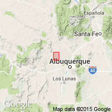
Type locality: along Arroyo Ojito, Cerro Conejo (formerly Sky Village NE) 7.5-min quadrangle, Sandoval Co., north-central NM.
Source: Publication.
- Usage in publication:
-
- Arroyo Ojito Formation
- Modifications:
-
- Revised
- AAPG geologic province:
-
- San Juan basin
Summary:
Pg. 331-333. Arroyo Ojito Formation of Santa Fe Group. Rocks are chiefly of fluvial origin. Lower part exposed in study area; includes (ascending) Cerro Conejo Member [transferred from underlying Zia Formation; see also Connell and others, this vol., p. 339+], and Navajo Draw Member. Higher units of the Arroyo Ojito (Loma Barbon and Ceja Members) are seen east of Sand Hill fault. Separated from underlying Zia Formation by unconformity (1 to 1.6 m.y. hiatus). [Age is Miocene to Pliocene(?) (Barstovian to possibly Blancan NALMA); Pliocene-Pleistocene boundary = 1.8 Ma.]
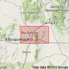
Area of study in T. 12 and 13 N., R. 1 E. and R. 1 W., along Ceja del Rio Puerco, a badland escarpment of Puerco River, [Sky Village SE and San Felipe Mesa 7.5-min quadrangles], southern Sandoval Co., northern Albuquerque basin, north-central NM; [5+ mi southwest of Cerro Conejo type locality].
Source: Publication.
- Usage in publication:
-
- Arroyo Ojito Formation†
- Modifications:
-
- Abandoned
- AAPG geologic province:
-
- Estancia basin
- San Juan basin
Summary:
Pg. 10 (fig. 3), 11 of pamphlet. †Arroyo Ojito Formation of Connell and others (1999) and Tedford and Barghoorn (1999) abandoned because of inconsistent usage and formation straddles a significant unconformity. Rocks reallocated to middle and upper Miocene "Middle Red" formation (= "Middle Red" member of Santa Fe Formation of Bryan and McCann, 1937) and Pliocene Ceja Formation (approx. = "Upper Buff" member of Santa Fe Formation of Bryan and McCann, 1937). The Cerro Conejo, Navajo Draw, and Loma Barbon members are transferred to "Middle Red" formation. All included in Santa Fe Group. [See also entry under Santa Fe.]
Source: Publication.
- Usage in publication:
-
- Arroyo Ojito Formation
- Modifications:
-
- [Reinstated]
- Revised
- AAPG geologic province:
-
- San Juan basin
Summary:
Pg. 15 (fig. 2), 20, 21 (fig. 6), 22. Arroyo Ojito Formation of Santa Fe Group. Includes strata between Cerro Conejo Formation (middle to upper Miocene) and Ceja Formation (Pliocene) [Pliocene-Pleistocene boundary placed at base of Irvingtonian NALMA, = 1.8 Ma]. Divided into (ascending) Navajo Draw Member, Loma Barbon Member, and Picuda Peak Member (new). Separated from overlying Ceja by Rincones paleosurface. Age is late Miocene (Clarendonian to Hemphillian NALMA).
Source: Publication.
For more information, please contact Nancy Stamm, Geologic Names Committee Secretary.
Asterisk (*) indicates published by U.S. Geological Survey authors.
"No current usage" (†) implies that a name has been abandoned or has fallen into disuse. Former usage and, if known, replacement name given in parentheses ( ).
Slash (/) indicates name conflicts with nomenclatural guidelines (CSN, 1933; ACSN, 1961, 1970; NACSN, 1983, 2005, 2021). May be explained within brackets ([ ]).