The National Geologic Map Database is migrating to a new infrastructure. We apologize for any service disruptions during this process.
|
|---|


- Usage in publication:
-
- Arroyo Hondo shale member
- Modifications:
-
- Revised
- AAPG geologic province:
-
- San Joaquin basin
Summary:
Pg. 257. Arroyo Hondo shale member, upper member of Lodo formation (new). Overlies Cantua sandstone member.
Source: US geologic names lexicon (USGS Bull. 1200, p. 143-144).
- Usage in publication:
-
- Arroyo Hondo shale member
- Modifications:
-
- Principal reference
- Dominant lithology:
-
- Shale
- AAPG geologic province:
-
- San Joaquin basin
Summary:
Pg. 1725 (fig. 1), 1726 (fig. 2), 1735, 1738. Arroyo Hondo shale member of Lodo formation. Type section designated. Name credited to E.R. Atwill (unpub. paper read before 9th annual meeting of Pacific Section of AAPG). Atwill described Arroyo Hondo as a shale formation, with a white arkosic sandstone member at top, lying between Cantua sandstone and restricted Domengine. White found Arroyo Hondo shale genetically a part of Lodo formation, relegated its rank to a member, and excluded from it the white sandstone unit. Vokes (1939, New York Acad. Sci. Annals, v. 38, p. 13 (table 1)) used preoccupied term Arroyo Hondo to include most of Lodo formation and an unnamed sandstone unit between Lodo and Domengine. Vokes also proposed term Ragged Valley shale member to include most of Lodo shale, Cerros shale member, and Arroyo Hondo shale member, all of which were named and defined previous to his designation. Underlies Yokut sandstone (new). Age is Eocene.
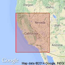
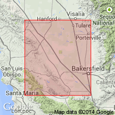
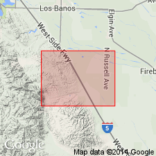
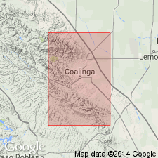
Type locality: on Arroyo Hondo Creek, in S/2 sec. 14, T. 17 S., R. 13 E., [Cierva Mountain 7.5-min quadrangle, Fresno Co.], central CA.
Source: US geologic names lexicon (USGS Bull. 1200, p. 143-144).
- Usage in publication:
-
- Arroyo Hondo member
- Modifications:
-
- Age modified
- AAPG geologic province:
-
- San Joaquin basin
Summary:
Correlation chart shows 344 feet of Arroyo Hondo claystone in East Coalinga oil field and 325+ feet of Arroyo Hondo siltstone and claystone in Kettleman North Dome. Age is Capay Stage (Clark and Vokes, 1936) [Eocene] based on foraminifers. Underlies beds of Domengine(?) age in East Coalinga oil field and Avenal sandstone in Kettleman North Dome.
Source: GNU records (USGS DDS-6; Menlo GNULEX).
- Usage in publication:
-
- Arroyo Hondo shale member*
- Modifications:
-
- Mapped
- AAPG geologic province:
-
- San Joaquin basin
Summary:
Arroyo Hondo shale member of Lodo formation. [Arroyo Hondo shale member of White (1938, 1940) adopted by the USGS as the uppermost member (of 3) of the Lodo formation. Vokes (1939) used name Ragged Valley shale member of Arroyo Hondo formation (his name for Lodo formation). Payne (1941, 1951) called same rocks Hondo shale member of Lodo formation.] In Tumey and Panoche Hills area, Fresno County, member consists of 1,040 feet of gray claystone and minor amounts of interbedded siltstone and sandstone. Overlies Cantua sandstone member; where Cantua is not present, it is impossible to distinguish between Cerros and Arroyo Hondo members. Underlies Yokut sandstone. [Age is Paleocene and Eocene (for all of Lodo formation).]
Source: US geologic names lexicon (USGS Bull. 1200, p. 143-144); supplemental information (in brackets) from GNU records (USGS DDS-6; Menlo GNULEX).
- Usage in publication:
-
- Arroyo Hondo shale member*
- Modifications:
-
- Age modified
- Biostratigraphic dating
- AAPG geologic province:
-
- San Joaquin basin
Summary:
Foraminifers from lower part of Arroyo Hondo shale member of Lodo formation at Cantua Creek, Fresno County, California, indicate Penutian and Ulatisian age [early and middle Eocene].
Source: GNU records (USGS DDS-6; Menlo GNULEX).
- Usage in publication:
-
- Arroyo Hondo Shale Member*
- Modifications:
-
- Areal extent
- AAPG geologic province:
-
- San Joaquin basin
Summary:
Arroyo Hondo Shale Member of Lodo Formation in Vallecitos area is 500 to 1100 ft thick. Unit is similar in age and lithology to Lodo Formation of other parts of southern Diablo and northern Temblor Ranges. Consists of mostly glauconitic, foraminiferal mudstone and siltstone with minor amounts of interbedded fine-grained sandstone. Is Penutian and ulatisian age (Mallory, 1959)
Source: GNU records (USGS DDS-6; Menlo GNULEX).
For more information, please contact Nancy Stamm, Geologic Names Committee Secretary.
Asterisk (*) indicates published by U.S. Geological Survey authors.
"No current usage" (†) implies that a name has been abandoned or has fallen into disuse. Former usage and, if known, replacement name given in parentheses ( ).
Slash (/) indicates name conflicts with nomenclatural guidelines (CSN, 1933; ACSN, 1961, 1970; NACSN, 1983, 2005, 2021). May be explained within brackets ([ ]).