

- Usage in publication:
-
- Arrey formation
- Modifications:
-
- Original reference
- Dominant lithology:
-
- Limestone
- Shale
- Chert
- AAPG geologic province:
-
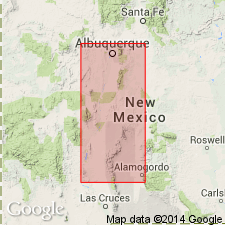
- Orogrande basin
Summary:
Pg. 27 (table 2), 31 (fig. 2), 32-33, 35-36. Arrey formation of Green Canyon group. Name used for the basal formation of the Derry series. At type locality, formation is composed of dense massive limestones, higher nodular limestones with irregular interbedded highly calcareous shales and very irregular masses and lenses of chert; northward from type locality, formation is more highly clastic, but southward it is essentially pure limestone. Thickness ranges from 32 feet at type locality to more than 300 feet in Hueco Mountains of western Texas. Underlies Apodaca formation (new). Age is Middle Pennsylvanian (Derry).
Type locality: on west-facing slope of hill, about 0.75 mi east of village of Derry, in sec. 32, T. 17 S., R. 4 W., Sierra Co., central NM. Named from small village of Arrey, on west side of Rio Grande on Highway 85, 4.5 mi northwest of Derry, Sierra Co., central NM.
Source: US geologic names lexicon (USGS Bull. 1200, p. 142).
For more information, please contact Nancy Stamm, Geologic Names Committee Secretary.
Asterisk (*) indicates published by U.S. Geological Survey authors.
"No current usage" (†) implies that a name has been abandoned or has fallen into disuse. Former usage and, if known, replacement name given in parentheses ( ).
Slash (/) indicates name conflicts with nomenclatural guidelines (CSN, 1933; ACSN, 1961, 1970; NACSN, 1983, 2005, 2021). May be explained within brackets ([ ]).