- Usage in publication:
-
- Arrastra volcanics
- Modifications:
-
- First used
- Dominant lithology:
-
- Basalt
- Andesite
- Tuff
- Conglomerate
- AAPG geologic province:
-
- Basin-and-Range province
Summary:
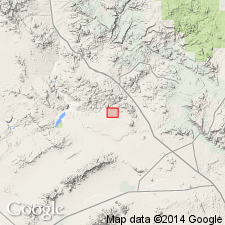
Recognized informally as top part of lower of two Tertiary sequences in Anderson Mine area, secs 2 and 9-16, T11N, R10W, Yavapai Co, AZ in Basin-and-Range province. No type locality designated; origin of name not stated. Northeast of Anderson Mine, lie directly on Precambrian? crystalline rocks, whereas in northwest they lie with angular discordance (as much as 35 deg) on basal Tertiary rocks. Consists of at least 457 m of basalt, augite and biotite andesite, andesitic tuff, and interstratified conglomerate (Reyner and others, 1956). Two dacitic domes nearby contributed large amounts of tuff and agglomerate. West of Anderson Mine, contains more water-reworked volcaniclastics and fewer flows. Local abundance of flows and thickening in vicinity of Anderson Mine suggestive of a proximal source for most of the volcanic deposit. An Eocene to Oligocene? age proposed based on stratigraphic position and apparent correlation with upper part of Artillery Formation of Lasky and Webber (1949). Overlain unconformably by Anderson Mine formation (new). Prior to deposition of Miocene arkosic and volcanic rocks, more than 120 m of relief developed on Arrastra strata in Anderson Mine area; thick paleosols and colluvial deposits developed on this erosion surface. Deposits are characterized by lack of sorting and abundant andesitic rock fragments in brick-red clay matrix. As much as 20 m of colluvium filled depressions in south and east parts of area.
Source: GNU records (USGS DDS-6; Denver GNULEX).
For more information, please contact Nancy Stamm, Geologic Names Committee Secretary.
Asterisk (*) indicates published by U.S. Geological Survey authors.
"No current usage" (†) implies that a name has been abandoned or has fallen into disuse. Former usage and, if known, replacement name given in parentheses ( ).
Slash (/) indicates name conflicts with nomenclatural guidelines (CSN, 1933; ACSN, 1961, 1970; NACSN, 1983, 2005, 2021). May be explained within brackets ([ ]).

