The National Geologic Map Database is migrating to a new infrastructure. We apologize for any service disruptions during this process.
|
|---|


- Usage in publication:
-
- Arnoldsburg limestone
- Modifications:
-
- Overview
- AAPG geologic province:
-
- Appalachian basin
Summary:
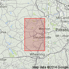
In many parts of WV and eastern OH, the limestone between Uniontown coal and Fulton green shale is divided into two well-defined limestone horizons separated from each other by arenaceous shale or sandstone. The lower part of this limestone lies in contact with or closely above Fulton shale, and upper part is usually a few ft below Uniontown coal. D.B. Reger of the West Virginia Geological Survey proposes to restrict Uniontown limestone to that part which lies closely below Uniontown coal and to use Arnoldsburg for the limestone which lies close above Fulton green shale. The term Arnoldsburg is hereby accepted by the Ohio Geological Survey and will be used in this and subsequent reports on Monongahela series of this State. The Uniontown limestone formerly included Arnoldsburg sandstone and Arnoldsburg limestone horizons. [Thicknesses of Arnoldsburg limestone given by Lamborn range from 3 to 12 ft in Jefferson Co., OH, but in some sections the name Uniontown limestone is applied to all the limestones and shales overlying Fulton green shale.]
Source: GNU records (USGS DDS-6; Reston GNULEX).
- Usage in publication:
-
- Arnoldsburg limestone
- Modifications:
-
- Named
- Dominant lithology:
-
- Limestone
- AAPG geologic province:
-
- Appalachian basin
Summary:
Arnoldsburg limestone (new) is a buff hard stratum occupying most of the interval between Fulton green shale and Arnoldsburg sandstone in northern pan-handle region of WV and belonging just below horizon of Lower Uniontown coal. Thickness ranges from 0 to 15 ft. Named for its association with Arnoldsburg sandstone.
Source: GNU records (USGS DDS-6; Reston GNULEX).
- Usage in publication:
-
- Arnoldsburg limestone
- Modifications:
-
- Overview
- AAPG geologic province:
-
- Appalachian basin
Summary:
In a generalized section of Monongahela formation of WV, the following downward succession is listed: Uniontown coal, 0 to 2 ft; gray or red shale, 0 to 10 ft; Uniontown limestone, 0 to 15 ft; red or green shale with thin sandstones and limestones, 44 to 59 ft; Arnoldsburg sandstone, 25 to 30 ft; shale, 0 to 5 ft; Lower Uniontown coal, 0 to 1 ft; Arnoldsburg limestone, yellow, freshwater, 0 to 5 ft; Fulton green shale, 0 to 5 ft.
Source: GNU records (USGS DDS-6; Reston GNULEX).
- Usage in publication:
-
- Arnoldsburg limestone and calcareous shale
- Modifications:
-
- Redescribed
- AAPG geologic province:
-
- Appalachian basin
Summary:
In a generalized section of Monongahela formation of OH, this downward succession is given: Uniontown coal, 10 in.; Uniontown shale and limestone, 5 ft; Arnoldsburg sandstone, 8 ft; Arnoldsburg coal absent; Arnoldsburg limestone and calcareous shale, 37 ft; Fulton green shale, 4 ft.
Source: GNU records (USGS DDS-6; Reston GNULEX).

- Usage in publication:
-
- Arnoldsburg limestone
- Modifications:
-
- Overview
- AAPG geologic province:
-
- Appalachian basin
Summary:
In Jefferson Co., OH, Arnoldsburg limestone consists of several layers of gray to buff limestone interbedded with buff calcareous clay shale. Average thickness about 13 ft, more than half of which is calcareous shale. Limestone is overlain by 30 ft of gray arenaceous shale. Overlies Fulton green shale.
Source: GNU records (USGS DDS-6; Reston GNULEX).
- Usage in publication:
-
- Arnoldsburg limestone and shale member
- Modifications:
-
- Overview
- AAPG geologic province:
-
- Appalachian basin
Summary:
Unit described in Monongahela series of Morgan Co., OH. Occurs between Fulton green shale member and Arnoldsburg coal member, although Fulton is not recognized definitely in Morgan Co. Thickness ranges from 25 to 35 ft.
Source: GNU records (USGS DDS-6; Reston GNULEX).
For more information, please contact Nancy Stamm, Geologic Names Committee Secretary.
Asterisk (*) indicates published by U.S. Geological Survey authors.
"No current usage" (†) implies that a name has been abandoned or has fallen into disuse. Former usage and, if known, replacement name given in parentheses ( ).
Slash (/) indicates name conflicts with nomenclatural guidelines (CSN, 1933; ACSN, 1961, 1970; NACSN, 1983, 2005, 2021). May be explained within brackets ([ ]).