- Usage in publication:
-
- Arnold member
- Modifications:
-
- Principal reference
- Dominant lithology:
-
- Sandstone
- Limestone
- Shale
- AAPG geologic province:
-
- South Oklahoma folded belt
Summary:
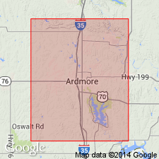
Pg. 36-38. Arnold member of Deese formation. Near middle of Deese formation, consists of (descending): (1) medium-grained massive buff sandstone, 50 feet; (2) shale, 50+/- feet; (3) limestone (fossiliferous, thin-bedded, more or less earthy and lumpy, interbedded with calcareous shale, and carrying lenses of smoky chert), 50+/- feet; (4) 100+/- foot interval; (5) richly fossiliferous shales associated with float or smoky chert. [Age is Pennsylvanian.] Named from Arnold's Reef, on Arnold farm, in sec. 33, T. 3 S., R. 1 E., Carter Co., central northern OK. [Columnar section on pl. 18 shows 1,900+/- feet of strata between Arnold member and underlying Devil's Kitchen member of Deese formation.]
[See also C.W. Tomlinson, AAPG Bull., v. 18, no. 8, 1934, p. 1085.]
Source: US geologic names lexicon (USGS Bull. 896, p. 75-76).
For more information, please contact Nancy Stamm, Geologic Names Committee Secretary.
Asterisk (*) indicates published by U.S. Geological Survey authors.
"No current usage" (†) implies that a name has been abandoned or has fallen into disuse. Former usage and, if known, replacement name given in parentheses ( ).
Slash (/) indicates name conflicts with nomenclatural guidelines (CSN, 1933; ACSN, 1961, 1970; NACSN, 1983, 2005, 2021). May be explained within brackets ([ ]).

