- Usage in publication:
-
- Armendaris group
- Modifications:
-
- Original reference
- Dominant lithology:
-
- Limestone
- Shale
- Sandstone
- AAPG geologic province:
-
- Orogrande basin
- San Juan basin
Summary:
Pg. 41-49. Armendaris group. Proposed for all rocks between top of Derry series below and base of Bolander group above. Entirely of marine origin and composed largely of gray to light-gray cherty limestone, with a few thin shale and sandstone beds scattered throughout. Subdivided into three formations (ascending): Elephant Butte, Whiskey Canyon limestone, and Garcia. Age is [Middle] Pennsylvanian (Des Moines).
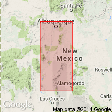
Type locality: at west end of Whiskey Canyon, in north portion of Mud Springs Mountains, in and on either side of westernmost box canyon, in southwest part sec. 1, T. 13 S., R. 5 W., Sierra Co., central NM. Named from Armendaris Grant, east and northeast of Hot Springs, Sierra Co., central NM.
Source: US geologic names lexicon (USGS Bull. 1200, p. 136).
- Usage in publication:
-
- Armendaris Group†
- Modifications:
-
- Abandoned
- AAPG geologic province:
-
- Orogrande basin
Lucas, S.G., Krainer, Karl, Barrick, J.E., and Vaaq, M.K., 2016, The Pennsylvanian System in the Mud Springs Mountains, Sierra County, New Mexico, USA: New Mexico Museum of Natural History and Science Bulletin, no. 69, 58 p.
Summary:
Pg. 1, 4 (figs. 4, 5). †Armendaris Group of Thompson (1942) abandoned. Boundaries of some of Thompson's constituent units do not correspond to easily mapped, distinctive lithologic changes. Authors employ classification developed in adjacent mountain ranges to east. Rocks reallocated to Gray Mesa Formation. The Garcia, Whiskey Canyon, and Elephant Butte, previously formations of the Armendaris, are here assigned to the Gray Mesa Formation as members.
See also Lucas, S.G., and others, 2009, IN Lueth, Virgil, and others, eds., Geology of the Chupadera Mesa [New Mexico], New Mexico Geol. Soc. Field Conf. Gdbk., no. 60, p. 186, 190. [Area of field trip east of Socorro, New Mexico, in the Cerros de Amado area.]
Source: Publication.
For more information, please contact Nancy Stamm, Geologic Names Committee Secretary.
Asterisk (*) indicates published by U.S. Geological Survey authors.
"No current usage" (†) implies that a name has been abandoned or has fallen into disuse. Former usage and, if known, replacement name given in parentheses ( ).
Slash (/) indicates name conflicts with nomenclatural guidelines (CSN, 1933; ACSN, 1961, 1970; NACSN, 1983, 2005, 2021). May be explained within brackets ([ ]).

