

- Usage in publication:
-
- Arlington Member
- Modifications:
-
- Original reference
- AAPG geologic province:
-
- Strawn basin
Summary:
(See also C.F. Dodge, 1969, Texas Jour Sci., v. 21, no. 4, p. 54; C.F. Dodge, 1969, Texas Jour. Sci., v. 21, no. 1, p. 43-62.) Arlington Member of Woodbine Formation. Two new member names proposed for the Woodbine. Rush Creek below and Arlington above. [Age is Late Cretaceous.]
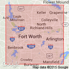
Area of report is Tarrant Co., north-central TX.
Source: US geologic names lexicon (USGS Bull. 1350, p. 31).
- Usage in publication:
-
- Arlington Member
- Modifications:
-
- Principal reference
- Dominant lithology:
-
- Sandstone
- Clay
- Conglomerate
- AAPG geologic province:
-
- Strawn basin
Summary:
Pg. 328-329 (credited to C.F. Dodge, Univ. Texas-Arlington, May 1970). Arlington Member of Woodbine Formation. Recognized in north and northeastern Texas. Consists of (ascending): (1) tan to reddish-brown, thinly laminated, fine-grained, friable sandstone with ferruginous cement, numerous very thin clay partings along ripple surfaces, upper part slightly cross-bedded, 29.2 feet; (2) light tan, fine-grained sandstone with calcareous cement, a few clay partings, 5 feet; (3) shell conglomerate containing OSTREA sp. and EXOGYRA sp. in a fine sand matrix, 1.2 feet. Total thickness 35.4 feet; top not exposed at type locality. Taff (1892, Texas Geol. Survey 3rd Ann. Rpt., p. 271) included these rocks in his Timber Creek Beds (= Lewisville Beds of Hill, 1901, USGS 21st Ann. Rpt.). Age is Late Cretaceous (Gulfian).
Type locality: roadcut in the 2000 block of West Park Row St., Arlington, [in vicinity of Lat. 32 deg. 43 min. 16 sec. N., Long. 97 deg. 08 min. 23 sec. W., Kennedale 7.5-min quadrangle], eastern Tarrant Co., north-central TX. Origin of name not stated by author, but probably named from Arlington, TX. [Additional locality information from ACME Mapper 2.0 and Montana State Univ. Graphical Locator, accessed January 31, 2012.]
Source: Publication.
- Usage in publication:
-
- Arlington Member
- Modifications:
-
- Mapped
- AAPG geologic province:
-
- Fort Worth syncline
- Ouachita folded belt
- Strawn basin
Summary:
Pg. 2, 6-7. Arlington Member of Woodbine Formation (of Dodge, 1969, Texas Jour. Sci., v. 21, no. 1, p. 43-62). Thickness at type 35 feet. Underlies Tarrant beds and overlies Lewisville Member, both of Woodbine. Age is Late Cretaceous (Gulfian).
Source: GNC index card files (USGS-Reston).
For more information, please contact Nancy Stamm, Geologic Names Committee Secretary.
Asterisk (*) indicates published by U.S. Geological Survey authors.
"No current usage" (†) implies that a name has been abandoned or has fallen into disuse. Former usage and, if known, replacement name given in parentheses ( ).
Slash (/) indicates name conflicts with nomenclatural guidelines (CSN, 1933; ACSN, 1961, 1970; NACSN, 1983, 2005, 2021). May be explained within brackets ([ ]).