

- Usage in publication:
-
- Arlington lake beds
- Modifications:
-
- Original reference
- Dominant lithology:
-
- Gravel
- Ash
- Silt
- AAPG geologic province:
-
- Columbia basin
Summary:
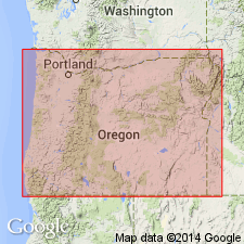
Arlington lake beds. Lake beds and stream gravels of white ash, diatomaceous material, and gray silts, 200 feet thick. Beds furnish evidence of period of extensive flooding of Cascade Range at a time contemporaneous with deposition of The Dalles and Madras formations. Underlie extensive morainal deposits and bear on their surface enormous glacial erratics. Occur on south side and very close to Columbia River. Greatly eroded. Once extended as far south as Willamette, as far west as The Dalles beds, as far north as north side of Columbia River, and unknown distance to the east. Conviction prevails that Dalles, Madras, and Arlington formations represent a period of aggradation during first glacial stage. Age is late Tertiary and Pleistocene.
[Probably named for town of Arlington, near Shutler, Gilliam Co., north-central OR].
Source: US geologic names lexicon (USGS Bull. 896, p. 74).
- Usage in publication:
-
- Arlington formation
- Modifications:
-
- Overview
- AAPG geologic province:
-
- Columbia basin
Summary:
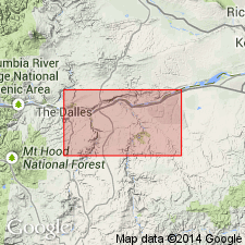
Pg. 924-968. Arlington formation. Early Pleistocene fossils in gravels of Arlington formation near Umatilla. Unconformably overlies Columbia River basalt (Miocene).
Source: US geologic names lexicon (USGS Bull. 896, p. 74).
- Usage in publication:
-
- Arlington lake beds
- Modifications:
-
- Overview
- AAPG geologic province:
-
- Columbia basin
Summary:
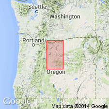
Arlington lake beds. Pleistocene fossils in older gravels. Perhaps part of formation is Recent. The name is not wholly distinctive of this formation, and in later publications we propose to call it Shutler formation. On east side of Deschutes River the formation intergrades with Madras formation. Lies unconformably on Columbia River basalt. The lake beds and gravels occur as erosional remnant patches up to elevation of 1,750 feet.
Source: US geologic names lexicon (USGS Bull. 896, p. 74).
- Usage in publication:
-
- Arlington formation
- Modifications:
-
- Not used
- AAPG geologic province:
-
- Columbia basin
Summary:
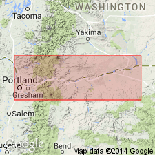
Name Shutler formation is proposed as substitute for Arlington formation of Hodge (1931, 1932) because of prior use of name Arlington. Shutler formation extends eastward from Horse Heaven Hills to Blue Mountains and westward in belt between 1550-ft and 1650-ft contours on Shaniko Surface; on the west it is interbedded with the Dalles formation.
Source: GNU records (USGS DDS-6; Menlo GNULEX).
- Usage in publication:
-
- "Arlington Lake Beds"
- Modifications:
-
- Not used
- Age modified
- Biostratigraphic dating
- AAPG geologic province:
-
- Columbia basin
Summary:
"Arlington Lake Beds" of Hodge (1932) and "Shutler Formation" of Hodge (1942) are "terms no longer needed." Rocks are included in Selah Member of Ellensburg Formation and Dalles Formation because the early designations gave little specific petrologic or location data. Age of Selah member is probably early Pliocene, based on camel bones (citing Foxworthy, 1962). Age of "Dalles Formation extended" is middle Pliocene, based on vertebrate fossils from deposits near Arlington and near McKay Reservoir, 60 miles further east.
Source: Modified from GNU records (USGS DDS-6; Menlo GNULEX).
For more information, please contact Nancy Stamm, Geologic Names Committee Secretary.
Asterisk (*) indicates published by U.S. Geological Survey authors.
"No current usage" (†) implies that a name has been abandoned or has fallen into disuse. Former usage and, if known, replacement name given in parentheses ( ).
Slash (/) indicates name conflicts with nomenclatural guidelines (CSN, 1933; ACSN, 1961, 1970; NACSN, 1983, 2005, 2021). May be explained within brackets ([ ]).