The National Geologic Map Database is migrating to a new infrastructure. We apologize for any service disruptions during this process.
|
|---|


- Usage in publication:
-
- Arkansas stone
- Arkansas novaculite
- Modifications:
-
- Overview
- Dominant lithology:
-
- Novaculite
- AAPG geologic province:
-
- Ouachita folded belt
Summary:
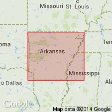
Pg. 57-61, 69, 85, 87-113. Arkansas stone [also repeatedly called Arkansas novaculite]. A true novaculite which occurs associated with shales into which it grades through opaque flinty layers. A type of rock that is fine-grained and hard, so hard that it cannot be scratched by a knife. Consists of 99.50 percent silica (see table of average chemical analyses); grains are less than 0.1 of a mm in diameter. Is white (fresh); some parts tinged brown or red by diffusion of iron oxide. Resembles chert in structure, composition, and manner of occurrence. Thickness 500 or 600 feet, which generally includes some flinty shales and soft shales or sandstones. The novaculites proper are the prominent members, however, and occur in massive beds from few inches to 12 or 15 feet thick. All highly siliceous rock, except occassional sandstones, is novaculite or flinty shale; there is no true chert or flint, although hard spots or masses are called flint by quarrymen. The Arkansas stone is a typical member of the novaculite formation, in which the two stones (Arkansas novaculite and Ouachita stone) occur. Mapped with the other Lower Silurian novaculites across the area from T. 2 to 5 S., R. 22 to 31 E., in Garland, Hot Springs, Pike, Montgomery, Howard and Polk Counties, Arkansas [exact extent of Arkansas stone not shown]. Report includes geologic maps, chemical analyses.
Source: US geologic names lexicon (USGS Bull. 896, p. 72-73); supplemental information from GNU records (USGS DDS-6; Denver GNULEX).

- Usage in publication:
-
- Arkansas novaculite
- Modifications:
-
- Redescribed
- Revised
- Dominant lithology:
-
- Novaculite
- Shale
- AAPG geologic province:
-
- Ouachita folded belt
Summary:
Pg. 30, 39-40. Arkansas novaculite. Is very resistant to weathering. Upper half is massive, white and variegated, thin-bedded novaculite with alternating thin layers of flint and soft black shale; top locally eroded and [contains locally?] layers of black novaculite 1 to 6 inches thick. Lower 300 feet wholly novaculite; is gray, jointed, irregularly bedded with ripple marks along bedding planes. Thickness 0 to 800 feet. Mapped in linear east-west belts across several mountain ranges from Pike and Montgomery Counties west to Howard and Polk Counties, Arkansas. Unconformably underlies Fork Mountain slate (new) and overlies Missouri Mountain slate. Age is unknown. Report includes geologic map, columnar section.
Source: US geologic names lexicon (USGS Bull. 896, p. 72-73); supplemental information from GNU records (USGS DDS-6; Denver GNULEX).
- Usage in publication:
-
- Arkansas novaculite*
- Modifications:
-
- Revised
- AAPG geologic province:
-
- Ouachita folded belt
Summary:
Pg. C66. Arkansas novaculite consists of 3 lithologic divisions: a lower one made up almost entirely of massive white novaculite, at whose top is one of the two manganese horizons; a middle one consisting mainly of thin layers of dense dark-colored novaculite interbedded with shale and having a conglomerate of local distribution at its base; and an upper one consisting chiefly of massive, highly calcareous novaculite which also yields manganese. Thickness 250 to 950 feet. Unconformably underlies Stanley shale and overlies Missouri Mountain slate. Some shale at base of Stanley shale has in places been altered to slate, to which name "Fork Mountain slate" has been earlier applied.
Source: US geologic names lexicon (USGS Bull. 896, p. 72-73).
- Usage in publication:
-
- Arkansas novaculite*
- Modifications:
-
- Biostratigraphic dating
- Age modified
- AAPG geologic province:
-
- Ouachita folded belt
Summary:
Pg. 211. At Caddo Gap, Montgomery County, west-central Arkansas, the Arkansas novaculite is 900 feet thick and typical of the formation in Ouachita Mountains. It is divisible into 3 lithologic units (descending): (1) mostly massive calcareous novaculite; (2) interbedded dark-colored dense novaculite and shale; (3) almost entirely massive thick-bedded novaculite. Ulrich, on basis of fossils from novaculite beds near Ti, Oklahoma, holds that the lower division is of Onondagan age. Evidence furnished by conodonts indicates upper and middle divisions are Mississippian. Of 45 species in the novaculite, 27 occur in the Woodford, 13 in the Hardin, and 17 in the Chattanooga. The formation therefore should be redefined. Writer suggests Caddo Gap for Mississippian part when necessary detailed mapping has been done. [Proof that the beds referred to are Mississippian is lacking. The USGS still (ca. 1938) classifies them as Devonian(?).]
Source: US geologic names lexicon (USGS Bull. 896, p. 72-73).

- Usage in publication:
-
- Arkansas novaculite*
- Modifications:
-
- Overview
- AAPG geologic province:
-
- Ouachita folded belt
Summary:
The upper part of lower member contains Middle Devonian fossils; the lower part of middle member contains fossils that were identified by E.O. Ulrich as Upper Devonian (Genessee); the upper member may be post-Devonian. (See H.D. Miser and A.H. Purdue, 1929, USGS Bull. 808, p. 57-59.)
Source: US geologic names lexicon (USGS Bull. 896, p. 72-73).

- Usage in publication:
-
- Arkansas novaculite*
- Modifications:
-
- Biostratigraphic dating
- Age modified
- AAPG geologic province:
-
- Ouachita folded belt
Summary:
Pg. 2526-2541. Arkansas novaculite. Definition and description based on section at Caddo Gap, Montgomery County, Arkansas. Lower division: nearly white thick-bedded novaculite; some interbedded greenish-gray and dark-gray shale near base; thickness 466 feet; Lower or Middle Devonian. Middle division: dark-gray and greenish-gray shale; many dark-gray beds of novaculite; thickness 347 feet; Upper Devonian and Mississippian. Upper division: nearly white granular thick-bedded novaculite; thickness 127 feet; Mississippian. Underlies Stanley shale; overlies Missouri Mountain slate (Silurian). Present in southwestern Arkansas and southeastern Oklahoma. Age is Devonian and Mississippian [adopted by the USGS].
Source: US geologic names lexicon (USGS Bull. 1200, p. 134).

- Usage in publication:
-
- Arkansas Novaculite
- Modifications:
-
- Overview
- AAPG geologic province:
-
- Ouachita folded belt
Summary:
Pg. 21-22. Arkansas Novaculite. Present in Ouachita Mountains, west-central Arkansas, and southeastern Oklahoma. Three divisions recognized (except in the northern exposures). Lower division is white massive novaculite with some interbedded gray shales near its base. Middle division is greenish- to dark-gray shales interbedded with many thin beds of dark novaculite. Upper Division is white, thick-bedded, often calcareous novaculite. Conodonts and other microfossils sometimes common. Thickness up to 900 feet in its southern outcrops; thins rapidly to the north to about 60 feet. Conformably overlies Missouri Mountain Formation at most places but presence of conglomerates in a few places suggest minor incipient submarine disconformity. Unconformably underlies Stanley Shale. Age is Devonian and Early Mississippian.
Named for quarries in Arkansas (especially near Hot Springs, Garland Co.) that produced this rock under the trade name of “Arkansas Novaculite." Credits Purdue (1909) with original reference.
Source: Publication.
For more information, please contact Nancy Stamm, Geologic Names Committee Secretary.
Asterisk (*) indicates published by U.S. Geological Survey authors.
"No current usage" (†) implies that a name has been abandoned or has fallen into disuse. Former usage and, if known, replacement name given in parentheses ( ).
Slash (/) indicates name conflicts with nomenclatural guidelines (CSN, 1933; ACSN, 1961, 1970; NACSN, 1983, 2005, 2021). May be explained within brackets ([ ]).