

- Usage in publication:
-
- Arkadelphia shales
- Modifications:
-
- Original reference
- Dominant lithology:
-
- Clay
- Sand
- AAPG geologic province:
-
- Ouachita folded belt
Summary:
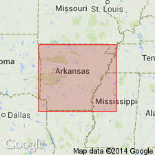
Pg. 53-56, 188. Arkadelphia shales. Alternating bands of marine blue clay and white or orange-colored sands, 5 feet thick. Unconformably overlies Washington or High Bluff (Cretaceous) greensands, and underlies Quaternary gravels and clays. Is basal formation of Eocene Camden series.
According to Veatch (1906), Hill named this from outcrops at Arkadelphia, Clark Co., AR.
Source: US geologic names lexicon (USGS Bull. 896, p. 71).
- Usage in publication:
-
- Arkadelphia shales
- Modifications:
-
- Revised
- AAPG geologic province:
-
- Arkla basin
- East Texas basin
- Ouachita folded belt
Summary:
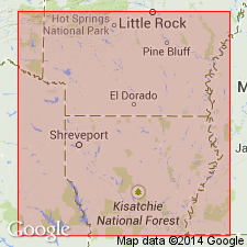
Pg. 28. Arkadelphia shales. The dark laminated clays which overlie Nacatoch sand and form the "blue dirt" of well drillers along line of Iron Mountain Railway from Arkadelphia to Texarkana were named by Hill in 1888 the Arkadelphia shales, from outcrops at Arkadelphia, Clark County, Arkansas. These beds contain uppermost Cretaceous fossils for 100 to 200 feet above Nacatoch sands, the fossil-bearing beds being well developed on Yellow Creek 3 to 4 miles northwest of Fulton, 5 to 6 miles north of Hope, north and northwest of Emmet, and at Arkadelphia. Thus far no fossils have been found in upper portion of this formation, which extends without any apparent break to the Eocene sand beds forming the sandy hills south of Iron Mountain Railway. Thickness 200 to 300 feet at Arkadelphia, 500 feet at Lanesburg, 500 to 600 feet at Hope and Spring Hill, and 500 feet at Texarkana, northeastern Texas, and Shreveport, northwestern Louisiana. [Age is Late Cretaceous (Gulf).]
Source: US geologic names lexicon (USGS Bull. 896, p. 71).
- Usage in publication:
-
- Arkadelphia marl
- Modifications:
-
- Revised
- Dominant lithology:
-
- Marl
- AAPG geologic province:
-
- Arkla basin
- East Texas basin
- Ouachita folded belt
Summary:
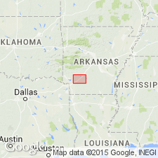
Arkadelphia marl. The outcrops near Arkadelphia are now known to be upper part of Nacatoch, which is unusually well stratified and consists of alternating clay and sand in this vicinity. The outcrops along Mine Creek are part of the clay phase of Tokio formation. Exact location of outcrops cited [by Hill] in southern Hempstead County is not known to writer, but a locality about half way between Fulton and Washington might be either in uppermost Nacatoch or possibly in lowest part of marl now defined as Arkadelphia. The "dark laminated clays" which according to Veatch [1906] are well developed on Yellow Creek 3 to 4 miles northwest of Fulton, 5 to 6 miles north of Hope, north and northwest of Emmet, are not the "blue clay and yellow sand outcropping in vicinity of Arkadelphia" to which Hill [1888] first applied the name Arkadelphia, and a new name would have been desirable. The name, however, has become firmly entrenched in geologic literature, although somewhat modified from the sense in which it was used by Veatch, and it now seems best to retain it, although with the clear understanding that the formation typically outcrops 2 to 3 miles northwest of Fulton and at numerous localities 5 to 7 miles north and northwest of Hope. Thickness 120 to 160 feet. It is possible basal few feet of formation outcrops, though not typically, at Arkadelphia, and this is an additional reason for retention of the name. [Age is Late Cretaceous (Gulf).]
[GNC remark (ca. 1930, US geologic names lexicon, USGS Bull. 896, p. 71-72): Arkadelphia marl is top formation of Upper Cretaceous or Gulf series in southwest Arkansas. Unconformably overlies Nacatoch sand and unconformably underlies Midway formation. According to 1925 and 1926 studies of L.W. Stephenson and C.H. Dane, marl is more appropriate lithologic designation than either shale or clay, by both of which names it has been called.]
Source: US geologic names lexicon (USGS Bull. 896, p. 71-72).
- Usage in publication:
-
- Arkadelphia marl*
- Modifications:
-
- Areal extent
- AAPG geologic province:
-
- Arkla basin
- Ouachita folded belt
Summary:
Chart 9. Arkadelphia marl shown on correlation chart of outcropping formations in southwestern Arkansas. Occurs above Nacatoch sand. Navarro group not used in this area. [Age is Late Cretaceous (Gulfian).]
Source: US geologic names lexicon (USGS Bull. 1200, p. 133).
- Usage in publication:
-
- Arkadelphia formation
- Modifications:
-
- Areal extent
- AAPG geologic province:
-
- Arkla basin
- Ouachita folded belt
Summary:
Fig 2 (facing p. 8). Arkadelphia formation of Navarro group. Arkadelphia formation shown on generalized columnar section of eastern Arkansas. Consists of light-gray calcareous shale, sparingly glauconitic; medium-gray finely micaceous fissile shale near base. Thickness 50 to 150 feet. Overlies Nacatoch formation; underlies Clayton "calcareous" Midway. Navarro group. [Age is Late Cretaceous.]
Source: US geologic names lexicon (USGS Bull. 1200, p. 133).
- Usage in publication:
-
- Arkadelphia Marl*
- Modifications:
-
- Paleomagnetics
- AAPG geologic province:
-
- Ouachita folded belt
Summary:
Paleomagnetic (a.f. demagnetized) data indicates the Upper Cretaceous Arkadelphia Marl of southwest AR possesses weak remanent magnetization of normal magnetic polarity. The normal polarity is assumed to be primary magnetization, and is interpreted to represent deposition during the Gubbio (Italy) normal polarity zone B+ (Campanian to early Maestrichtian).
Source: GNU records (USGS DDS-6; Denver GNULEX).

- Usage in publication:
-
- Arkadelphia Marl
- Arkadelphia Formation
- Modifications:
-
- Overview
- AAPG geologic province:
-
- Arkla basin
- Ouachita folded belt
Summary:
Arkadelphia Marl; Arkadelphia Formation. Mostly a dark-gray to black marl or marly clay with some limy, gray sandstone, gray sandy clay, sandy limestone, concretionary limestone, and white to light brown impure chalk. Sandy marls and limestones found at or near base; impure chalks found closer to top. Strata that Hill first applied name "Arkadelphia" are no longer considered part of this unit. Thickness 120 to 160 feet. Rests with slight unconformity on Nacatoch Sand. Fossils. Age is Late Cretaceous (Gulfian Provincial Epoch).
Recognized in Gulf Coastal Plain of southwestern AR, in part of Clark, Nevada, and Hempstead Cos.
Source: Publication.
For more information, please contact Nancy Stamm, Geologic Names Committee Secretary.
Asterisk (*) indicates published by U.S. Geological Survey authors.
"No current usage" (†) implies that a name has been abandoned or has fallen into disuse. Former usage and, if known, replacement name given in parentheses ( ).
Slash (/) indicates name conflicts with nomenclatural guidelines (CSN, 1933; ACSN, 1961, 1970; NACSN, 1983, 2005, 2021). May be explained within brackets ([ ]).