

- Usage in publication:
-
- Argo-Fay Bed
- Modifications:
-
- Original reference
- Dominant lithology:
-
- Shale
- AAPG geologic province:
-
- Wisconsin arch
Summary:
Argo-Fay Bed of Scales Formation of Maquoketa Group. Hard, brownish-black to black carbonaceous, fissile clay shale. Thickness 1 foot. Is in lower part of Scales Formation. Lies 4 feet above the unconformable contact of the Scales with the Dubuque Formation. Equivalent to beds in the "Brown Shaly Unit" of Brown (1974) in Clayton County, Iowa, and in Grant County, Wisconsin. Fossils. Fragments of graptolites and chitinozoans stand out on weathered bedding planes. Age is Late Ordovician.
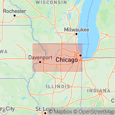
Type section: Mt. Carroll southwest section, in quarry on the north side of U.S. Highway 52, 2.5 mi southwest of Mt. Carroll and 5 mi north of Argo-Fay, in SW/4 NE/4 SW/4 sec. 10, T. 24 N., R. 4 E., Savanna 15-min quadrangle, Carroll Co., IL.
Source: Modified from US geologic names lexicon (USGS Bull. 1565, p. 14).
For more information, please contact Nancy Stamm, Geologic Names Committee Secretary.
Asterisk (*) indicates published by U.S. Geological Survey authors.
"No current usage" (†) implies that a name has been abandoned or has fallen into disuse. Former usage and, if known, replacement name given in parentheses ( ).
Slash (/) indicates name conflicts with nomenclatural guidelines (CSN, 1933; ACSN, 1961, 1970; NACSN, 1983, 2005, 2021). May be explained within brackets ([ ]).