- Usage in publication:
-
- Ardmore limestone
- Modifications:
-
- Original reference
- Dominant lithology:
-
- Limestone
- AAPG geologic province:
-
- Lincoln anticline
Summary:
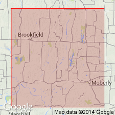
Pg. 20. Ardmore limestone. Irregular marly and concretionary fossiliferous limestone in Lower Coal Measures of Bevier quadrangle (covering parts of Macon, Randolph, and Charlton Counties, Missouri), separated from underlying Lower Ardmore coal by 25 to 30 feet of shale with few interstratified limestone beds, and from overlying Bevier coal by 6 to 18 inches of clay. [Later reports give thickness of 0 to 10 feet. Is †Hydraulic limestone of Swallow.] Age is Carboniferous.
Named from Ardmore, Macon Co., north-central MO.
Source: US geologic names lexicon (USGS Bull. 896, p. 68-69).

- Usage in publication:
-
- Ardmore limestone member*
- Modifications:
-
- Overview
Summary:
Pg. 56. Ardmore limestone member of Cherokee shale. Most important limestone in Cherokee shale is in upper part. Ardmore limestone has priority for this bed, but Oklahoma name Verdigris limestone has usage. Age is Middle Pennsylvanian (Des Moines).
Source: US geologic names lexicon (USGS Bull. 896, p. 68-69); GNC KS-NE Pennsylvanian Corr. Chart, sheet 2.
- Usage in publication:
-
- Ardmore formation
- Ardmore cyclothem (informal)
- Modifications:
-
- Revised
- AAPG geologic province:
-
- Cherokee basin
Summary:
Pg. 18, 20, 22; 1938, Kansas Acad. Sci. Trans., v. 41, p. 193, 195. Ardmore formation (cyclothem) of Cherokee group. Cherokee group is divided into 15 cyclic formational units. Ardmore 13th in sequence (ascending); occurs above Croweburg and below Bevier. Average thickness 5 feet. Age is Middle Pennsylvanian (Des Moines). [For complete sequence see Cherokee group.]
Source: US geologic names lexicon (USGS Bull. 1200, p. 130).
- Usage in publication:
-
- Ardmore limestone
- Modifications:
-
- Revised
- AAPG geologic province:
-
- Forest City basin
- Lincoln anticline
Summary:
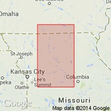
Pg. 53-54. Ardmore limestone of Cherokee group. Redefined to include all of limestones (and intervening shale members) between coal [lower Ardmore] and top of Ardmore of previous definitions. Missouri and Kansas Surveys have traced Ardmore toward southwest and showed it to be equivalent to Rich Hill limestone of southeastern Kansas and to Verdigris limestone of northeastern Oklahoma. Has been traced northwestward from Iowa-Missouri line for 135 miles into Iowa. Throughout this distance is best developed limestone in Cherokee group. Age is Middle Pennsylvanian (Des Moines).
Source: Publication; US geologic names lexicon (USGS Bull. 1200, p. 130).
- Usage in publication:
-
- Ardmore formation
- Modifications:
-
- Areal extent
- AAPG geologic province:
-
- Forest City basin
Summary:
Pg. 83-89. Ardmore formation of Cherokee group. In Missouri overlies Tebo formation (new); underlies Bevier formation. Thickness as much as 17 feet. [Age is Middle Pennsylvanian (Des Moines).]
[Notable exposures in Henry Co., east-central MO.]
Source: US geologic names lexicon (USGS Bull. 1200, p. 130).
- Usage in publication:
-
- Ardmore cyclothem
- Modifications:
-
- Revised
Summary:
Pg. 45. Ardmore cyclothem in Cherokee group. Redefined to include Croweburg cyclothem of Abernathy (1937). Age is Middle Pennsylvanian (Des Moines).
Source: Publication; US geologic names lexicon (USGS Bull. 1200, p. 130).
- Usage in publication:
-
- Ardmore limestone
- Modifications:
-
- Not used
- AAPG geologic province:
-
- Cherokee basin
- Forest City basin
Summary:
Pg. 72-74. Verdigris limestone (Smith, IN Woodruff and Cooper, 1928) comprises bed or beds called Ardmore by Gordon (1893) in Missouri. Term Verdigris has had wider usage than Ardmore and for that reason was adopted at Nevada Conference (Searight and others, 1953, AAPG Bull., v. 37, no. 12) for limestone in Verdigris formation.
Source: US geologic names lexicon (USGS Bull. 1200, p. 130).
- Usage in publication:
-
- Ardmore limestone
- Modifications:
-
- Overview
Summary:
Pg. 34, fig. 5. Ardmore limestone, Cherokee group. Is exceptionally widespread unit that maintains approximately same characteristics over wide area reaching from Oklahoma to Iowa. Consists of two thin gray limestones separated by thinly laminated dark-gray shale. Ardmore limestone of Iowa is Verdigris limestone of Kansas, Missouri, and Oklahoma, and may be equivalent of lower Oak Grove of Illinois.
Source: US geologic names lexicon (USGS Bull. 1200, p. 130).
- Usage in publication:
-
- Ardmore Limestone Member
- Modifications:
-
- Areal extent
- Revised
- AAPG geologic province:
-
- Iowa shelf
Summary:
Traced into southern IA on the Iowa shelf from MO as a member of Swede Hollow Formation (new) of Cherokee Group of Des Moines Supergroup. Forms two limestone layers that were referred to informally as the "Two-Layer Limestone" in many areas. In report area, lower limestone is a massive bed that averages 0.5 ft thick is present. The middle shale is dark gray, silty, micaceous and ranges from 4.5 to 8 ft thick. Upper limestone is generally 2 ft thick may be 15 ft thick. Overlies Oakley Shale Member (named) of Swede Hollow. Underlies an unnamed shale of Swede Hollow. Cross section. Nomenclature chart. Of Desmoinesian, Pennsylvanian age.
Source: GNU records (USGS DDS-6; Denver GNULEX).
For more information, please contact Nancy Stamm, Geologic Names Committee Secretary.
Asterisk (*) indicates published by U.S. Geological Survey authors.
"No current usage" (†) implies that a name has been abandoned or has fallen into disuse. Former usage and, if known, replacement name given in parentheses ( ).
Slash (/) indicates name conflicts with nomenclatural guidelines (CSN, 1933; ACSN, 1961, 1970; NACSN, 1983, 2005, 2021). May be explained within brackets ([ ]).

