


- Usage in publication:
-
- Arcadia Park formation
- Modifications:
-
- Principal reference
- AAPG geologic province:
-
- Ouachita folded belt
Summary:
Pg. 239, 270, 425. Arcadia Park formation. (from W.L. Moreman's unpublished description). Thlckness 100+/- feet; thins to south and north; about 10 feet thick at Austin. Type section consists of 20 feet of blue clay at base, overlain by 1 to 3 feet of thin limestone flags forming escarpment and dip-slope; upper 75 feet consists of blue shale containing numerous calcareous concretions of various sizes. On Red River the upper part is sandy and lower part blue shaly clay with a few thin scattered sandstone seams. In McLennan and Bell Counties the unit is laminated marl. At Austin the lower part is flaggy, laminated marl and upper part is blue shale. Is unconformably overlain by Austin chalk; the transition zone, Taff's "Fish Bed conglomerate," consists of clay containing gypsum, phosphatic pebbles, and reworked pelecypods and fish remains. Is upper part of Eagle Ford [group]. Overlies Britton formation. Age is Late Cretaceous (Gulfian).
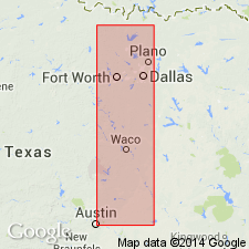
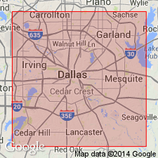
Type locality: Arcadia Park station, 7 mi west of Dallas, on Fort Worth-Dallas interurban, Trinity and Brazos River regions, [Eagle Ford quadrangle], Dallas Co., eastern TX.
Source: US geologic names lexicon (USGS Bull. 896, p. 67).
- Usage in publication:
-
- Arcadia Park formation
- Modifications:
-
- Biostratigraphic dating
Summary:
Pg. 192-220. Discussion of paleontology of Eagle Ford group which comprises (ascending) Tarrant, Britton, and Arcadia Park formations.
Source: US geologic names lexicon (USGS Bull. 1200, p. 125).
- Usage in publication:
-
- Arcadia Park formation
- Modifications:
-
- Not used
Summary:
Discussion of geology of Eagle Ford quadrangle, which contains type locality of Eagle Ford formation as well as Moreman's (in Adkins, 1933) Arcadia Park formation. Moreman's classification of rocks exposed in Eagle Ford quadrangle not applicable for purposes of this study. Eagle Ford formation subdivided into three unnamed lithologic units.
Source: US geologic names lexicon (USGS Bull. 1200, p. 125).
For more information, please contact Nancy Stamm, Geologic Names Committee Secretary.
Asterisk (*) indicates published by U.S. Geological Survey authors.
"No current usage" (†) implies that a name has been abandoned or has fallen into disuse. Former usage and, if known, replacement name given in parentheses ( ).
Slash (/) indicates name conflicts with nomenclatural guidelines (CSN, 1933; ACSN, 1961, 1970; NACSN, 1983, 2005, 2021). May be explained within brackets ([ ]).