- Usage in publication:
-
- Aravaipa Member*
- Modifications:
-
- Named
- Reference
- Dominant lithology:
-
- Tuff
- AAPG geologic province:
-
- Basin-and-Range province
Summary:
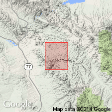
Named Aravaipa Member of the Galiuro Volcanics, for exposures (its type locality) in Aravaipa Canyon, Arizona, in the Basin-and-Range province. Occurs along Aravaipa, Whitewash, and Bear Springs Canyons, in south part of quadrangle. Is a rhyolitic ash-flow tuff, a simple cooling unit, and possibly a single flow with a well developed zonal pattern. Contains pumice shards, lapilli, and crystal fragments of quartz, sanidine, plagioclase, biotite. Divided into: (1) an older partly welded zone, welded zone, and lower nonwelded zone, 200 to 250 feet thick, that are cliff-forming; and (2) an upper nonwelded zone, 0 to 100 feet thick, of massive, slope-forming, white tuff. The lower zones can be further subdivided into (ascending): (a) lower nonwelded zone 0 to 10 feet thick; (b) welded zone 0 to 30 feet thick; (c) welded devitrified zone 0 to 160 feet thick; (d) columnar-jointed vapor-phase zone 0 to 80 feet thick. Overlies tuff and conglomerate of Bear Springs Canyon of Galiuro Volcanics. Underlies andesite and conglomerate of Virgus Canyon of Galiuro. Age is Miocene.
Type locality: Aravaipa Canyon, in NE/4 sec. 17, T. 6 S., R. 18 E., Brandenburg Mountain 7.5-min quadrangle, Pinal Co., AZ (Krieger, 1968).
Reference sections: on north side of Holy Joe Peak quadrangle (adjoins south border of Brandenburg Mountain quadrangle) in (1) sec. 8, T. 7 S., R. 18 E., on north side Table Mountain, (2) sec. 5, T. 7 S., R. 18 E., along an unnamed gulch, and (3) sec. 32, T. 6 S., R. 18 E., along Bear Springs Canyon.
Source: Modified from GNU records (USGS DDS-6; Denver GNULEX).

- Usage in publication:
-
- Aravaipa Member*
- Modifications:
-
- Geochronologic dating
- Age modified
- AAPG geologic province:
-
- Basin-and-Range province
Summary:
As a member of Galiuro Volcanics, has ages of 22.9 +/-0.7 m.y. on sanidine and of 25.7 +/-0.8 m.y. on biotite, or Miocene and late Oligocene. [Formerly assigned only to the Miocene.] Occurs in the northern Galiuro Mountains, AZ, Basin-and-Range province. Geologic map; correlation chart.
Source: GNU records (USGS DDS-6; Denver GNULEX).

- Usage in publication:
-
- Aravaipa Member*
- Modifications:
-
- Age modified
- AAPG geologic province:
-
- Basin-and-Range province
Summary:
Age of the Aravaipa Member of the Galiuro Volcanics is late Oligocene based on radiometric (K-Ar) ages of 25.7 +/-0.8 and 22.9 +/-0.8 Ma [based on time scale in use at time of publication].
Source: GNU records (USGS DDS-6; Menlo GNULEX).
For more information, please contact Nancy Stamm, Geologic Names Committee Secretary.
Asterisk (*) indicates published by U.S. Geological Survey authors.
"No current usage" (†) implies that a name has been abandoned or has fallen into disuse. Former usage and, if known, replacement name given in parentheses ( ).
Slash (/) indicates name conflicts with nomenclatural guidelines (CSN, 1933; ACSN, 1961, 1970; NACSN, 1983, 2005, 2021). May be explained within brackets ([ ]).

