- Usage in publication:
-
- Araby Formation
- Modifications:
-
- Named
- Biostratigraphic dating
- Dominant lithology:
-
- Phyllite
- Siltstone
- AAPG geologic province:
-
- Piedmont-Blue Ridge province
Summary:
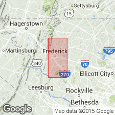
Named for Araby, 1.5 km southwest of Frederick Junction, Frederick Co., north-central MD. Rocks were previously mapped as Antietam Quartzite by Jonas and Stose (1938), but have now been determined not to be either lithologically or time equivalent to Antietam rocks elsewhere. Most complete section is exposed along Baltimore and Ohio RR just east of Frederick Junction; other good exposures are 4 km south of Buckeystown along Lily Pons Rd between MD Hwy 85 and Monocacy River, and just east of Woodsboro along MD Hwy 550 between MD Hwy 194 and Lehigh Portland Quarry. Outcrops on eastern and western margins of Frederick Valley. Consists of buff, tan, green, or black, uniformly fine-grained, highly cleaved and (or) jointed, poorly bedded siltstone or phyllite. Thickness estimated at 100 m. Western belt almost completely overlain by Triassic sediments or mountain wash; eastern belt overlain by Rocky Station Springs Member (new) of Frederick Formation (revised). Western belt conformably overlies Harpers Phyllite; eastern belt separated from underlying Ijamsville Phyllite by Martic Line. Trilobite OLENELLUS sp. found during this study indicates late Early Cambrian age (A.R. Palmer, 1972, personal commun.); pelmatozoans from upper 20 m of formation cannot be older than very latest Middle Cambrian (J. Sprinkle, 1971, personal commun.). Overall age is Early and Middle Cambrian. Report includes geologic map and sections, geologic columns, measured sections, correlation charts, and fossil lists.
Source: GNU records (USGS DDS-6; Reston GNULEX).
For more information, please contact Nancy Stamm, Geologic Names Committee Secretary.
Asterisk (*) indicates published by U.S. Geological Survey authors.
"No current usage" (†) implies that a name has been abandoned or has fallen into disuse. Former usage and, if known, replacement name given in parentheses ( ).
Slash (/) indicates name conflicts with nomenclatural guidelines (CSN, 1933; ACSN, 1961, 1970; NACSN, 1983, 2005, 2021). May be explained within brackets ([ ]).

