- Usage in publication:
-
- Aquia Creek stage
- Modifications:
-
- Named
- Dominant lithology:
-
- Marl
- AAPG geologic province:
-
- Atlantic Coast basin
Summary:
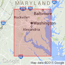
Named for lower beds of Eocene age of middle Atlantic slope. [Presumably included in Darton's Pamunkey formation, but wording is unclear.] Named for Aquia Creek, Stafford Co., eastern VA. Forms bluffs in MD and VA along Potomac River. Consists largely of greensand marl, in places thoroughly indurated so that limestone ledges are formed. Contains "Lignitic" fossils. Age is Eocene.
Source: GNU records (USGS DDS-6; Reston GNULEX).
- Usage in publication:
-
- Aquia Creek stage
- Modifications:
-
- Revised
- Overview
- AAPG geologic province:
-
- Atlantic Coast basin
Summary:
Assigned to Pamunkey formation. Consists of greensand, 77 feet thick, containing fauna resembling middle Lignitic. Separated from overlying Woodstock stage of Pamunkey by 117 feet of greensands and argillaceous sand; separated from underlying Rancocas formation (Cretaceous) by 60 feet of greensand, somewhat argillaceous, with basal pebble bed.
Source: GNU records (USGS DDS-6; Reston GNULEX).
- Usage in publication:
-
- Aquia Formation
- Modifications:
-
- Revised
- Overview
- AAPG geologic province:
-
- Atlantic Coast basin
Summary:
Pg. 58. Aquia formation of Pamunkey group. More highly arenaceous and much more calcareous than overlying Nanjemoy formation. Consists of greensands and greensand marls, frequently argillaceous. Thickness 100 feet. Characterized by well-marked fauna representing a clearly defined paleontological stage. Is divided into Paspotansa member or substage above and Piscataway member or substage below, which are faunally separable over considerable parts of Maryland and Virginia. Rests unconformably on Cretaceous. This is an expanded definition of †Aquia Creek stage or fauna, which did not include basal 60 feet of unfossiliferous greensand. Is bottom formation of Pamunkey group. Age is early Eocene.
Type locality: Aquia Creek, Stafford Co., VA. Extends into Maryland and Delaware.
Source: US geologic names lexicon (USGS Bull. 896, p. 63).
- Usage in publication:
-
- Aquia formation
- Modifications:
-
- Overview
- AAPG geologic province:
-
- Atlantic Coast basin
Gildersleeve, B., 1942, Eocene of Virginia: Virginia Geological Survey Bulletin, no. 57, 43 p.
Summary:
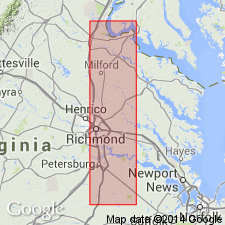
Best exposed in bluffs near mouth of Aquia Creek and along south bank of Potomac River between Bull Bluff and Fairview Beach. Composed principally of medium- to fine-grained greensand and greensand marl with some interbedded layers consisting almost entirely of shells. Unconformably overlies Lower Cretaceous Potomac Group and is disconformably overlain by Nanjemoy formation or by unconsolidated Pliocene and Pleistocene deposits. Lower Piscataway member consists principally of greensands and greensand marls; lower beds are argillaceous. Upper Paspotansa member consists of beds of greensand marl. In Potomac River area, Piscataway is divided into seven zones, Paspotansa is divided into two zones. Members are lithologically similar.
Source: GNU records (USGS DDS-6; Reston GNULEX).
- Usage in publication:
-
- Aquia greensand
- Modifications:
-
- Revised
- AAPG geologic province:
-
- Atlantic Coast basin
Summary:
Name revised as Aquia greensand [a variant]. Revised to exclude Paleocene sediments of newly defined Brightseat formation. Paleocene sediments were considered absent from coastal plain of MD until Cushman (date?) detected Paleocene foraminifers in a deep oil test well near Salisbury, MD. Later, same section was detected at shallower depths in coastal plain. This indicates that Paleocene sediments were previously overlooked and were mapped with either the Aquia greensand (Eocene) or Monmouth formation (Upper Cretaceous). Brightseat formation is named to encompass all Paleocene sediments between the two formations in southern MD.
Source: GNU records (USGS DDS-6; Reston GNULEX).
- Usage in publication:
-
- Aquia formation
- Modifications:
-
- Age modified
- AAPG geologic province:
-
- Atlantic Coast basin
Summary:
Twenty-four species of planktonic Foraminifera described from the Aquia formation at Aquia Creek, VA. Unit is considered to be late Paleocene in age and correlate with the Vincentown formation of NJ and the Salt Mountain limestone of AL.
Source: GNU records (USGS DDS-6; Reston GNULEX).
- Usage in publication:
-
- Aquia Formation
- Modifications:
-
- Overview
- Revised
- AAPG geologic province:
-
- Atlantic Coast basin
Summary:
Aquia Formation crops out in an irregular northeast-southwest belt from the MD-DE border to south of Petersburg, VA. Outcrop thickness is approximately 100 ft, but in the subsurface reaches at least 210 ft. Lithology varies from a very fine- to medium-grained glauconitic quartz sand to a very fine- to medium-grained quartz glauconite sand. Color in outcrop is dark greenish-gray, weathering to a yellowish-brown, but color of dry sediment is gray. Mollusks are abundant. Light colored indurated glauconitic quartz sandstone ledges up to two ft thick occur throughout the formation. Two members, the Piscataway and the Paspotansa, were differentiated on the basis of their weathered appearance. The writer found that the Piscataway, at its type locality, is a yellowish-brown, glauconitic quartz sand--a color and lithology that Clark and Martin attributed to the Paspotansa. It is proposed here to drop the Piscataway and Paspotansa as Members of the Aquia as the basis upon which the units were defined is unreliable. Contact with the overlying Nanjemoy Formation is marked by a sharp change to pink clay. The lower contact with the Brightseat Formation is marked by a change in texture and color, as the Brightseat is composed of a greenish-gray, silty, very fine-grained glauconitic quartz sand, the median size of which is approximately half the diameter of the Aquia sand. The base of the Aquia is also marked by a molluscan shell bed, which has been considered to indicate an unconformity by some authors. It is recommended here that the Brightseat be relegated to member status in the Aquia as field, sedimentologic, and paleontologic evidence all indicate that the Brightseat is not a distinct enough unit to be regarded as a formation. Age of the Aquia is Paleocene and Eocene based on foraminifers. The GLOBOROTALIA PSEUDOBULLOIDES Assemblage Zone of late Paleocene age is present in the middle portion of the Aquia. The GLOBIGERINA SPIRALIS-GLOBOROTALIA ACUTA Assemblage Zone, early Eocene in age, is found in the upper fossiliferous section.
Source: GNU records (USGS DDS-6; Reston GNULEX).
- Usage in publication:
-
- Aquia Formation*
- Modifications:
-
- Revised
- Biostratigraphic dating
- Dominant lithology:
-
- Sand
- AAPG geologic province:
-
- Atlantic Coast basin
Summary:
Consists of clayey, silty, very shelly, glauconitic sand. Crops out in a continuous arc from upper Chesapeake Bay to around Hopewell, southern VA. Macro- and microfossil work indicates placement of Aquia in upper Paleocene, zones NP 5-9 on basis of calcareous nannofossils. Principal reference section is located on almost vertical bluff along Virginia shore of Potomac River between Potomac and Aquia Creeks (USGS Locality 26332), 2.4 km below mouth of Aquia Creek and Youbedom Landing, Stafford Co., in Passapatanzy 7.5-minute quad. Consists of 23.1 m of fine, silty, micaceous, glauconitic, and quartzose sand and sandstone; is shelly in places.
Source: GNU records (USGS DDS-6; Reston GNULEX).
- Usage in publication:
-
- Aquia Formation*
- Modifications:
-
- Overview
- AAPG geologic province:
-
- Atlantic Coast basin
Summary:
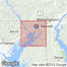
Aquia Formation is present in the study area only in the southeastern part of Cecil County, Maryland. A good exposure several feet thick is located about 0.5 mile south-southwest of Ginns Corner. Unit for the most part is somewhat glauconitic, poorly sorted quartz sand. Basal few feet contain 10 to 15 percent glauconite, much more than the 5 percent found in the upper portion. Unit gradationally overlies the Hornerstown Formation and underlies the Upland Gravel (new) [considered informal by the GNU]. Age is late Paleocene.
[GNU remark (Aug. 19, 1992, USGS DDS-6; Reston GNULEX): Aquia in this report is apparently not assigned to the Pamunkey Group and members are not mentioned. This manuscript was reviewed by the GNU in 1973, but was not published until 1990. Field work for this study was done in the late 1960's. The nomenclature in this report may not reflect current usage.]
Source: GNU records (USGS DDS-6; Reston GNULEX).

- Usage in publication:
-
- Aquia Formation
- Modifications:
-
- Overview
- AAPG geologic province:
-
- Atlantic Coast basin
Summary:
Undifferentiated Pamunkey Group, Old Church Formation, and unnamed glauconitic sands are lumped on the State map as lower Tertiary deposits. Individual units are discussed in accompanying text. Aquia Formation of Pamunkey Group is described as light- to dark-olive gray, glauconitic quartz sand, fine- to coarse-grained, clayey and silty, thick- to massively bedded, sparsely to abundantly shelly. Lower part of unit is more poorly sorted and more calcareous than upper part and contains a few thin to medium beds of olive-gray, white, and pale greenish-yellow limestone. Upper part of unit is moderately well sorted and characterized by thin beds of the large, high-spired gastropod TURRITELLA MORTONI. Other common mollusks include CUCULLAEA GIGANTEA, OSTREA SINUOSA, and CRASSATELLITES ALAEFORMIS. Thickness ranges from 0 to 130 ft. Age is late Paleocene.
Source: GNU records (USGS DDS-6; Reston GNULEX).
- Usage in publication:
-
- Aquia Formation*
- Modifications:
-
- Biostratigraphic dating
- AAPG geologic province:
-
- Atlantic Coast basin
Summary:
Aquia Formation shown as Paleocene (Midway and Wilcox) age on fig. 1. Midway and Wilcox age based on CRASSATELLA AQUIANA collected from Stafford Co., eastern VA, and Prince George's and Charles Cos., southern MD; and BATHYTORMUS ALAEFORMIS collected from Stafford, King George, and Hanover Cos., eastern VA, and Prince Georges and Charles Cos., MD.
Source: GNU records (USGS DDS-6; Reston GNULEX).
- Usage in publication:
-
- Aquia Formation
- Modifications:
-
- Overview
- AAPG geologic province:
-
- Atlantic Coast basin
Summary:
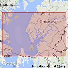
Aquia Formation occupies the interval between 109.1 ft and 23.5 ft in the Ken-Bf 180 core-hole. In the basal 23 ft the clayey, medium to fine-gained sands are calcareous; the glauconite is relatively fresh, but the quartz grains are commonly iron-stained. Lower contact with Hornerstown Formation is sharp and flat. Upper 63 ft is coarser grained, less clayey, and better sorted. Contact with overlying Oligocene Old Church Formation is sharp and flat. Late Paleocene (Thanetian) foraminifers and the brachiopod OLENEOTHYRIS HARLINI were found near the base of the formation. In eastern Kent Co. underlies Miocene and Pliocene Pensauken Formation and in southwestern Kent Co. underlies the early Eocene Nanjemoy Formation. [No mention of Pamunkey Group assignment.]
Source: GNU records (USGS DDS-6; Reston GNULEX).
For more information, please contact Nancy Stamm, Geologic Names Committee Secretary.
Asterisk (*) indicates published by U.S. Geological Survey authors.
"No current usage" (†) implies that a name has been abandoned or has fallen into disuse. Former usage and, if known, replacement name given in parentheses ( ).
Slash (/) indicates name conflicts with nomenclatural guidelines (CSN, 1933; ACSN, 1961, 1970; NACSN, 1983, 2005, 2021). May be explained within brackets ([ ]).

