

- Usage in publication:
-
- Aqua Torres formation
- Modifications:
-
- Original reference
- Dominant lithology:
-
- Conglomerate
- Arkose
- Sandstone
- Shale
- Limestone
- AAPG geologic province:
-
- Orogrande basin
Summary:
Pg. 1154-1155, 1171, pls. 1, 7. Aqua Torres formation. Consists of a thin basal conglomerate (brown, pebbles of quartz, gray limestone and occasionally red limestone in a fine-grained calcareous and well cemented matrix), a sequence of arkoses, red sandstones, red shales, nodular limestones, and at top gray massive limestone. Thickness about 80 feet. Underlies Abo formation; overlies Pennsylvanian rocks of Virgil age. [Age is Permian.]
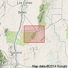
Type exposure in the Arroyo Aqua Torres [now Agua de los Torres] in southern part of Los Pinos Mountains, Socorro Co., central NM. Also exposed along U.S. Highway 60 east of the thrust faults.
[Misspelled Agua Torres in GNU records (USGS DDS-6; Denver GNULEX).]
Source: US geologic names lexicon (USGS Bull. 1200, p. 120); GNC index card files (USGS-Menlo).
- Usage in publication:
-
- Aqua Torres formation
- Modifications:
-
- Not used
- AAPG geologic province:
-
- Orogrande basin
Summary:
Pg. 1034, 1044. Aqua Torres formation. Suggested as being synonymous with Bursum formation and Red Tanks member of Madera limestone.
Prior to 1946 it had been known that an unnamed interval of transitional beds occurred in central New Mexico between gray limestones of Late Pennsylvanian age and continental red beds of the Abo formation. In 1946 this interval received no less than 3 names and was assigned to 3 different ages: Permian Aqua Torres formation, Permian? Bursum formation, and Pennsylvanian Red Tanks member of Madera limestone. The Red Tanks has priority, but it is doubtful if the unit in question will remain at the nomenclatural level of a member.
Source: US geologic names lexicon (USGS Bull. 1200, p. 120); GNC index card files (USGS-Menlo).
- Usage in publication:
-
- Aqua Torres formation
- Modifications:
-
- Areal extent
- AAPG geologic province:
-
- Estancia basin
Summary:
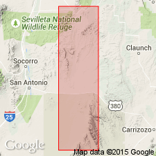
The part of the "Magdalena" which contains red beds is called Aqua Torres by Stark and Dapples (1946), who present evidence for its Wolfcamp (Permian) age, and described it in Socorro County, New Mexico. As thus defined, crops out only in east flank of north end of Manzano Mountains, Bernalillo County, New Mexico, into which it is areally extended.
[Misspelled Agua Torres in GNU records (USGS DDS-6; Denver GNULEX).]
Source: Modified from GNU records (USGS DDS-6; Denver GNULEX).
- Usage in publication:
-
- Aqua Torres Formation†
- Modifications:
-
- Abandoned
- AAPG geologic province:
-
- Orogrande basin
Summary:
Pg. 126. †Aqua Torres Formation. Name used by Stark and Dapples (1946) for a sequence of Lower Permian interbedded red sandstone and shale and gray limestone below the Abo in the Abo Canyon area and Los Pinos Mountains [Socorro County, New Mexico]; Lloyd (1949, New Mexico Bur. Mines and Mineral Res. Bull., no. 29) pointed out that this unit had earlier been named the Bursum Formation.
Source: Publication.
For more information, please contact Nancy Stamm, Geologic Names Committee Secretary.
Asterisk (*) indicates published by U.S. Geological Survey authors.
"No current usage" (†) implies that a name has been abandoned or has fallen into disuse. Former usage and, if known, replacement name given in parentheses ( ).
Slash (/) indicates name conflicts with nomenclatural guidelines (CSN, 1933; ACSN, 1961, 1970; NACSN, 1983, 2005, 2021). May be explained within brackets ([ ]).