- Usage in publication:
-
- Appomattox formation
- Modifications:
-
- Original reference
- Dominant lithology:
-
- Clay
- Sand
- AAPG geologic province:
-
- Atlantic Coast basin
Summary:
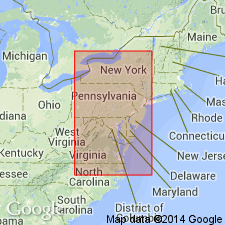
Pg. 125, 328-330. Appomattox formation. A series of predominantly orange-colored clays and sands of later Tertiary age, regularly but obscurely stratified, sometimes interbedded with gravel or interspersed with pebbles. Thickness 0 to 100 feet. Typically exposed on and near Appomattox River from its mouth to some miles west of Petersburg, [Dinwiddle County, Virginia]. Rests on Potomac sandstone, from which it is readily distinguished by its greater homogeneity, the more complete intermingling of its arenaceous and argillaceous materials, its more regular stratification, and its more uniform and predominating orange color. It is as readily distinguished from overlying Columbia deposits by its vertical homogeneity, its comparatively regular stratification, distinctive color, and greater range in altitude, extending as it does from tide level to highest eminences of Piedmont escarpment between the Rappahannock and the Roanoke. Continues to thicken and expand south of Appomattox River, until it forms the surface everywhere in vicinity of fall line save where it is cut away by erosion or concealed beneath Columbia deposits. Is typically exposed on the Roanoke opposite Weldon, North Carolina. Forms predominant surface formation over a zone 40 or 50 miles wide on the Roanoke, but attenuates and narrows northward, finally disappearing on Potomac Creek 4 or 5 miles north of Fredericksburg; and although it appears to thicken seaward it soon disappears beneath tide level and newer deposits. No fossils. Overlies Miocene and underlies Columbia formation. Fresh aspect and comparatively slight erosion indicate its age is much nearer Columbia formation than Miocene. It is probable it will be found to reach considerable volume in South Carolina, Georgia, and Alabama, and although precise relations have not been ascertained, it is indicated not only by physical considerations but by Fontaine's recent studies in Virginia and Alabama that at least part of Orange sand of Hilgard and other southern geologists is = Appomattox formation of north rather than Columbia, which is not known to extend much farther south than North Carolina.
Source: US geologic names lexicon (USGS Bull. 896, p. 62-63).

- Usage in publication:
-
- Appomattox formation†
- Modifications:
-
- Abandoned
- AAPG geologic province:
-
- Atlantic Coast basin
Summary:
†Appomattox formation abandoned. Includes equivalents of †Lafayette formation (Pliocene?) and of Columbia group (Pleistocene).
Source: US geologic names lexicon (USGS Bull. 896, p. 62-63).
For more information, please contact Nancy Stamm, Geologic Names Committee Secretary.
Asterisk (*) indicates published by U.S. Geological Survey authors.
"No current usage" (†) implies that a name has been abandoned or has fallen into disuse. Former usage and, if known, replacement name given in parentheses ( ).
Slash (/) indicates name conflicts with nomenclatural guidelines (CSN, 1933; ACSN, 1961, 1970; NACSN, 1983, 2005, 2021). May be explained within brackets ([ ]).

