- Usage in publication:
-
- Apache Wash facies
- Modifications:
-
- First used
- Dominant lithology:
-
- Sandstone
- Siltstone
- Conglomerate
- AAPG geologic province:
-
- Basin-and-Range province
Summary:
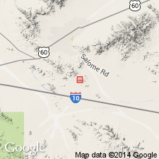
First published use as a name for some brown-weathering lithofeldspathic sandstone, siltstone, and conglomerate at least 750 m thick that are part of the Centennial plate in the southern Little Harquahala Mountains, La Paz Co, AZ in the Basin-and-Range province. Cross sections. Geologic map. Intent to name, source of geographic name, designation of a type not stated. Divided into lower and upper members. Lower member consists of evaporitic shale in the northeast that grades to southeast into sandstone and conglomerate. The shale is white-weathering silty, calcareous, locally interbedded with brown, very thin-bedded porcelaneous dolomite. The sandstone to the southeast is thin-bedded, green, volcanic lithic with poorly sorted angular fine sand to grit. Lenses of pebble to cobble conglomerate with limestone and quartzite clasts from the Supai, Coconino and Kaibab Formations. Thin limestone with algal structures locally. Upper member is a lithofeldspathic gray sandstone, brown siltstone, and conglomerate. Siltstone and shale more abundant higher in section. Clasts in the conglomerate are predominantly tan quartzite, but also includes limestone, granite. Poorly preserved brachiopod. Nonmarine environment. May have been deposited in a separate but coeval basin of the McCoy Mountains. Assigned a Jurassic and Cretaceous age.
Source: GNU records (USGS DDS-6; Denver GNULEX).
For more information, please contact Nancy Stamm, Geologic Names Committee Secretary.
Asterisk (*) indicates published by U.S. Geological Survey authors.
"No current usage" (†) implies that a name has been abandoned or has fallen into disuse. Former usage and, if known, replacement name given in parentheses ( ).
Slash (/) indicates name conflicts with nomenclatural guidelines (CSN, 1933; ACSN, 1961, 1970; NACSN, 1983, 2005, 2021). May be explained within brackets ([ ]).

