The National Geologic Map Database is migrating to a new infrastructure. We apologize for any service disruptions during this process.
|
|---|


- Usage in publication:
-
- Antrim Shale
- Modifications:
-
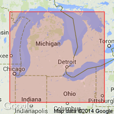
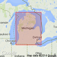
- Areal extent
- AAPG geologic province:
-
- Michigan basin
Summary:
Antrim is youngest Paleozoic unit in WI. Occurs at bedrock surface in study area, therefore total thickness unknown. Strata in WI were called Kenwood, but correlated with Michigan's Antrim by Schumacher (1971). A mixture of Upper Devonian conodonts occurs in the Antrim in IL, WI, and possibly MI. Not only are nearshore and pelagic biofacies represented in the Antrim, but so are at least five Upper Devonian biostratigraphic zones--intermixed. Deposition subtidal. Overlies Milwaukee Formation (Givetian). Age is Late Devonian (Frasnian-Famennian).
Source: GNU records (USGS DDS-6; Reston GNULEX).
- Usage in publication:
-
- /Antrim Group
- /Antrim Formation
- Modifications:
-
- Revised
- AAPG geologic province:
-
- Michigan basin
Summary:
[Antrim Group in conflict with nomenclatural guidelines stating it is not permissible to apply the same name to a unit and to a part of it (CSN, 1933; ACSN, 1961, 1970; NACSN, 1983, 2005, 2021). Antrim Group considered invalid.]
Previously defined Antrim Shale is here raised in rank to Antrim Group and divided into three formations (ascending): Antrim (revised), Ellsworth (revised), and Sanilac (new) Formations. The Sanilac consists of black shales formerly included within the upper part of the Ellsworth Shale in western MI and upper black shales within the Antrim Shale of eastern MI. Ellsworth Formation (revised) consists of gray shales below the upper black shales of the former Ellsworth in western MI and the gray shales of the "Upper" or "Light" Antrim of eastern MI. The Antrim Formation [of this report] is composed of black and gray shales below the Ellsworth and includes the previously known Traverse Formation. Antrim Formation is subdivided into (ascending) Mud Lake Gray Shale Member (Traverse Formation), Charlton Black Shale Member (lower black shale), Crapo Creek Gray Shale Member (middle gray shale), and Chester Black Shale Member (upper black shale).
Source: GNU records (USGS DDS-6; Reston GNULEX).

- Usage in publication:
-
- Antrim Shale*
- Modifications:
-
- Revised
- Age modified
- Biostratigraphic dating
- AAPG geologic province:
-
- Michigan basin
Summary:
Age of the Antrim Shale in the Michigan basin is changed to Late Devonian only (early Frasnian to late Famennian) based on conodonts, and is divided into four members, from base to top: Norwood, Paxton, and Lachine Members and informal upper member. Conformably overlies the Squaw Bay Limestone [See Note Below]; conformably underlies the Ellsworth Shale.
[NOTE: In accordance with Department of Interior's Secretarial Order 3404, discontinuing use of derogatory term squaw, the Squaw Bay Limestone is in process of being formally renamed Birdsong Bay Limestone (RESERVED). The geographic feature Squaw Bay, from which the geologic name was taken (Warthin and Cooper, 1935), was renamed Birdsong Bay by U.S. Board on Geographic Names, September 2022, USGS GNIS FeatureID 638662.]
Source: Modified from GNU records (USGS DDS-6; Reston GNULEX).
- Usage in publication:
-
- Antrim Shale
- Modifications:
-
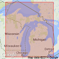
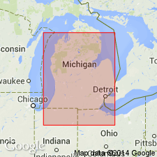
- Areal extent
Summary:
Antrim Shale in MI is exposed only in the northern part of the basin in Antrim, Charlevoix, Cheboygan, and Alpena Counties. Also exposed in a few localities near the southern margin of the basin in northwestern Ohio, and northern Indiana. Underlies all of the Mississippian System in the Michigan basin and continues upward into the Mississippian throughout much of the basin. This age assignment is in disagreement with Gutshick and Sandberg (this volume) who state that the Antrim is Late Devonian only. Antrim is perhaps the most interesting of Mississippian formations in Michigan. It cannot be adequately described or interpreted, by considering only the Michigan occurrence. There is a remarkable geographic extent of the same peculiar lithology near the Devonian-Mississippian boundary through much of the US. Unit is known as Antrim only in the Michigan basin. Similar rocks occur in Illinois, Indiana, and western Kentucky, as the New Albany Shale; in Ohio and eastern Kentucky as the Ohio Shale; in Iowa, Missouri, Kansas, Oklahoma, Arkansas, Tennessee, Mississippi and Alabama as the Chattanooga Shale; and in West Virginia, Pennsylvania, and New York as the Geneseo Shale. The Antrim is dark gray or brown to largely black, highly carbonaceous, thinly laminated shale with meager fossil content except for profuse algal spores. Large dark brown, bituminous and pyritic limestone concretions occur in the lower Antrim and are typically from 9.6 to 1.5 m in diameter.
Source: GNU records (USGS DDS-6; Reston GNULEX).
- Usage in publication:
-
- Ellsworth, upper Antrim
- Modifications:
-
- Revised
- AAPG geologic province:
-
- Michigan basin
Summary:
Author feels existing formational names defined by lithology and color are inadequate to describe a framework based on gamma-ray log correlations. New informal terminology is introduced to recognize the facies relation between the western Ellsworth Shale and the upper part of the eastern Antrim Shale. The new unit is called the "Ellsworth/upper Antrim" and conforms to Forgotson's definition of a "format." In addition, the term "lower Antrim" is introduced for the western Antrim and the lower part of the eastern Antrim. It is continuous throughout the entire basin. Contact between the lower Antrim and the Ellsworth/upper Antrim is at the position of the time-stratigraphic marker FOERSTIA (PROTOSALVINIA).
Source: GNU records (USGS DDS-6; Reston GNULEX).
For more information, please contact Nancy Stamm, Geologic Names Committee Secretary.
Asterisk (*) indicates published by U.S. Geological Survey authors.
"No current usage" (†) implies that a name has been abandoned or has fallen into disuse. Former usage and, if known, replacement name given in parentheses ( ).
Slash (/) indicates name conflicts with nomenclatural guidelines (CSN, 1933; ACSN, 1961, 1970; NACSN, 1983, 2005, 2021). May be explained within brackets ([ ]).