The National Geologic Map Database is migrating to a new infrastructure. We apologize for any service disruptions during this process.
|
|---|


- Usage in publication:
-
- Antoine Canyon Formation*
- Modifications:
-
- Named
- Dominant lithology:
-
- Quartzite
- AAPG geologic province:
-
- Sierra Nevada province
Summary:
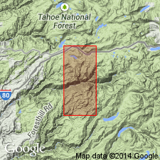
Antoine Canyon Formation is named for exposures in Antoine Canyon (type locality: sec.13, T15N R12E, Duncan Peak 7.5' quad), Placer Co, CA. Reference localities are found in Manilia Canyon and Screwauger Canyon (sec.18, T15N R13E). Consists of thick-bedded, parallel-laminated, generally fine-grained quartzite with minor thin beds of black pelite. Total thickness is unknown; thickness at type locality is at least 2700 m. Base of unit is not exposed; locally overlain in much of map area by the Screwauger Breccia (new) and the Big Valley Bluff Formation (new). Age is Ordovician(?) to Devonian(?) based on regional stratigraphic relationships.
Source: GNU records (USGS DDS-6; Menlo GNULEX).
For more information, please contact Nancy Stamm, Geologic Names Committee Secretary.
Asterisk (*) indicates published by U.S. Geological Survey authors.
"No current usage" (†) implies that a name has been abandoned or has fallen into disuse. Former usage and, if known, replacement name given in parentheses ( ).
Slash (/) indicates name conflicts with nomenclatural guidelines (CSN, 1933; ACSN, 1961, 1970; NACSN, 1983, 2005, 2021). May be explained within brackets ([ ]).