- Usage in publication:
-
- Antioch Limestone Member
- Modifications:
-
- Original reference
- Dominant lithology:
-
- Limestone
- Conglomerate
- AAPG geologic province:
-
- Illinois basin
Summary:
Pg. 5 (article by A.M. Burger), table 3. Antioch Limestone Member of Dugger Formation of Carbondale Group. Conglomeratic limestone, 6.4 feet thick. Lies below Bucktown Coal Member (coal Vb, †Grape Creek coal of Illinois) and above Alum Cave Limestone Member; all of Dugger Formation. From type section extends southward into Knox County and northward into Vermillion County, Indiana. Previously included in "Upper Alum Cave Limestone" by Kottlowski (Dugger quadrangle, USGS Coal Inv. Map C-11, 1954) and Wier (Linton quadrangle, USGS Coal Inv. Map C-9, 1951). Fossils (gastropods, brachiopods, crinoids). Age is Middle Pennsylvanian (Desmoinesian).
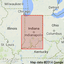
Type section (Antioch Church section, loc. 10 of Wier): in an abandoned strip mine in coal V, 1.5 mi north of Antioch Church, in NE/4 SE/4 NW/4 sec. 24, T. 8 N., R. 8 W., [northeastern corner Dugger 7.5-min quadrangle], Sullivan Co., western IN.
Name credited to C.E. Wier (in prep.) [= Stratigraphy of the Carbondale and McLeansboro Groups in southwestern Indiana, Indiana Geol. Survey Bull. XX, 171 p., unpub. ms., ca. 1961; available online through Indiana Univ. Scholarworks http://hdl.handle.net/2022/3612, accessed on September 18, 2009]
Source: Publication.
For more information, please contact Nancy Stamm, Geologic Names Committee Secretary.
Asterisk (*) indicates published by U.S. Geological Survey authors.
"No current usage" (†) implies that a name has been abandoned or has fallen into disuse. Former usage and, if known, replacement name given in parentheses ( ).
Slash (/) indicates name conflicts with nomenclatural guidelines (CSN, 1933; ACSN, 1961, 1970; NACSN, 1983, 2005, 2021). May be explained within brackets ([ ]).

