

- Usage in publication:
-
- Antietam sandstone
- Modifications:
-
- Areal extent
- Dominant lithology:
-
- Sandstone
- AAPG geologic province:
-
- Appalachian basin
Summary:
(As reported by G.H. Williams and W.B. Clark, in Maryland, its resources, industries, and institutions, chap. 3, p. 68. The formation was described, but not named, by Keith in Amer. Geol., v. 10, p. 365, 1892.) Antietam sandstone. Fine-grained white sandstone, 250 feet thick, with SCOLITHUS [SKOLITHOS] and other Early Cambrian fossils. Underlies Cambrian limestone and overlies Harper's Ferry shales [Harpers shale]. Age is Early Cambrian.
Source: US geologic names lexicon (USGS Bull. 896, p. 57); supplemental information from GNU records (USGS DDS-6; Reston GNULEX).

- Usage in publication:
-
- Antietam sandstone*
- Modifications:
-
- Overview
- AAPG geologic province:
-
- Appalachian basin (Eastern Overthrust area)
Summary:
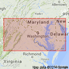
Antietam sandstone. Recognized in West Virginia, Virginia, Maryland, and southeastern Pennsylvania. In southeastern Pennsylvania, the lithologic character of formation changes and it is there called Antietam quartzite in some areas and Antietam schist in other areas. Age is Early Cambrian.
Named from exposures east of Antietam Creek, north of Potomac River, in Harpers Ferry quadrangle, Washington Co., western MD.
Source: US geologic names lexicons (USGS Bull. 896, p. 57; USGS Bull. 1200, p. 110-111).
- Usage in publication:
-
- Antietam quartzite*
- Modifications:
-
- Areal extent
- Dominant lithology:
-
- Quartzite
- AAPG geologic province:
-
- Piedmont-Blue Ridge province
Summary:
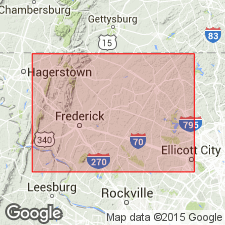
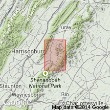
Pg. 41-42. Antietam quartzite. Described in Carroll and Frederick Counties, Maryland. Occurs in foothills on east side of Catoctin Mountain west of Frederick Valley, and in series of linear hills in eastern part of valley. In foothills of Catoctin Mountain, crops out in a narrow belt about 0.25 mile wide which extends from Point of Rocks at Potomac River to Little Tuscarora Creek northwest of Frederick, where it is cut out by Triassic border fault. Quartzite throughout this belt is underlain by Harpers phyllite and overlain by Tomstown dolomite, in normal sequence. On east side of Frederick Valley, Antietam forms discontinuous line of low wooded hills from New Midway, where quartzite is overlapped by Triassic sedimentary rocks, southwestward to Potomac River. Quartzite here is unconformably overlain by Frederick limestone. Total thickness in belt west of Frederick Valley estimated about 300 feet. Age is Early Cambrian.
Source: US geologic names lexicon (USGS Bull. 1200, p. 110-111).
- Usage in publication:
-
- Antietam quartzite
- Antietam sandstone
- Modifications:
-
- Areal extent
- Dominant lithology:
-
- Quartzite
- Sandstone
- AAPG geologic province:
-
- Appalachian basin
Summary:
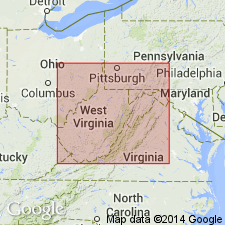
Pg. 115-124. Referred to as Antietam quartzite or Antietam sandstone in West Virginia. Only outcrop is in Jefferson County where its length is about 14 miles and its width 0.75 mile. Underlies Tomstown dolomite. Oldest fossiliferous formation in state. Estimated thickness 500 to 600 feet. [Age is Early Cambrian.]
Source: US geologic names lexicon (USGS Bull. 1200, p. 110-111).
- Usage in publication:
-
- Antietam schist
- Modifications:
-
- Areal extent
- Dominant lithology:
-
- Schist
- AAPG geologic province:
-
- Appalachian basin
Summary:
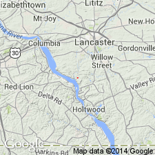
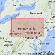
Pg. 193-194, 200-201. Antietam schist. Described in Safe Harbor area, Pennsylvania. Grades upward into Vintage dolomite through zone roughly 10 feet thick. [Age is Early Cambrian.]
Source: US geologic names lexicon (USGS Bull. 1200, p. 110-111).
- Usage in publication:
-
- Antietam quartzite*
- Modifications:
-
- Revised
- Areal extent
- Dominant lithology:
-
- Quartzite
- AAPG geologic province:
-
- Appalachian basin
Summary:
Pg. 15 (fig. 5), 20-24, pl. 1 (geol. map), pl. 2 (strat. sections). Antietam quartzite of Chilhowee group. Described in Elkton area, Virginia, where it is assigned top formation of Chilhowee group. Uniform thickness of about 800 feet. Divided into two members of about equal thickness. Lower member composed of massive, cliff-forming (up to 100 feet thick), white vitreous quartzite, separated by slope-forming beds. Upper member composed of interbedded sandstone and quartzite. Overlies Harpers formation; underlies Tomstown dolomite. SCOLITHUS [SKOLITHOS] worm tubes in lower member. Elsewhere, Early Cambrian age fossils have been reported from crumbly sandstone beds in uppermost part of Antietam, such beds occur near top of formation in Elkton area but were not carefully searched for fossils during present investigation. Age is considered Early Cambrian.
(On p. 21, author states in the Elkton area, most of the sands of the formation are so well cemented and the rock is so vitreous that the unit is termed the Antietam quartzite.)
Source: Publication; US geologic names lexicon (USGS Bull. 1200, p. 110-111).
- Usage in publication:
-
- Antietam sandstone
- Modifications:
-
- Areal extent
- Dominant lithology:
-
- Sandstone
- AAPG geologic province:
-
- Appalachian basin
Summary:
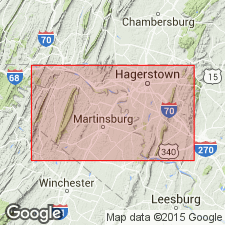
Pg. 39. Referred to as Antietam sandstone. Occurs only in eastern Washington County, western Maryland, in foothills of South Mountain and Elk Ridge.
Source: US geologic names lexicon (USGS Bull. 1200, p. 110-111).
- Usage in publication:
-
- Antietam quartzite
- Modifications:
-
- Areal extent
- Dominant lithology:
-
- Quartzite
- AAPG geologic province:
-
- Appalachian basin
Summary:
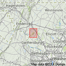
Pg. 51-52, pl. 1. Antietam quartzite. In Sugarloaf Mountain area, Antietam quartzite conformably overlies Harpers phyllite and underlies Frederick limestone. Crops out in two southeast-trending belts, 1 to 2 miles wide, along western part of area. Western belt is tight anticline that forms ridge above surrounding Frederick limestone. Eastern belt, which is discontinuous, is separated from western belt by limestone valley. [Age is Early Cambrian.]
Source: US geologic names lexicon (USGS Bull. 1200, p. 110-111).
- Usage in publication:
-
- Antietam formation
- Modifications:
-
- Areal extent
- AAPG geologic province:
-
- Appalachian basin
Summary:
Mapped as Antietam formation. [Age is Early Cambrian.]
Source: US geologic names lexicon (USGS Bull. 1200, p. 110-111).
- Usage in publication:
-
- Antietam Formation*
- Modifications:
-
- Age modified
- AAPG geologic province:
-
- Piedmont-Blue Ridge province
Summary:
Age of Chilhowee Group is Proterozoic Z and Early Cambrian. The basal part, Weverton Formation in the north and Unicoi Formation in the south, is overlain by Harpers Formation in the north and Hampton Formation in the south. The topmost formation is Antietam Formation in the north and Erwin Formation in the south. Therefore, the Weverton and Unicoi are Proterozoic Z; Antietam and Erwin are Early Cambrian; Harpers and Hampton are Early Cambrian(?) based on SCOLITHUS [SKOLITHOS] tubes found in the Snowden Member of Harpers (MF-1337-A).
Source: GNU records (USGS DDS-6; Reston GNULEX).
For more information, please contact Nancy Stamm, Geologic Names Committee Secretary.
Asterisk (*) indicates published by U.S. Geological Survey authors.
"No current usage" (†) implies that a name has been abandoned or has fallen into disuse. Former usage and, if known, replacement name given in parentheses ( ).
Slash (/) indicates name conflicts with nomenclatural guidelines (CSN, 1933; ACSN, 1961, 1970; NACSN, 1983, 2005, 2021). May be explained within brackets ([ ]).