The National Geologic Map Database is migrating to a new infrastructure. We apologize for any service disruptions during this process.
|
|---|


- Usage in publication:
-
- Antelope shale
- Modifications:
-
- Original reference
- Dominant lithology:
-
- Shale
- AAPG geologic province:
-
- San Joaquin basin
Summary:
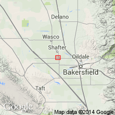
Pg. 1332 (fig. 1); see also P.D. Goudkoff, IN Jenkins, O.P., 1943, California Div. Mines Bull., no. 118, p. 247-252. Antelope shale. Initially used as local name for a productive oil zone in subsurface, Rio Bravo field, 15 miles northwest of Bakersfield, Kern County, central California. [Type locality not designated.] Antelope shale is described with McLure [shale] as hard thinly bedded brown shales with occasional hard cherty streaks. Conformably underlies McLure [shale] and unconformably overlies McDonald shale. Age is late Miocene. [Goudkoff (1943, p. 248-249) indicates Antelope shale is upper Mohnian to upper Delmontian, BOLIVINA MARGINATA to HAPLOPHRAGMOIDES sp. faunal zones.]
Source: Publication; GNU records (USGS DDS-6; Menlo GNULEX); US geologic names lexicon (USGS Bull. 1200, p. 108).
- Usage in publication:
-
- Antelope shale member
- Modifications:
-
- Revised
- Biostratigraphic dating
- AAPG geologic province:
-
- San Joaquin basin
Summary:
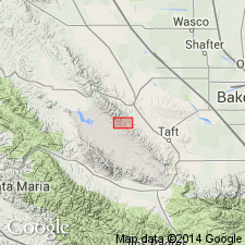
Pg. 1611 (fig. 2), 1617, 1621 (fig. 4), 1627 (fig. 8). Antelope shale member of Monterey formation. At surface, consists of siliceous, well-bedded, light brown shale containing minor lenses of sandstone and limestone. Thickness about 2400 feet. Unconformably underlies Santa Margarita formation; conformably overlies McDonald shale member of Monterey formation. Stratigraphic section is in Crocker Flat-Recruit Pass area of central Temblor Range. Microfauna permits correlation with BOLIVINA MARGINATA var. "MULTICOSTA" zone of Chico Martinez Creek area and indicates late Mohnian age (late Miocene).
Source: US geologic names lexicon (USGS Bull. 1200, p. 108); GNU records (USGS DDS-6; Menlo GNULEX).
- Usage in publication:
-
- Antelope shale
- Modifications:
-
- Areal extent
- AAPG geologic province:
-
- San Joaquin basin
Summary:
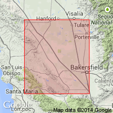
Subsurface Antelope shale shown in correlation chart on west side of San Joaquin Valley as occurring in McKittrick Field, Midway-Sunset (Williams and Republic areas, and Maricopa Flat), Buena Vista Hills and Wheeler Ridge. Age is late Mohnian to early Delmontian [late Miocene].
Source: GNU records (USGS DDS-6; Menlo GNULEX).

- Usage in publication:
-
- /Antelope (McClure) shale member
- Modifications:
-
- Redescribed
- Dominant lithology:
-
- Shale
- Siltstone
- AAPG geologic province:
-
- San Joaquin basin
Summary:
Redescribed in text as Antelope (McClure) shale. Shown as /Antelope shale member of McClure shale member of Monterey Formation on stratigraphic column in general Chico-Martinez Creek area. Described as hard light brown to buff, blocky, brittle laminated shale and siltstone about 2750 ft thick. Contains UVIGERINA SUBPEREGRINA, BULIMINELLA ELEANTISSIMA, NONIONELLA MIOCENICA fauna. Is Miocene (Mohnian stage) age.
[Conflicts with classification hierarchy; members are not subdivided into other members (CSN, 1933; ASCN, 1961, 1970, NACSN, 1983, 2005, 2021).]
Source: GNU records (USGS DDS-6; Menlo GNULEX).
- Usage in publication:
-
- Antelope formation
- Antelope shale
- Modifications:
-
- Revised
- AAPG geologic province:
-
- San Joaquin basin
Summary:
Antelope formation divided into (ascending); Williams, Republic, Spellacy, 555, Orloff, Sub-Lakeview, and Lakeview sands (members). Electric log of Antelope shale shows stratigraphic occurrence of sands in subsurface. Outcrop areas of Williams, Republic and Spellacy sands are given. Unconformably underlies Reef Ridge formation; unconformably overlies McDonald formation. Age is late Miocene.
Source: GNU records (USGS DDS-6; Menlo GNULEX).
- Usage in publication:
-
- Antelope unit
- Modifications:
-
- Revised
- AAPG geologic province:
-
- San Joaquin basin
Summary:
Antelope Shale member of Monterey Formation of Foss and Blaisdell (1968) is reduced in rank to Antelope unit of McClure member of Monterey Formation. "We have combined and slightly modified the nomenclature, in order to extend the units consistently eastward and northward across the basin." In most basinal areas McClure Member can be subdivided into lower McDonald unit (lower Mohnian) and upper Antelope unit (middle Mohnian). Antelope unit is porcelaneous. Underlies Reef Ridge Member of Monterey Formation. Overlies MacDonald unit. Age is Miocene (Mohnian stage).
Source: GNU records (USGS DDS-6; Menlo GNULEX).
For more information, please contact Nancy Stamm, Geologic Names Committee Secretary.
Asterisk (*) indicates published by U.S. Geological Survey authors.
"No current usage" (†) implies that a name has been abandoned or has fallen into disuse. Former usage and, if known, replacement name given in parentheses ( ).
Slash (/) indicates name conflicts with nomenclatural guidelines (CSN, 1933; ACSN, 1961, 1970; NACSN, 1983, 2005, 2021). May be explained within brackets ([ ]).