- Usage in publication:
-
- Antelope Flat Basalt
- Modifications:
-
- Named
- Dominant lithology:
-
- Basalt
- Sandstone
- Volcaniclastics
- AAPG geologic province:
-
- Snake River basin
Summary:
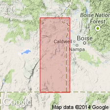
Named for exposures near Antelope Flat, SE/4 SW/4 sec.12 T25S R41E, Crowley District, Malheur Co, OR. [no type designated] Is widely exposed in western part of Owyhee Reservoir district and eastern part of Crowley district. Composed of pyroxene basalt with interbeds of altered volcanic sandstones; volcanic sandstones and conglomerate at base. Probably not more than four flows less than 300 ft in total thickness. Rocks at base of unit contain Hemphillian (middle Pliocene) mammalian fauna (J.A. Shotwell, oral commun., 1960). Unconformably overlies erosion surface of upper Miocene rocks. Underlies unnamed basalt at Seaburn reservoir. Regional correlation chart shows Pliocene age.
Source: GNU records (USGS DDS-6; Menlo GNULEX).

- Usage in publication:
-
- Antelope Flat Basalt
- Modifications:
-
- Geochronologic dating
- AAPG geologic province:
-
- Snake River basin
Summary:
Antelope Flat Basalt. Sample from stock reservoir 2 miles southeast of Antelope Flat, in NW/4 sec. 24, T. 25 S., R. 41 E., Boise sheet, Malheur County, Oregon. K-Ar age on whole rock 15.6 +/-0.9 Ma.
Source: Modified from GNU records (USGS DDS-6; Menlo GNULEX).
For more information, please contact Nancy Stamm, Geologic Names Committee Secretary.
Asterisk (*) indicates published by U.S. Geological Survey authors.
"No current usage" (†) implies that a name has been abandoned or has fallen into disuse. Former usage and, if known, replacement name given in parentheses ( ).
Slash (/) indicates name conflicts with nomenclatural guidelines (CSN, 1933; ACSN, 1961, 1970; NACSN, 1983, 2005, 2021). May be explained within brackets ([ ]).

