

- Usage in publication:
-
- Anon Formation*
- Modifications:
-
- Redescribed
- Revised
- Dominant lithology:
-
- Lava
- Pyroclastics
- AAPG geologic province:
-
- Caribbean region
Summary:
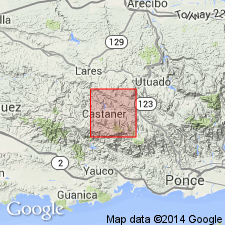
Outside the type locality the Anon is of mixed lithologies, largely a complex of interbedded lava and pyroclastic rocks with only minor volcanic intrusive rocks and minor mudstone and volcanic sandstone, and analyses show that the rocks are dacite with minor andesite. For these reasons it is redefined here as Anon Formation. Gradationally overlies and interfingers with the Monserrate Formation; upper contact has been removed by erosion. Thickness is about 1,400 m. Age is middle to late Eocene in west-central PR based on Foraminifera.
Source: GNU records (USGS DDS-6; Reston GNULEX).
- Usage in publication:
-
- Anon Formation*
- Modifications:
-
- Age modified
- AAPG geologic province:
-
- Caribbean region
Summary:
In the Monte Guilarte quadrangle the Anon is interbedded with the Yauco, Lago Garzas, and Maricao Formations of Late Cretaceous age. Anon in type area is Eocene, and partly Cretaceous.
Source: GNU records (USGS DDS-6; Reston GNULEX).
- Usage in publication:
-
- Anon Formation*
- Modifications:
-
- Revised
- AAPG geologic province:
-
- Caribbean region
Summary:
Interbedded lithofacies of the Anon and Lago Garzas are not given separate formation names. Therefore the Santas Pascuas Member of the Lago Garzas is abandoned and considered to be a lithofacies of the Anon. The Mal Paso and Palma Escrita Formations are abandoned and are considered to be interbedded facies of the Anon and Lago Garzas. Different formational names have been applied to lithofacies of the Anon Formation in the Ponce, Jayuya, Adjuntas, Monte Guilarte, Bayaney, Maricao, and San Sebastian quads, but the rocks are lithologically identical to the Anon as defined by Mattson (1967) and are not distinguishable from similar repetitive sequences in the Anon proper. Along the border of the Adjuntas and Penuelas quads, the Robles (Maricao) is identical to the Anon (former Santas Pascuas Member of the Lago Garzas). Lithofacies characteristics of the Anon, Maricao, and Yauco are interbedded in the Monte Guilarte quad. Age is Late Cretaceous (Maestrichtian?) through Eocene.
Source: GNU records (USGS DDS-6; Reston GNULEX).

- Usage in publication:
-
- Anon Formation*
- Modifications:
-
- Overview
- AAPG geologic province:
-
- Caribbean region
Summary:
The Anon Formation occurs in southwestern Puerto Rico and consists of volcanic breccia and lava, subordinate tuff, tuffaceous sandstone, siltstone, and mudstone. Maximum estimated thickness is 2000 meters. The Anon is of Late Cretaceous to Eocene age.
Source: GNU records (USGS DDS-6; Reston GNULEX).
For more information, please contact Nancy Stamm, Geologic Names Committee Secretary.
Asterisk (*) indicates published by U.S. Geological Survey authors.
"No current usage" (†) implies that a name has been abandoned or has fallen into disuse. Former usage and, if known, replacement name given in parentheses ( ).
Slash (/) indicates name conflicts with nomenclatural guidelines (CSN, 1933; ACSN, 1961, 1970; NACSN, 1983, 2005, 2021). May be explained within brackets ([ ]).