


- Usage in publication:
-
- Annville limestone
- Modifications:
-
- Original reference
- Dominant lithology:
-
- Limestone
- AAPG geologic province:
-
- Appalachian basin
Summary:
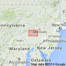
Pg. 124, 133. Annville limestone. Trade name for belt of "Cambro-Ordovician" [Upper Cambrian] limestones, a few hundred feet wide and about 15 miles long that passes through or very near Myerstown, Lebanon, Annville, and Palmyra, Lebanon County, Pennsylvania. Quarried in vicinity of Annville. [Age and thickness not stated.]
[Named from town of Annville, Lebanon Co., eastern PA.]
Source: US geologic names lexicon (USGS Bull. 896, p. 56).
- Usage in publication:
-
- [Annville limestone]
- Modifications:
-
- Areal extent
- AAPG geologic province:
-
- Appalachian basin
Summary:
Pg. 12-15. [Annville limestone.] Composed of two members: lower, thick-bedded high-calcium limestone; and upper, thin-bedded impure limestone. Total thickness more than 250 feet at western boundary of Berks County, eastern Pennsylvania. Overlies Beekmantown limestone; underlies Jacksonburg formation. Formerly considered to be of Stones River age, but now correlated with "cement limestone" member of Jacksonburg. This correlation implies that Annville is in part Trenton and possibly in part Black River in age. Name Annville has been used as trade name. [Age is Middle Ordovician.]
Source: US geologic names lexicon (USGS Bull. 1200, p. 106).
- Usage in publication:
-
- Annville limestone
- Modifications:
-
- Areal extent
- AAPG geologic province:
-
- Appalachian basin
Prouty, C.E., 1951, "Leesport" and "Annville" formations of Pennsylvania [abs.]: Geological Society of America Bulletin, Detroit, November 8-11, 1951, v. 62, no. 12, pt. 2, p. 1471.
Summary:
Annville limestone. Heretofore a commercial term for cement limestone in Lebanon and adjacent counties, eastern Pennsylvania, is defined and given formational status. Overlying "Leesport" will be renamed. [Age is Middle Ordovician.]
Source: US geologic names lexicon (USGS Bull. 1200, p. 106).
- Usage in publication:
-
- Annville
- Modifications:
-
- Areal extent
- AAPG geologic province:
-
- Appalachian basin
Summary:
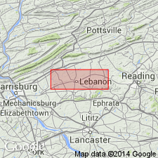
Pg. 1, 3. Annville limestone. Predominantly thick-bedded to massive crystalline high-calcium limestone. In eastern part of area, beds are blue, with some light-gray colors and pinkish gray. Light-gray and pinkish-gray colors dominant in west. Normal stratigraphic thickness about 240 feet; thins east of Myerstown to 20 feet at Womelsdorf. Underlies Myerstown limestone (new). Directly overlies Beekmantown group. [Age is Middle Ordovician.]
Source: US geologic names lexicon (USGS Bull. 1200, p. 106).
- Usage in publication:
-
- Annville limestone
- Modifications:
-
- Areal extent
- AAPG geologic province:
-
- Appalachian basin
Summary:
Pg. 2720. Annville limestone. Overlies Ontelaunee formation (new). [Age is Middle Ordovician.]
Source: US geologic names lexicon (USGS Bull. 1200, p. 106).
- Usage in publication:
-
- Annville limestone
- Modifications:
-
- Principal reference
- AAPG geologic province:
-
- Appalachian basin
Prouty, C.E., 1959, The Annville, Myerstown, and Hershey formations of Pennsylvania: Pennsylvania Geological Survey Bulletin, 4th series, G-31, 47 p.
Summary:
Pg. 6-12. Annville limestone. Though Miller (1925) used name in formational sense (Annville limestone), it was apparently proposed as trade name. Overlies Beekmantown group throughout most of its extent, but, in Harrisburg area, eastern Pennsylvania, overlies rocks similar to middle member of "Stones River." Underlies Myerstown limestone in all observed sections. Type section designated. [Age is Middle Ordovician.]
Type section: quarry at old Palmyra plant of H.E. Millard Limestone Company about 1.5 mi northwest of Palmyra, southeast PA.
Source: US geologic names lexicon (USGS Bull. 1200, p. 106).
- Usage in publication:
-
- Annville formation
- Modifications:
-
- Revised
- AAPG geologic province:
-
- Appalachian basin
Summary:
Annville formation. Mapped in St. Paul group. [Age is Middle Ordovician.]
Source: US geologic names lexicon (USGS Bull. 1200, p. 106).
- Usage in publication:
-
- Annville Limestone
- Modifications:
-
- Age modified
- AAPG geologic province:
-
- Appalachian basin
Brezinski, D.K., Taylor, J.F., and Repetski, J.E., 2012, Sequential development of platform to off-platform facies of the great American carbonate bank in the central Appalachians; Chapter 15: American Association of Petroleum Geologists Memoir, 98, p. 383-420.
Summary:
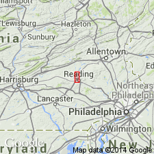
Pg. 386 (fig. 2); see also T.M. Berg and others, Pennsylvania Geol. Survey Gen. Geol. Rpt., no. 75 (revised 1993). Annville Limestone. Notable exposures in Conestoga Valley, southeastern Pennsylvania. Lies below Myerstown Formation and above Ontelaunee Dolomite of Beekmantown Group. Correlative with Loysburg Formation of central and western Pennsylvania, and with St. Paul Group of Maryland. Extends from CAHABAGNATHUS FRIENDSVILLENSIS to PLECTODINA ACULEATA conodont zone (see also Morgan, ch. 4, fig. 4 foldout, same vol.). Age is Middle to Late Ordovician (late Whiterockian; Chazyan).
Source: Publication.
For more information, please contact Nancy Stamm, Geologic Names Committee Secretary.
Asterisk (*) indicates published by U.S. Geological Survey authors.
"No current usage" (†) implies that a name has been abandoned or has fallen into disuse. Former usage and, if known, replacement name given in parentheses ( ).
Slash (/) indicates name conflicts with nomenclatural guidelines (CSN, 1933; ACSN, 1961, 1970; NACSN, 1983, 2005, 2021). May be explained within brackets ([ ]).