The National Geologic Map Database is migrating to a new infrastructure. We apologize for any service disruptions during this process.
|
|---|


- Usage in publication:
-
- Annelly gypsum member
- Modifications:
-
- Original reference
- Dominant lithology:
-
- Gypsum
- Clay
- AAPG geologic province:
-
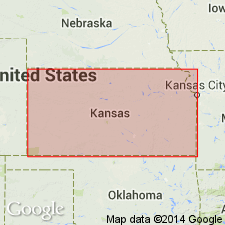
- Sedgwick basin
Summary:
Pg. 5, 12. Annelly gypsum member of Wellington formation. Consists of gypsum interbedded with lesser amounts of drab clays; both selenite and alabaster varieties of gypsum are present. Three prominent beds of gypsum commonly present, but locally, only two are present; in some places additional thin gypsum beds are interbedded with the clays. Thickness about 13 feet; at type locality, three beds of gypsum are exposed, each about 3 feet thick. Underlies Chisolm Creek shale member (new); overlies Geuda Springs shale member (new). Age is Permian.
Type locality: high cliff on west branch of Whitewater River 0.25 mi south of Annelly, in sec. 15, T. 24 S., R. 2 E., Harvey Co., southeastern KS.
Source: US geologic names lexicon (USGS Bull. 1200, p. 104).
For more information, please contact Nancy Stamm, Geologic Names Committee Secretary.
Asterisk (*) indicates published by U.S. Geological Survey authors.
"No current usage" (†) implies that a name has been abandoned or has fallen into disuse. Former usage and, if known, replacement name given in parentheses ( ).
Slash (/) indicates name conflicts with nomenclatural guidelines (CSN, 1933; ACSN, 1961, 1970; NACSN, 1983, 2005, 2021). May be explained within brackets ([ ]).