

- Usage in publication:
-
- Anklam Formation
- Modifications:
-
- First used
- Dominant lithology:
-
- Volcaniclastics
- Arkose
- Siltstone
- AAPG geologic province:
-
- Basin-and-Range province
Summary:
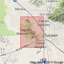
First published use in southern Tucson Mountains, Pima Co, AZ, Basin-and-Range province. Derivation of name not discussed; no type section designated. Name follows usage of J. E. Kinneson (oral communication); not stated if unit is considered formal by author. Formerly called Safford Tuff by Brown (1939, Geol. Soc. America Bull., v. 50, p. 697-760); however Safford of Brown is distinctly older in southern area than Safford in northern part of Tucson Mountains. Lower part consists of reworked tuffs of Cat Mountain Rhyolite and upper part consists of tuffaceous arkoses and siltstones intruded conformably at top by dark porphyritic andesite (Ivy May andesite of Kinnison, 1958, unpub. thesis, Univ. AZ). Anklam and Ivy May sequence underlies Shorts Ranch Andesite; overlies Cat Mountain. South of Ajo Road, "Biotite Rhyolite" of Brown (1930) is found in small area and lies between Ivy May and Shorts Ranch. Idealized section. Average K-Ar date of 68 m.y. (Late Cretaceous) on underlying Cat Mountain and K-Ar dates of 60.5 m.y. and 56.8 m.y., respectively, on overlying "Biotite Rhyolite" and Shorts Ranch [epochs not specified] suggest Laramide age for Anklam.
Source: GNU records (USGS DDS-6; Denver GNULEX).
- Usage in publication:
-
- Anklam Formation
- Modifications:
-
- Not used
Summary:
Not used. Author states that formal status of Anklam is inappropriate because of its limited thickness and areal extent, lateral lithologic variability, occurrence at multiple stratigraphic horizons, and because of generally poor exposures. Rocks are reassigned to, and mapped as, volcaniclastic sedimentary rocks of the southeastern postcollapse volcanics. Study area is Tucson Mountains, Pima County, Arizona, Basin-and-Range province.
Source: Modified from GNU records (USGS DDS-6; Denver GNULEX).
For more information, please contact Nancy Stamm, Geologic Names Committee Secretary.
Asterisk (*) indicates published by U.S. Geological Survey authors.
"No current usage" (†) implies that a name has been abandoned or has fallen into disuse. Former usage and, if known, replacement name given in parentheses ( ).
Slash (/) indicates name conflicts with nomenclatural guidelines (CSN, 1933; ACSN, 1961, 1970; NACSN, 1983, 2005, 2021). May be explained within brackets ([ ]).