

- Usage in publication:
-
- Animikie group*
- Modifications:
-
- Original reference
- Dominant lithology:
-
- Sandstone
- Argillite
- AAPG geologic province:
-
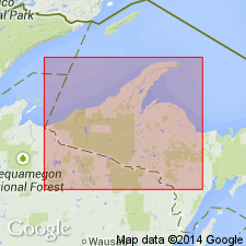
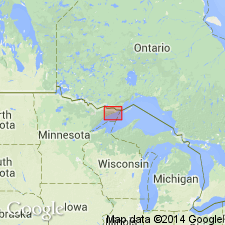
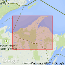
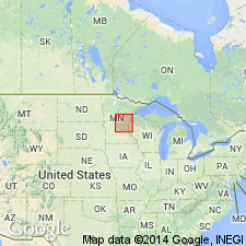
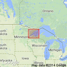
- Lake Superior region
Summary:
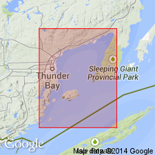
Pg. 331-395. Animikie group. Dark-colored argillites and sandstones underlying the great Keweenaw group and overlying Huronian crystalline schists along Thunder Bay (of north shore of Lake Superior, Canada). This is lower division of upper copper-bearing series of Logan. Animikie is Indian name for Thunder Bay.
Source: US geologic names lexicon (USGS Bull. 896, p. 54-55).
- Usage in publication:
-
- Animikie group*
- Modifications:
-
- Overview
- AAPG geologic province:
-
- Lake Superior region
Summary:
Pg. 124, 135, 157-163. Gave thickness of Animikie group (slates and quartzites) of the Huronian as 10,000 feet.
Source: US geologic names lexicon (USGS Bull. 896, p. 54-55).
- Usage in publication:
-
- Animikie series*
- Modifications:
-
- Revised
- Age modified
- AAPG geologic province:
-
- Lake Superior region
Summary:
Stated Animikie series = upper Huronian; rests unconformably on lower Huronian; is unconformably overlain by Keweenawan series; and is = Penokee series.
Source: US geologic names lexicon (USGS Bull. 896, p. 54-55).
- Usage in publication:
-
- Animikie [group]*
- Modifications:
-
- Overview
- AAPG geologic province:
-
- Lake Superior region
Summary:
Authors compose the Special Committee of American and Canadian geologists appointed to determine the proper nomenclature for Lake Superior region. Animikie (upper Huronian) rests unconformably on middle Huronian in Lake Superior region and is unconformably overlain by Keweenawan series.
Source: US geologic names lexicon (USGS Bull. 896, p. 54-55).

- Usage in publication:
-
- Animikie group*
- Modifications:
-
- Overview
- AAPG geologic province:
-
- Lake Superior region
Summary:
Pg. 54-55. Some geologists later [post-1905] restricted Huronian to pre-Animikie rocks, but the USGS continued to follow the definition adopted by the Special Committee in 1905, which included in it Animikie group (upper Huronian). Much has been written about the Animikie rocks and their correlation. R.C. Allen, 1915 (Jour. Geol., v. 23, table opp. p. 703) transferred to middle Huronian the Animikie group, the Vulcan formation, the Felch schist, the †Hanbury slate, the Tyler slate, and Quinnesec schist. In 1919 (Amer. Inst. Min. and Met. Eng. Bull., no. 153, p. 2579-2594) he referred Quinnesec schist and upper part of †Hanbury slate to upper Huronian, but included Vulcan formation and lower part of †Hanbury in middle Huronian, and stated that his middle Huronian "carries the distinctive members of the old Animikie, the main iron-bearing series. Whether the name Animikie should be retained for the portion remaining as the upper Huronian, or shall follow its most distinctive members into the middle Huronian may be left for later decision."
Source: US geologic names lexicon (USGS Bull. 896, p. 54-55).
- Usage in publication:
-
- Animikie [group]*
- Modifications:
-
- Age modified
- AAPG geologic province:
-
- Lake Superior region
Summary:
Pg. 383. The Animikie rests, at Thunder Bay, on the peneplain evolved in Eparchean interval, and therefore is not Huronian in any sense. Its correlative north of Lake Huron is very uncertain and may be nonexistent.
Source: US geologic names lexicon (USGS Bull. 896, p. 54-55).
- Usage in publication:
-
- Animikie group†
- Modifications:
-
- Abandoned
- AAPG geologic province:
-
- Lake Superior region
Summary:
Pg. 325. There are a few iron formations within the upper Huronian. Among them are the formations at Iron River, Crystal Falls, Florence, the western part of Marquette district, and probably in Cuyuna district. The great producers, however, including the iron formations of Marquette, Mesabi, Gogebic, and Menominee districts, are now considered to be of middle Huronian age. Because of this new correlation it seems necessary to abandon the term Animikie, because it includes formations of both upper and middle Huronian age, separated by an unconformity which, at least in Marquette district, is of great magnitude.
Source: US geologic names lexicon (USGS Bull. 896, p. 54-55).
- Usage in publication:
-
- Animikie group*
- Modifications:
-
- Reinstated
- AAPG geologic province:
-
- Lake Superior region
Summary:
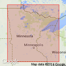
Pg. 1021 (table 3), 1041-1051. Animikie group. Retained as a group name in Minnesota because outcrops are well correlated with original Animikie locality and not well correlated with type locality of Huronian. Includes (ascending) Pokegamma quartzite, Biwabik iron formation series, and Virginia slate. Unconformable above Algoman batholithic intrusives; unconformable below Keweenawan group.
Source: US geologic names lexicon (USGS Bull. 1200, p. 102).
- Usage in publication:
-
- Animikie group*
- Modifications:
-
- Revised
- Areal extent
- AAPG geologic province:
-
- Lake Superior region
Summary:
Pg. 3 (table 1), 4. In Gunflint district, the three units of Animikie group corresponding to Pokegamme, Biwabik, and Virginia formations of Mesabi district are called, respectively, Kakabeka, Gunflint, and Rove formations. Age is Precambrian.
Source: US geologic names lexicon (USGS Bull. 1200, p. 102).
- Usage in publication:
-
- Animikie series*
- Modifications:
-
- Revised
- Areal extent
- AAPG geologic province:
-
- Lake Superior region
Summary:
Pg. 30 (table 1), 33-35. Animikie series. Reinstated and given series rank in application to Michigan strata (Iron and Dickinson Counties, Lake Superior region). Term Huronian, used in area for nearly 60 years, is not used here because of uncertainty of correlation with type Huronian of Canada. Strata previously correlated with Huronian are now referred to Animikie on basis of accepted correlations with strata of Mesabi district of Minnesota, which have been traced into type Animikie of Thunder Bay area of Canada (see Grout, Gruner, Schwartz, and Thiel, 1953). Series divided into four groups (ascending): Chocolay, Menominee, Baraga, and Paint River. Series rests unconformably on eroded surface of lower Precambrian (post-Dickinson) granitic rocks; Animikie strata were deformed, metamorphosed, and intruded by dikes, stocks, and sills of gabbroic to granitic composition in a pre-Keweenawan orogenic interval. Roughly middle third of series is equivalent to Animikie group of Mesabi district. Age is middle Precambrian. Report includes stratigraphic sequence chart.
Source: US geologic names lexicon (USGS Bull. 1200, p. 102); supplemental information from GNU records (USGS DDS-6; Denver GNULEX).
- Usage in publication:
-
- Animikie group
- Modifications:
-
- Areal extent
- AAPG geologic province:
-
- Lake Superior region
Summary:
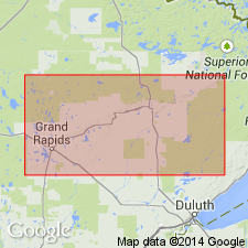
Pg. 20-29. Animikie group. In Cook County, northeastern Minnesota, group consists of Pokegama quartzite, Gunflint iron formation, and Rove formation. These units are correlated with Pokegama quartzite, Biwabik formation, and Virginia formation of Mesabi Range. Lies between Knife Lake group below, and Keweenawan group above. Age is Precambrian.
Source: US geologic names lexicon (USGS Bull. 1200, p. 102).
- Usage in publication:
-
- Animikie series†
- Animikie group*
- Modifications:
-
- Abandoned
- Areal extent
- AAPG geologic province:
-
- Lake Superior region
Summary:
The middle Precambrian Animikie series of James (1958) abandoned south of Lake Superior, in northern Michigan and northern Wisconsin; replaced with Marquette Range Supergroup (new). Animikie Group remains in good usage in northern Minnesota.
[In Canada, the Animikie Group remains in good usage (the Animikie series has not been used in reports since 1970). See Lexicon of Canadian Geologic Units, available online: http://www.cgkn.net/weblex/weblex_list_e.pl (database accessed September 30, 2007).]
Source: Modified from Changes in stratigraphic nomenclature, 1970 (USGS Bull. 1354-A, p. A2-A3).
- Usage in publication:
-
- Animikie Group*
- Modifications:
-
- Revised
- Areal extent
- AAPG geologic province:
-
- Lake Superior region
Summary:
Animikie Group. Extended from Mesabi Range into Cuyuna Range, east-central Minnesota (Lake Superior region). Correlation based on similar stratigraphic successions and on sparse subsurface information from southeastern Cass County; main iron-formations not directly traced between Mesabi Range and Cuyuna district. In Mesabi Range, Animikie includes Pokegama Quartzite (base), Biwabik Iron-Formation, and Virginia Formation. In Cuyuna district, Animikie includes (ascending) Mahnomen, Trommald, and Rabbit Lake Formations (revised; not synopsized). East of Cuyuna district, in parts of St. Louis, Pine, and Carlton Counties, Animikie includes Thomson Formation in upper part (see correlation of map units, pl. 1). Boundary between nomenclatural usage between Mesabi and Cuyuna Ranges is placed along northeast-trending fault that extends just north of the Emily area in T. 138 N.[?], R. 27 W. to vicinity of T. 52 N., R. 23 W. Unconformably overlies Trout Lake Formation. Age is middle Precambrian. Report includes bedrock geologic map.
Source: Modified from GNU records (USGS DDS-6; Denver GNULEX).
- Usage in publication:
-
- Animikie Group*
- Modifications:
-
- Revised
- AAPG geologic province:
-
- Lake Superior region
Summary:
Animikie Group subdivided in northeastern Minnesota. Divided into: Thomson Formation and (=) Rove Formation. Underlies Keweenawan Supergroup. Age is Precambrian X.
Source: Changes in stratigraphic nomenclature, 1978 (USGS Bull. 1482-A, p. A3).

- Usage in publication:
-
- Animikie Group*
- Modifications:
-
- Overview
- AAPG geologic province:
-
- Lake Superior region
Summary:
Animikie Group. Present in northwestern segment of Animikie basin, east-central Minnesota (Lake Superior region); in Cuyuna Range, includes (ascending) Mahnomen, Trommald, and Rabbit Lake Formations; in Mesabi Range, includes (ascending) Pokegama Quartzite, Biwabik Iron-Formation, and Virginia Formation. In Gunflint Range, Ontario, Canada, includes (ascending) basal conglomerate member, Gunflint Iron-Formation, and Rove Formation. Correlates with middle part of Marquette Range Supergroup of Michigan and Wisconsin. Age is considered Early Proterozoic; overlies dike rocks of Early Proterozoic age in northern Minnesota. Animikie and underlying Mille Lacs Group characterized by five depositional phases (ascending): (1) two miogeosynclinal sequences; (2) shelf conditions and formation of iron-bearing sediment; (3) rapid subsidence; (4) submarine flysch deposits. Report includes correlation charts.
Source: Modified from GNU records (USGS DDS-6; Denver GNULEX).
For more information, please contact Nancy Stamm, Geologic Names Committee Secretary.
Asterisk (*) indicates published by U.S. Geological Survey authors.
"No current usage" (†) implies that a name has been abandoned or has fallen into disuse. Former usage and, if known, replacement name given in parentheses ( ).
Slash (/) indicates name conflicts with nomenclatural guidelines (CSN, 1933; ACSN, 1961, 1970; NACSN, 1983, 2005, 2021). May be explained within brackets ([ ]).