- Usage in publication:
-
- Animas beds*
- Modifications:
-
- Original reference
- Dominant lithology:
-
- Clay
- Tuff
- Sandstone
- Conglomerate
- AAPG geologic province:
-
- San Juan basin
Summary:
Pg. 217-219 (Chapter III, Section III, titled "Age of the Arapahoe and Denver formations" by Whitman Cross, p. 206-252); see also J.H. Gardner, 1917, USGS Prof. Paper 101, p. 185-186.
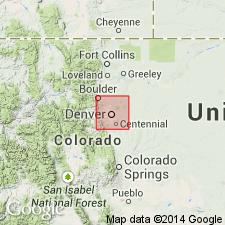
Animas River beds [in heading]; Animas beds [in text]. Yellowish-brown clays, tuffs, sandstones, and conglomerates in which andesitic material greatly predominates and presents a variety rivaling that in the Denver beds, of which they are considered the direct equivalent. Thickness 700 or more feet. Overlie Laramie formation and underlie Puerco formation on Animas River below Durango, [La Plata County, southwestern Colorado]. Plant fossils of the type found on Table Mountain [west of Denver, Jefferson County, Colorado]. Age not specifically stated.
Typical exposures on Animas River below Durango, CO.
Source: US geologic names lexicons (USGS Bull. 896, p. 53-54; USGS Bull. 1200, p. 100-101); supplemental information from GNU records (USGS DDS-6; Denver GNULEX).

- Usage in publication:
-
- Animas formation*
- Modifications:
-
- Revised
- AAPG geologic province:
-
- San Juan basin
Summary:
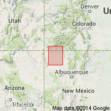
Animas formation (restricted). Andesitic fluviatile deposits, of probable Eocene age, 0 to 2,670 feet thick. Unconformably underlies Torrejon formation and unconformably overlies McDermott formation --a purplish andesitic formation 0 to 400 feet thick, heretofore included in Animas formation, but believed to be of Cretaceous age. Animas formation as here restricted appears to be present in only a limited area, along northern rim of San Juan basin in La Plata County, southwestern Colorado. Consists of (ascending): (1) pebble conglomerate (quartz, quartzite, and chert) separated by shale and sandstone with much weathered andesitic material, 300 feet; (2) shale and sandstone interrupted by layers of fine-grained conglomerate, shale is gray to tan with reddish bands. Thickness 1,100 feet on Animas River; 2,760 feet on divide between Pine and Piedra Rivers, in secs. 31 and 32, T. 35 N., R. 5 W.; 1,840 feet at Pagosa Junction. Is in part equivalent in part to Denver, Raton, and Lance formations outside the basin. In northwestern New Mexico deposits believed to be approximately contemporaneous with it, but geographically separated from it and different lithologically, are here designated as Ojo Alamo sandstone. Age is Eocene(?). Report includes measured sections, stratigraphic chart.
Source: US geologic names lexicon (USGS Bull. 896, p. 53-54); supplemental information from GNU records (USGS DDS-6; Denver GNULEX).

- Usage in publication:
-
- Animas formation*
- Modifications:
-
- Revised
- AAPG geologic province:
-
- San Juan basin
Summary:
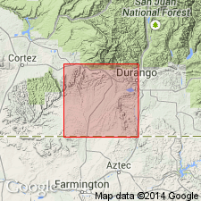
Lower contact of Animas formation changed to the base of the purple beds of the McDermott. The McDermott, formerly a formation, is reduced in stratigraphic rank to basal member of the Animas. The 95 ft thick pebble-bearing sandstone and sandy shale beneath the purple beds that were part of Reeside's (1925) original McDermott are reassigned to the underlying Kirtland shale. The top 106 ft thick unit above the purple beds removed from the McDermott and reassigned as the basal part of the upper member of the Animas. The revised McDermott member is composed of dominantly brown to purple interbedded breccia, conglomerate, tuffaceous sandstone, and shale. The McDermott consists mainly of slightly weathered andesitic detritus and partly of quartz, quartzite and chert. McDermott is of Late Cretaceous age. The revised upper member of the Animas is a lower ridge-forming conglomerate of boulders, pebbles, and matrix of andesite, and some quartz and quartzite, 260 ft thick, and an upper sandy and shaly sequence, 850 ft thick. The upper member is Late Cretaceous and Paleocene age. Contact with overlying Nacimiento formation is gradational. Mapped in east part of report area in La Plata Co, CO in the San Juan basin. Geologic map. Columnar section.
Source: GNU records (USGS DDS-6; Denver GNULEX).

- Usage in publication:
-
- Animas Formation*
- Modifications:
-
- Overview
- AAPG geologic province:
-
- San Juan basin
Summary:
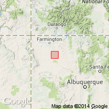
McDermott Member not recognized in western part of San Juan basin. McDermott thins southward from its type in CO and is cut out by an unconformity east of La Plata River northwest of Farmington, NM near center of T30N, R13W. Equivalent beds mapped as lower part of Animas.
Source: GNU records (USGS DDS-6; Denver GNULEX).
For more information, please contact Nancy Stamm, Geologic Names Committee Secretary.
Asterisk (*) indicates published by U.S. Geological Survey authors.
"No current usage" (†) implies that a name has been abandoned or has fallen into disuse. Former usage and, if known, replacement name given in parentheses ( ).
Slash (/) indicates name conflicts with nomenclatural guidelines (CSN, 1933; ACSN, 1961, 1970; NACSN, 1983, 2005, 2021). May be explained within brackets ([ ]).

