- Usage in publication:
-
- Anderson Mine formation
- Modifications:
-
- First used
- Dominant lithology:
-
- Mudstone
- Siltstone
- Sandstone
- Conglomerate
- Tuff
- Limestone
- AAPG geologic province:
-
- Basin-and-Range province
Summary:
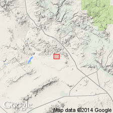
Recognized informally as lowest part in upper of 2 Tertiary sequences in Anderson Mine area, secs 2 and 9-16, T11N, R10W, Yavapai Co, AZ, Basin-and-Range province. No type locality designated. 80-150 m thick. Includes a) lower arkosic member, 120 m of coarse, poorly sorted, reddish- to yellowish-gray arkosic sedimentary rocks and locally developed volcanic sandstones and conglomerates, and b) upper uranium-bearing tuffaceous mudstone member, a lacustrine succession of 4 units: (1 and 3) lower and upper carbonaceous unit (both of greenish-gray tuffaceous mudstones and siltstones interstratified with tan tuffaceous marlstones) divided by 2) intermediate clastic unit (tuffaceous siltstones and sandstones, consisting of greenish-gray to tan water-reworked tuff and volcanic rocks); and 4) upper tuff and limestone unit (tuffaceous greenish-gray mudstones, reworked vitric tuffs, fossiliferous marlstones, and limestones). In southern part of area upper member is 140 m thick; thins to 80 m where member onlaps volcanic rocks to north. Near Anderson Mine, sediments thicken gradually to south and west and thin to north and east where they onlap Arrastra paleohigh. Tentatively correlated with and intertongues with fanglomerates of Chapin Wash Formation. Overlies Arrastra volcanics and underlies Flat Top Formation (both new); contacts unconformable. Early to middle Miocene age indicated by Hemingfordian-age fossils, and position.
Source: GNU records (USGS DDS-6; Denver GNULEX).
For more information, please contact Nancy Stamm, Geologic Names Committee Secretary.
Asterisk (*) indicates published by U.S. Geological Survey authors.
"No current usage" (†) implies that a name has been abandoned or has fallen into disuse. Former usage and, if known, replacement name given in parentheses ( ).
Slash (/) indicates name conflicts with nomenclatural guidelines (CSN, 1933; ACSN, 1961, 1970; NACSN, 1983, 2005, 2021). May be explained within brackets ([ ]).

