


- Usage in publication:
-
- Ancha formation*
- Modifications:
-
- Original reference
- Dominant lithology:
-
- Sandstone
- Siltstone
- Conglomerate
- AAPG geologic province:
-
- Estancia basin
Summary:
Pg. 12, 15, 16, 17. Ancha formation. Consists of poorly consolidated sandstone, siltstone, and conglomerate. Thickness 0 to 200 feet. Unconformably overlies Galisteo sandstone. Considered eastward extension of Puye gravel. [Age is late Pliocene or Pleistocene.]
Source: US geologic names lexicon (USGS Bull. 1200, p. 93).
- Usage in publication:
-
- Ancha formation
- Modifications:
-
- Areal extent
- AAPG geologic province:
-
- Estancia basin
Summary:
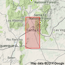
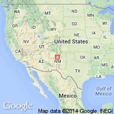
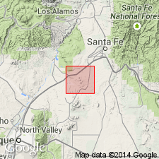
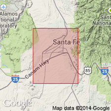
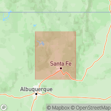
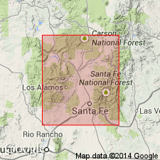
Pg. 8, 21, 24, geol. map. Ancha formation. Rests on westward-sloping surface that cuts across tilted Tesuque formation. Mapped near Canada Ancha west of city of Santa Fe, north-central New Mexico. [Age is late Pliocene or Pleistocene.]
Source: US geologic names lexicon (USGS Bull. 1200, p. 93-94).
- Usage in publication:
-
- Ancha formation
- Modifications:
-
- Areal extent
Summary:
Ancha formation. Included in upper unit of Santa Fe group. Puye gravel, Ancha formation, and Tuerto gravel all rest with angular unconformity on deformed beds of Tesuque formation. These units of gravel are 500, 300, and 150 feet in maximum thickness respectively. Distinction between Tesuque and Ancha formations in Santa Fe area is based largely on westward dip and somewhat better consolidation of the former. In Buckman area, Ancha appears to intertongue with Puye gravel and with river gravel that has been assigned by some workers to the ancestral Rio Grande. [Age is late Pliocene or Pleistocene.]
Source: US geologic names lexicon (USGS Bull. 1200, p. 93-94).
- Usage in publication:
-
- Ancha formation
- Modifications:
-
- Revised[?]
- AAPG geologic province:
-
- Estancia basin
Summary:
Ancha formation of Santa Fe group (revised). Previously mapped as Tuerto gravel by Stearns (1953). Consists of beds of clastic and reworked pyroclastic material. In Santa Fe area, Santa Fe County, New Mexico, underlies Cuerbio basalt, [?uppermost formation of Santa Fe; uncertain if author intended to include Cuerbio in Santa Fe group]. Age is Pleistocene(?); inference and fossil evidence. Report includes geologic map.
Source: Modified from GNU records (USGS DDS-6; Denver GNULEX).
- Usage in publication:
-
- Ancha formation*
- Modifications:
-
- Principal reference
- Dominant lithology:
-
- Gravel
- Sand
- AAPG geologic province:
-
- Estancia basin
Summary:
Pg. 45-50, geol. map. Ancha formation of Santa Fe group. Silt, sand, gravel. Estimated thickness at least 300 feet in northwestern part of study area; in south-central part, is about 100 to 200 feet thick. Upper and lower boundaries are erosional surfaces, both previously called "Ortiz surface." Rests with angular unconformity on Tesuque formation. Distinction between the Ancha and Tesuque is difficult because of lithologic similarities. Distinguishing characteristics: horizontal beds, larger grain size (gravel and coarse sand abundant), poor sorting, and only a few beds are cemented (aphanitic). Age is considered Pliocene or Pleistocene.
Type section (partial): west of Santa Fe, at north end of Canada Ancha, in E/2 sec. 32, T. 18 N., R. 8 E. (unsurveyed), [Agua Fria and Horcado Ranch 7.5-min quadrangles, Santa Fe National Forest], Santa Fe Co., north-central NM. Named from exposures along Canada Ancha in northwestern part of Agua Fria quadrangle.
Source: Publication.
- Usage in publication:
-
- Ancha Formation*
- Modifications:
-
- Age modified
- Geochronologic dating
- AAPG geologic province:
-
- Estancia basin
Summary:
Ancha Formation. Sample from basalt immediately overlying Ancha Formation, in Cerros del Rio volcanic field, Horcado Ranch quadrangle, Santa Fe County, New Mexico, yielded K-Ar age of 1.96 +/-0.06 Ma (whole-rock); provides minimum age for Ancha. Ancha, previously considered Pliocene to early Pleistocene, now Pliocene.
Source: Modified from GNU records (USGS DDS-6; Denver GNULEX).

- Usage in publication:
-
- Ancha Formation*
- Modifications:
-
- Geochronologic dating
- AAPG geologic province:
-
- San Juan basin
- Estancia basin
Summary:
As classified in previous USGS reports, Santa Fe Group in its type region (Espanola basin, north-central NM in San Juan and Estancia basins) is middle? Miocene to Pleistocene? in age. Tesuque Formation is Miocene to Pliocene, and is unconformably overlain by Ancha Formation near southeastern margin of Espanola basin, and by Puye Formation to west. In this report, new radiometric ages provide more precise dating for Tesuque, Puye, and Ancha Formations of Santa Fe Group. Ancha has been assigned a Pliocene or Pleistocene age--fission-track age of 2.7 +/-0.4 m.y. was obtained from zircons in pumice 15 m from top of Ancha type locality. Puye is Pliocene--zircon fission-track age of 2.9 +/-0.5 m.y. was obtained from a pumice bed directly overlying Totavi Lentil of Puye, 8 km north of type locality of Ancha (Santa Fe Co, NM in Estancia basin). These ages support the correlation of Puye and Ancha Formations and establish a minimum age for the Rio Grande [River] (Totavi Lentil of Puye) in Espanola basin. In northeastern part of Espanola basin, Ancha Formation was assigned a probable Pleistocene age, partly on basis of a "Pearlette-like" ash. Remapping has shown that this formation consists of two units: 1) a deposit that contains two pumice beds fission-track dated at 10.8 +/-1.6 m.y. and 12.7 +/-1.8 and, therefore, equivalent to a part of Tesuque Formation; and 2) discontinuous surface gravels that are late Pliocene to Pleistocene in age.
Source: GNU records (USGS DDS-6; Denver GNULEX).

- Usage in publication:
-
- Ancha Formation*
- Modifications:
-
- Geochronologic dating
- AAPG geologic province:
-
- Estancia basin
Summary:
Ancha Formation of Santa Fe Group of Spiegel and Baldwin (1963). Pumice sample from near top of type Ancha Formation (near Lat. 35 deg. 45 min. 10 sec. N., Long. 106 deg. 06 min. 26 sec. W.), Santa Fe County, Horcado Ranch 7.5-min quadrangle, north-central New Mexico, yielded a fission-track age of 2.7 +/-0.4 Ma (zircon), establishing Ancha as late Pliocene and contemporaneous with Puye and Servilleta Formations. Overlying basalt flow yielded an age of 2.0 Ma (Manley [abs.], 1976, GSA Abs. w/ Prog., v. 8, no. 5, p. 606-607).
Source: Publication.
- Usage in publication:
-
- Ancha Formation*
- Modifications:
-
- Revised
- AAPG geologic province:
-
- San Luis basin
Summary:
Distinctive flows of coarse-grained, diktytaxitic olivine tholeiite, which constitute the most voluminous and widespread rock type of the Taos Plateau volcanic field, Taos Co, north-central NM in San Luis basin, have previously been included in Servilleta Formation, along with interlayered nonvolcanic sedimentary rocks. Regional stratigraphic relations and radiometric ages indicate that these interlayered sedimentary rocks are correlative with lithologically similar named units of the Santa Fe Group, such as Ancha Formation (Manley, 1978). Servilleta is here renamed Servilleta Basalt and redefined to include only the distinctive olivine tholeiite flows which have always been its dominant constituent. Ancha is therefore revised to include these interlayered sedimentary and nonvolcanic rocks formerly included in Servilleta.
Source: GNU records (USGS DDS-6; Denver GNULEX).
- Usage in publication:
-
- Ancha Formation*
- Modifications:
-
- Not used
Summary:
Area of report is northeast plateau, Espanola basin, which is northernmost Rio Grande rift basin, Rio Arriba and Santa Fe Cos, NM in San Juan and Estancia basins. As a result of author's recent mapping and radiometric dating, sedimentary rocks previously mapped (Miller and others, 1963) as the Pleistocene Ancha Formation and part of the underlying Miocene Tesuque Formation have been reassigned to (ascending): 1) Cejita Member of Tesuque Formation; 2) a piedmont facies of Tesuque Formation (containing a pumice layer dated at 10.8 m.y.); 3) high surface gravel deposits of Pliocene to early Pleistocene age; and 4) Quaternary gravel deposits (including the Santa Barbara, Santa Cruz, and Chamisal gravel deposits). Use of term Ancha Formation for the varied gravel deposits is considered inappropriate and is not used in this report.
Source: GNU records (USGS DDS-6; Denver GNULEX).
- Usage in publication:
-
- Ancha Formation
- Modifications:
-
- Revised
- Reference
- Geochronologic dating
- Dominant lithology:
-
- Sand
- Gravel
- AAPG geologic province:
-
- Estancia basin
Koning, D.J., Connell, S.D., Pazzaglia, F.J., and McIntosh, W.C., 2002, Redefinition of the Ancha Formation and Pliocene-Pleistocene deposition in the Santa Fe embayment, north-central New Mexico: New Mexico Bureau of Geology and Mineral Resources, New Mexico Geology, v. 24, no. 3, p. 75-87.
Summary:
Ancha Formation of Santa Fe Group. Restricted to upper 38+ feet (12+ m) of Spiegel and Baldwin's (1963) partial type section at Canada Ancha. [Lower 115+ feet of pebble conglomerate transferred to underlying Tesuque Formation of Santa Fe Group.] As restricted, consists of brownish yellow to pale brown, silty sand to pebbly sand with varying amounts of granite-rich gravel. In places contains volcaniclastic (tephra) deposits. Subdivided into two informal members, ascending: (1) coarse alluvial member, gravelly sand, 20 feet (6.1 m) thick; and (2) fine alluvial member, clayey to silty sand with minor pebble lenses and coarse- to very coarse-grained sand beds, 18.3 feet (5.6 m) thick. Total thickness of formation ranges from 33 to 295 feet (10 to 90 m); commonly 33 to 131 feet (10 to 90 m) in outcrop and 98 to 295 feet (30 to 90 m) in subsurface. At type section overlies Tesuque Formation and underlies basalt and pyroclastic deposits of Cerros del Rio volcanic field. At reference sections, rests with angular unconformity on tilted Tesuque Formation, Galisteo Formation, or unnamed Cretaceous sandstone and shale; underlies Quaternary gravel or Tuerto formation. Top of the Ancha is typically modified by erosion and is best preserved locally on broad interfluves (Plains surface) between entrenched drainages in the Santa Fe embayment. Age is late Pliocene to Pleistocene, based on isotopic ages of tephras (40Ar/39Ar method) from about 2.7 to 1.5 Ma.
Source: Publication.
For more information, please contact Nancy Stamm, Geologic Names Committee Secretary.
Asterisk (*) indicates published by U.S. Geological Survey authors.
"No current usage" (†) implies that a name has been abandoned or has fallen into disuse. Former usage and, if known, replacement name given in parentheses ( ).
Slash (/) indicates name conflicts with nomenclatural guidelines (CSN, 1933; ACSN, 1961, 1970; NACSN, 1983, 2005, 2021). May be explained within brackets ([ ]).